
Tertius (sand bank)

Tertius or Tertiussand is a sandbank in the Heligoland Bay off the coast of Dithmarschen . It lies west of the Mittelplate , between Norder- and Süderpiep . Tertius used to be a high sand , but has often been flooded for decades and therefore has no vegetation. Like other high sands or flooded sandbanks, the area is not assigned to any municipality or district.
Tertius is located about 10 kilometers west of the seaside resort of Büsum in the Meldorfer Bay and, like the other unpaved islands, high sands and sandbanks on the west coast of Schleswig-Holstein, is subject to constant eastward migration. In the south is the island of Trischen , in the northeast of the high sand Blauort . Tertius and the plate (sandbank) Tertiussand surrounding it are surrounded by the tidal current Piep , which allows access to the port of Büsum and is divided here seaward into Norderpiep and Süderpiep.
In addition to seabirds, numerous seals rest on the sandbank, so excursions to Tertius are offered from Büsum. Entering the sandbank in the Schleswig-Holstein Wadden Sea National Park , which is not in protection zone I , is only possible under certain conditions. The only building on Tertius is a beacon that serves as an optical navigation mark .
Picture gallery
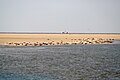
Tertius with seals

Tertius (from the southwest)

On Geerz's map from 1858, Mittel Plaat ( not the Mittelplate 16 kilometers further south ) is drawn in place of Tertius between the priels Norderpiep and Süderpiep , and to the east (towards the mainland) the Piep is entered as Miele (river) .

Map from 1893, Tertius and Mittelplate are separate


.jpg)
_Eider-M%C3%BCndung.jpg&filetimestamp=20181226223139&)
Web links
Individual evidence
- ↑ Tertiussand beacon. In: baken-net.de. Retrieved November 4, 2018 .
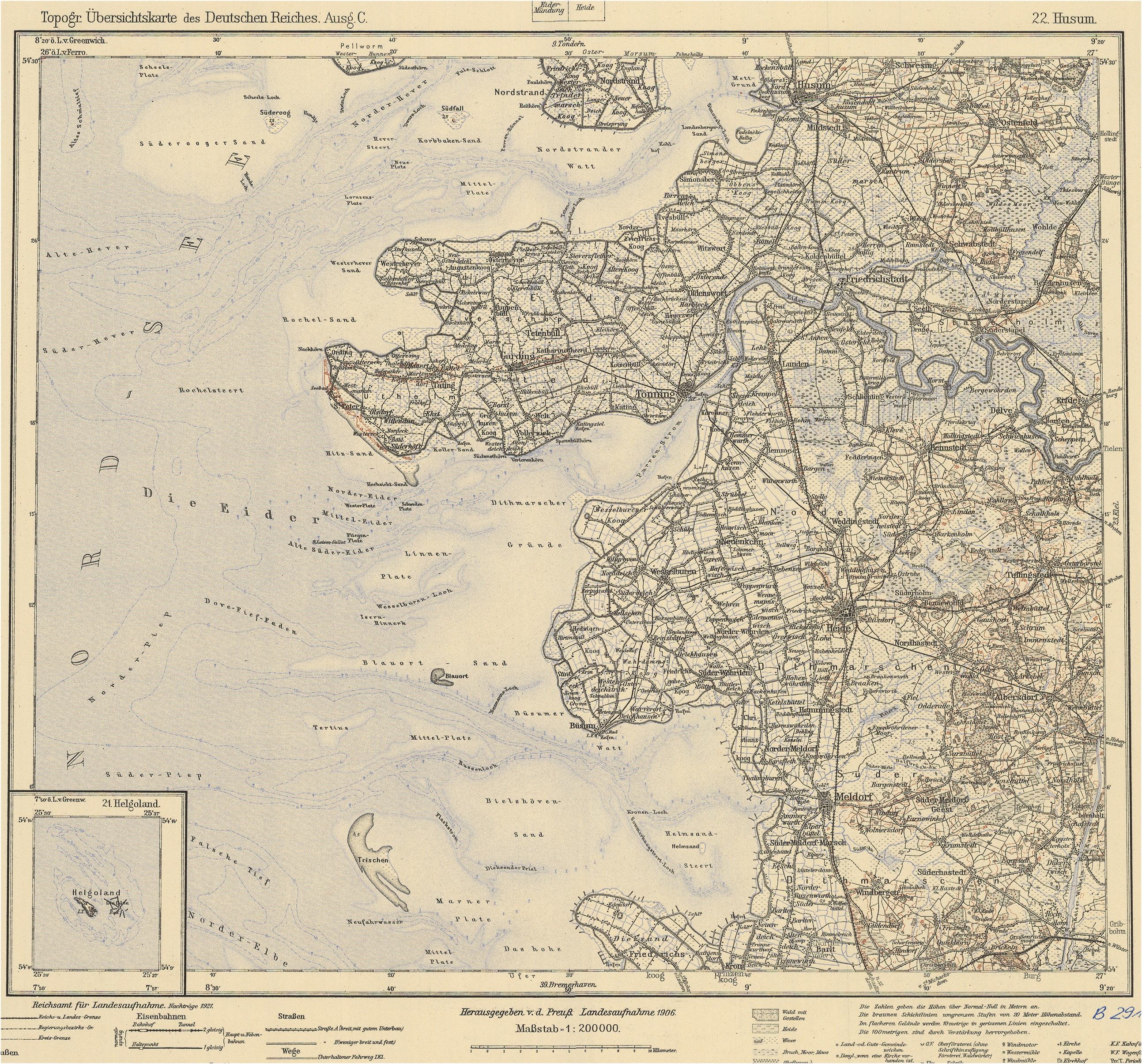
- ^ Topographic overview map of the German Empire. Edition C. 22 Husum. Prussian land survey 1906. (JPEG graphic, 2587 × 2411 pixels). In: geogreif.uni-egoswald.de. Retrieved November 4, 2018 .
Coordinates: 54 ° 8 ' N , 8 ° 42' E

Schleswig-Holstein: Heligoland | Dune | Blauort | Trischen - Hamburg: Scharhörn | Niger horns | Neuwerk - Lower Saxony: Hoher Knechtsand | Mellum
West Frisian Islands - East Frisian Islands - North Frisian Islands