Teufelsgrund (Geiselbach)


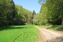
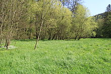
The Teufelsgrund is a narrow, densely wooded valley southwest of Geiselbach in the Aschaffenburg and Main-Kinzig districts , in the Spessart . It runs along the state border between Hesse and Bavaria . The valley is unpopulated and the Geiselbach flows through it.
geography
The Teufelsgrund begins immediately below Frohnbügel and continues in the direction of the Teufelsmühle , including the lower valley of the Omersbach and Falkenbach . The end of the Teufelsgrund is in Hüttelngesäß , where the Geiselbach reaches the Kahltal on state road 2305 .
The Hessian peaks of Heidkopf (371 m) and Schanzenkopf (365 m) in the Sölzert stretch on the steep right side of the slope . The Geiselbach feeds a few ponds from the mouth of the Omersbach . These were created a few years ago for fish farming, but had to be left to nature because of over- vegetation caused by strong algae development in the water.
Buildings
The remains of the legendary Teufelsmühle , one of three former mills in the lower Omersbachtal, are located near the confluence of the Omersbach and Geiselbach . On the left on the slopes of the Teufelsgrund, the last remains of the Rothenberger Hof were located until the mid-1990s . These were removed as part of a forest path renewal.
Web links
Individual evidence
- ↑ Federal Agency for Cartography and Geodesy , State Office for Surveying and Geoinformation Bavaria : Digital Topographic Map 1:10 000, BayernAtlas , accessed on March 23, 2014
Coordinates: 50 ° 6 ′ 21 ″ N , 9 ° 9 ′ 50 ″ E
