
Schanzenkopf (Schwedenschanze)
| Schanzenkopf | ||
|---|---|---|
 The summit of the Schanzenkopf from the neighboring mountain over the Teufelsgrund , seen from the southeast |
||
| height | 365 m above sea level NN | |
| location | Bavaria , Hessen , Germany | |
| Mountains | Spessart | |
| Dominance | 0.42 km → Heidkopf | |
| Notch height | 8 m | |
| Coordinates | 50 ° 6 '2 " N , 9 ° 8' 41" E | |
|
||
| Type | Low mountain range | |
.JPG) The Schanzenkopf near the Hessenkurve from the southwest |
||

The Schanzenkopf is a 365 meter high mountain in the Spessart in the Bavarian district of Aschaffenburg . The state border with Hesse is on the edge of the mountain .
geography

The wooded mountain is at the lower end of the Teufelsgrund , north of Hüttelngesäß , on the right side of the Kahltal . The valley separates the Schanzenkopf from the Hohen Mark on the Hahnenkamm . The Schanzenkopf is located in the northeastern part of the urban area of Alzenau . It is not to be confused with the mountain of the same name south of the city.
On the so-called Hessenkurve between Niedersteinbach and Michelbach , the very steep south-facing slopes extend towards the summit. The mountain also drops steeply over 200 m to the west and east. To the north it is related to the Heidkopf (371 m). This mountain range is also called Sölzert , although the term has almost disappeared to this day. It is the continuation of the Hahnenkamm mountain range to the Näßlichbach near Geiselbach . The entire area north and south of the Kahl was previously called Hohe Mark.
There are three ways to the top of the hill. One from the west, over the Dörsthöfe through the Wolfsgrund. Another way comes over the eastern slope of Hüttelngesäß through the Teufelsgrund. From the north, the summit can be reached from Frohnbügel via the Heidkopf.
The Aloisengarten vineyard is located on the southwest slope of the Schanzenkopf .
history
Schwedenschanze
The Schanzenkopf has a ring wall on its summit , which is called the Schwedenschanze . The term is often used in Germany in connection with ring walls. These are two large walls running in a semicircle.
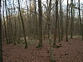
Since the mountain has three steep sides, the area to the north was covered by walls, the remains of which can still be seen. The main wall enclosed an area approximately 225 m long and 100 m wide. Even today, a 100 m long wall 2 to 4 m high and 12 m thick at the bottom gives an impression of the thickness of the facility. A 4 m wide trench was in front of the main wall. In front of it, an equally thick embankment extends in a semicircle, enclosing an area 65 m in diameter. In the interior, remnants of square masonry are said to have been recognized on the west side.
The fortifications were built in the Hallstatt period (between 800 and 400 BC). However, so far there has been a lack of scientific studies to confirm this assumption.
Picture gallery

The main wall
The main wall (east side)

The matrix

The main courtyard in the ring wall of the Schwedenschanze

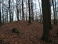
Remains of the wall can still be seen on the north side
The summit ridge towards Heidkopf


See also
Web links
- Location of the Schanzenkopf on the BayernAtlas
- At the Sölzert (PDF; 1.6 MB)
- From the ring wall (PDF; 1.3 MB)
- The Chronicle of Albstadt