Tippecanoe River
| Tippecanoe River | ||
|
River course and catchment area |
||
| Data | ||
| Water code | US : 452944 | |
| location | Indiana (USA) | |
| River system | Mississippi River | |
| Drain over | Wabash → Ohio → Mississippi → Gulf of Mexico | |
| source |
Big Lake , east of North Webster 41 ° 16 ′ 33 ″ N , 85 ° 30 ′ 42 ″ W |
|
| Source height | 273 m | |
| muzzle |
Wabash River north of Lafayette, IN Coordinates: 40 ° 30 ′ 54 " N , 86 ° 47 ′ 8" W 40 ° 30 ′ 54 " N , 86 ° 47 ′ 8" W |
|
| Mouth height | 157 m | |
| Height difference | 116 m | |
| Bottom slope | 0.43 ‰ | |
| length | 267 km | |
| Catchment area | 5040 km² | |
| Discharge at the Winamac A Eo gauge : 2439 km² |
MQ 2002/1016 Mq 2002/1016 |
29 m³ / s 11.9 l / (s km²) |
| Flowing lakes | Tippecanoe Lake | |
| Reservoirs flowed through | Lake Shafer, Lake Freeman | |
| Small towns | Monticello , Rochester , Warsaw | |
| Communities | North Webster, Winamac | |
|
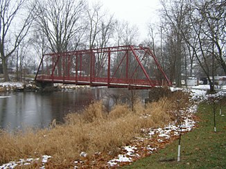
Tippecanoe River near Warsaw |
||
The Tippecanoe River is a right tributary of the Wabash River in the US state of Indiana . The river is 267 km long and drains an area of 5040 km² in central north Indiana.
The Tippecanoe River has its source in Noble County in northeast Indiana. Initially it flows in a westerly direction. At North Webster it flows through the Tippecanoe Lake . It passes the small town of Warsaw and flows north past Rochester . Later, west of Monterey , he turns south. The Tippecanoe River State Park is on the western riverbank. The Tippecanoe River flows past Winamac . On the lower reaches there are two hydropower plants whose dams, Norway Dam and Oakdale Dam , impound the Tippecanoe River to Lake Shafer and Lake Freeman . In between is the small town of Monticello on the river bank. About 20 km below Oakdale Dam, the Tippecanoe River joins the Wabash River north of Lafayette .
Web links
Individual evidence
- ^ Big Lake in the United States Geological Survey's Geographic Names Information System
- ^ Tippecanoe River in the Geographic Names Information System of the United States Geological Survey
- ^ Tippecanoe River . Indiana Dept. of Natural Resources. Retrieved July 30, 2017.
- ↑ Tippecanoe River Watershed Restoration Action Strategy (PDF 455 KB) Indiana Dept. of Environmental Management. Retrieved July 30, 2017.
- ↑ USGS 03331753 TIPPECANOE RIVER AT WINAMAC, IN

