
Toyohira-ku (Sapporo)
|
municipality of Sapporo |
|
|---|---|
 |
|
| Coordinates | 43 ° 1 '53 " N , 141 ° 22' 48" E |
| surface | 46.23 km² |
| Residents | 223,408 (Sep 30, 2019) |
| Population density | 4833 inhabitants / km² |
| Start-up | Apr 1, 1972 |
| Community key | 01105-3 |
| Website |
www.city.sapporo.jp/ toyohira / |
Toyohira-ku ( Japanese. 豊 平 区 ) is one of ten districts ( ku ) of Sapporo , the capital of the Japanese prefecture of Hokkaidō . It is 46.23 km² and is located southeast of the city center. In the west it borders on Minami-ku , in the northwest on Chūō-ku , in the north on Shiroishi-ku and in the east on Kiyota-ku .
geography
The name Toyohira comes from the Ainu language and means "crumbled rock face". The southern half of the district is dominated by forested hills, the highest is the Yaki-yama (262 m). The Toyohira River forms the northwestern boundary of the district. Major tributaries are Atsubetsu, Motsukisamu, Shōjin, Tsukisamu and Urauchinai.
history
Development of the area began in 1857 with the construction of a road towards Chitose . In the same year, Tetsuichi Shimura, who is known as the "founder of Sapporo", settled in the area. More settlers followed in the 1870s; most of them came from Iwate Prefecture . In 1875 the American engineer N. W. Holt built the first bridge over the Toyohira . The villages ( mura ) Hiragishi, Toyohira and Tsukisamu merged on April 1, 1902 to form Toyohira municipality, which was part of ( gun ) Sapporo County . In 1908 the community received the status of a district city ( machi ).
From 1913 a horse-drawn bus connected the cities of Sapporo and Toyohira, from 1924 a tram line . From 1918 the Jōzankei railway line also crossed the city. For a long time, Toyohira was best known for its apple orchards . However, these gradually disappeared due to increasing urbanization. In 1920 there were already 11,430 inhabitants. On May 1, 1961, Toyohira merged with Sapporo. The Jōzankei railway line was shut down in 1969, the tram two years later. The subway was also opened in 1971. From April 1, 1972, the urban part of the former urban area formed the Toyohira-ku district, while the more rural part in the west now belonged to the Minami-ku district .
Due to the continued strong growth of Toyohira, the municipality was divided by government resolution. So on November 4, 1997, the new Kiyoto-ku district was created from the eastern half . 2001 saw the opening of the Sapporo Dome , which is considered a symbol of Sapporo. Among other things, three group matches of the 2002 World Cup took place there; since 2004 it has been the home of the baseball team Hokkaidō Nippon Ham Fighters .
traffic
Toyohira-ku's main thoroughfare is National Road 36 , which crosses the district from northwest to southeast. National Road 453 runs south towards Lake Shikotsu .
Toyohira-ku is served by two lines of the Sapporo subway : on the one hand the Namboku line , which opened in 1971 with the stations Nakanoshima, Hiragashi and Minami-Hiragashi, on the other hand the Tōhō line , which has existed since 1994, with the stations Gakuen-mae, Toyohira-kōen , Misono, Tsukisamu-chūō and Fukuzumi. There are also several bus routes operated by private companies.
Attractions
- Hitsujigaoka (viewpoint)
- Hokkaidōritsu Sōgō Taiiku Center
- Nishioka Park
- Sapporo Dome
- Sapporo Tenjinyama Art Studio
- Toyohira Park
- Tsukisamu High School
- Tsukisamu Park

Toyohira-ku City Hall
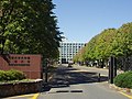
University of Sapporo

Nishioka Park

Minami-Hiragishi Subway Station


.jpg)

education
- Hokkai Gakuen University
- University of Sapporo
- International School of Hokkaidō
Web links
- Toyohira-ku website (Japanese)
Individual evidence
- ↑ a b 概況. Toyohira-ku, March 26, 2015, accessed April 17, 2018 (Japanese).
- ↑ a b c d 歴 史 ・ 年表. Toyohira-ku, July 31, 2014, accessed April 17, 2018 (Japanese).
- ↑ 豊 平 区 歴 史 年表. Toyohira-ku, October 24, 2017; accessed April 17, 2018 (Japanese).
Atsubetsu-ku | Chūō-ku | Higashi-ku | Kita-ku | Kiyota-ku | Minami-ku | Nishi-ku | Shiroishi-ku | Teine-ku | Toyohira-ku