
Trento (river)
| Trent | ||
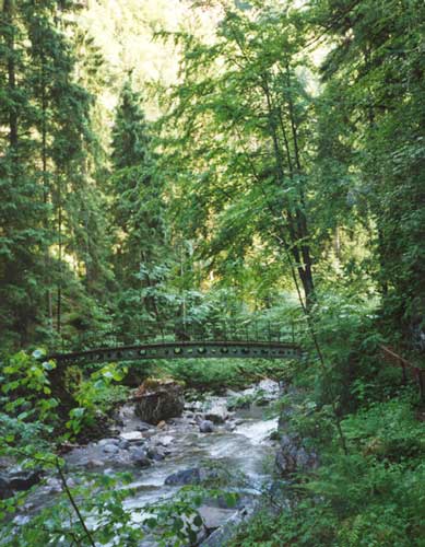
 View of the Gorges du Trient |
||
| Data | ||
| Water code | CH : 143 | |
| location | Canton of Valais , Switzerland | |
| River system | Rhone | |
| Drain over | Rhone → Mediterranean | |
| source | Originates from the Trient Glacier 46 ° 1 ′ 18 ″ N , 7 ° 1 ′ 25 ″ E |
|
| Source height | 2650 m | |
| muzzle | At Vernayaz in the Rhone coordinates: 46 ° 8 ′ 16 ″ N , 7 ° 3 ′ 6 ″ E ; CH1903: 570 090 / 109676 46 ° 8 '16 " N , 7 ° 3' 6" O |
|
| Mouth height | 450 m | |
| Height difference | 2200 m | |
| Bottom slope | 13% | |
| length | 17 km | |
| Catchment area | 164.2 km² | |
| Left tributaries | Nant Noir, Eau Noire , Besson, Triège | |
| Small towns | Martigny | |
| Communities | Trento , Finhaut , Salvan , Martigny-Combe , Vernayaz | |
.jpg) Trento |
||
The Trient is a river in the Swiss canton of Valais and flows through the valley of the same name, Vallée du Trient .
River course
It rises on the Trient Glacier above the town of Trento , about two kilometers from the border with France . Below Trento, the river takes on the Eau Noire from the left . Near the city of Martigny , Trento forms a 200-meter-deep gorge that can be reached via paved trails. This gorge is spanned by a bridge, the Pont de Gueuroz . Also nearby is the 114 meter high Pissevache - waterfall . After about 17 kilometers the Trento joins the Rhone at Vernayaz .
Gorges du Trento
Shortly before it flows into the Rhône, the gorge is accessible to visitors via a catwalk suspended from the rock. The access to the gorge is in the municipality of Vernayaz on the national road 21. The opening period is between May 1st and September 30th.
For an entrance fee, tourists can enter the front part of this gorge and find out about the geology of the formations cut by the water and about the special habitat. In places in the gorge, the rocks above the footbridge come together so closely that there is only a twilight atmosphere in these areas.
geology
The Gorges du Trient ravine cuts through the gneiss zone of the Mont Blanc massif , which stretches down into the Rhône valley.
See also
Web links
- Trient (river) on the ETHorama platform
- Vernayaz community site (French)
- Bridge over the Trient Gorge
- Construction of the bridge (French)
- Panoramic photos of Vernayaz and the surrounding area
- Bridge over the river
Individual evidence
- ↑ catchment area . map.geo.admin.ch.