Trukhaniv Island
| Trukhaniv Island | ||
|---|---|---|
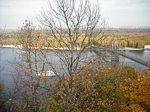
| The park bridge to Truchaniv Island | ||
| Waters | Dnepr | |
| Geographical location | 50 ° 28 ′ N , 30 ° 33 ′ E | |
|
|
||
| surface | about 450 hectares | |
| Residents | uninhabited | |
The Truchaniw Island ( Ukrainian Труханів острів / Truchaniw ostriw ) is an approximately 450 hectare river island of the Dnieper in the Ukrainian capital Kiev .
Use and development
The island is a recreational area and the center of the 1,558 hectare Dnieper Park. In addition to numerous cafes, bars and restaurants, it has the cleanest and longest beaches in the city. There is also a water sports center on the island with boat rentals, water slides, playgrounds, quiet bays, lakes, forests and meadows.
geography
The river island is located south of Muromets Island in the Dnieper between the center of the city and Podil on the western bank and the Dnipro Rajon on the eastern bank, to which the island also belongs administratively. On the island is the underground station Truchaniw Ostriw of the Kiev Metro, which is under construction .
Truchaniv Island has been connected to the center on the right Dneprufer since 1957 via the Park Bridge , a pedestrian bridge that begins on the Dneprufer below the Khreshchatyj Park near the Magdeburg Law Monument . The access for cars is in the north at the Moscow bridge. In addition to the bridges, the island can be reached from the Podil river port by water bus .
In the north of the island, the Podil Bridge , which crosses the island and the river, has been under construction for several years . To the south of the island are other Dnieper Islands, on which the Hidropark is located.
history
In the 10th century the island belonged to the Rurikid princess Olga of Kiev , who hunted falcons here. The name of the island probably comes from the Cuman khan Tugorkan, whose daughter, the wife of Grand Duke Svyatopolk II, lived here in her summer residence at the end of the 11th century. From 1534 to 1698 the island belonged to a Kiev monastery that no longer exists and then came into the possession of the city of Kiev. A subsequently grown village on the island was destroyed during the Second World War and not rebuilt.
Web links
- Leisure activities on the island (Russian)
Individual evidence
- ↑ a b c d e Günther Schäfer: Kiev tours through the metropolis on the Dnepr . 3. Edition. Trescher, Berlin 2011, ISBN 978-3-89794-181-6 , pp. 268–269 ( limited preview in Google Book Search [accessed December 31, 2016]).
- ↑ a b Trukhanov Ostrov on kiev.info ; last accessed on April 19, 2014 (English)
- ↑ Trukhaniv Island on Kiev Encyclopedia ; last accessed on April 19, 2014 (Ukrainian)
- ↑ Kiev water bus ; last accessed on April 19, 2014 (Russian)
- ↑ Truchaniw-Insel on oldkiev.info ( memento of the original from February 18, 2013 in the web archive archive.today ) Info: The archive link was automatically inserted and not yet checked. Please check the original and archive link according to the instructions and then remove this notice. ; last accessed on April 19, 2014 (Russian)


