Tschuggen (Bernese Oberland)
| Tschuggen | ||
|---|---|---|
|
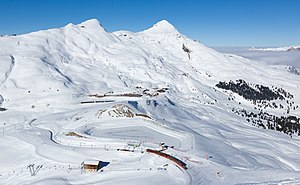
Tschuggen seen from the Kleine Scheidegg |
||
| height | 2521 m above sea level M. | |
| location | Canton of Bern , Switzerland | |
| Mountains | Bernese Alps | |
| Dominance | 3.52 km → Rotstock ( Eiger ) | |
| Notch height | 460 m ↓ Kleine Scheidegg | |
| Coordinates | 639 139 / 161129 | |
|
|
||
| rock | Dogger , slate | |
| Normal way | East ridge T4 | |
|
Kleine Scheidegg with Lauberhorn (left) and Tschuggen (right) |
||
|
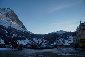
Tschuggen next to the north face of the Eiger above the Grindelwald valley |
||
The Tschuggen is 2521 m above sea level. M. high summit in the Bernese Pre-Alps above Wengen . It is the highest point in a chain of three mountains that rise north of the Kleine Scheidegg between Grindelwald and Wengen or the Lauterbrunnen valley . To the south of the Tschuggen lies the Lauberhorn ( 2,472 m above sea level ), in the north of the Männlichen ( 2,343 m above sea level ).
The mountain range drops steeply to the west over cliffs. As with other mountains of the Axen Nappe , which consists of 180 million year old slates , clay and marl stones , the Tschuggen falls steeply into rock faces not only in the west to Wengen, but also in the north, while the southeast flank is less steep and rocky . In contrast to the Männlichen and the Lauberhorn, the pyramid-like Tschuggen is much more difficult to climb, as the southeast flank in the summit area is also quite steep and interspersed with rocks.
On the east side of the Tschuggen, the popular hiking trail leads from Männlichen to Kleine Scheidegg. In contrast to its neighbors, the Tschuggen summit is neither accessible by marked hiking trails nor by railways. On the east side there are two chair lifts for skiers . The mountain station of the higher is at approx. 2300 m above sea level. M. on the east shoulder.
literature
- Daniel Anker: Bernese Oberland: 50 tours between the Eigerwand and Emmental . Bergverlag Rother, Munich 2009, ISBN 978-3-7633-3038-6 , p. 28–30 ( limited preview in Google Book search).
Web links
Individual evidence
- ^ René Herb: Report on the excursion of the Swiss Geological Society to the Schilthorn on September 19, 1982 . In: Eclogae Geologicae Helvetiae . tape 76 , March 1983, p. 181-188 , doi : 10.5169 / seals-165356 .
- ^ Herbert Seeber: Contributions to the geology of the Faulhorn group (western part) and the Männlichen group. Buchdruckerei Otto Lanz, Bern 1911 ( entry in Google Books - dissertation).
- ↑ Via GeoAlpina: Stage 2 Grindelwald-Lauterbrunnen. (PDF; 3.8 MB) In: swisstopo. Archived from the original on March 20, 2016 ; accessed on September 27, 2016 .
- ↑ Via GeoAlpina: Stage 1 Rosenlaui-Grindelwald. (PDF; 2.6 MB) In: swisstopo. Retrieved September 27, 2016 .


