Tula (Tamaulipas)
| Tula | ||
|---|---|---|
|
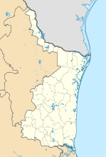
Coordinates: 23 ° 0 ′ N , 99 ° 43 ′ W Tula on the map of Tamaulipas
|
||
| Basic data | ||
| Country | Mexico | |
| State | Tamaulipas | |
| Municipio | Tula | |
| City foundation | 1617 | |
| Residents | 10,043 (2010) | |
| City insignia | ||
| Detailed data | ||
| surface | 9.03 km 2 | |
| Population density | 1,112 inhabitants / km 2 | |
| height | 1175 m | |
| Website | ||
| Tula - San Antonio de Padua Church and Monument | ||
| Tula - Plaza Mayor | ||
Tula (official name Ciudad Tula ) is a small town with about 12,000 inhabitants and the administrative seat of a municipality (municipio) consisting of several villages and hamlets with about 32,000 inhabitants in the southwest of the Mexican state Tamaulipas . Because of its historic city center, it is one of the Pueblos Mágicos .
location
Tula is located in the mountains of the Sierra Madre Oriental in northeast Mexico at an altitude of about 1175 m . Ciudad Victoria , the capital of the state, is approximately 145 km (driving distance) to the northeast. The climate is temperate because of the altitude; Rain (approx. 490 mm / year) falls mainly in the summer months.
Population and economy
| year | 2000 | 2005 | 2010 |
| Residents | 8,375 | 8,778 | 10,043 |
Much of the population is of Spanish descent; Colloquial language is mostly Spanish.
economy
While the surrounding area is more agriculturally oriented, smaller trade, craft and service companies have settled in Tula.
history
Tula was founded as a mission center on July 22, 1617 by the Franciscan monk Juan Bautista de Mollinedo . In 1744 the place was raised to the rank of town (villa) . The citizens of Tula took an active part in the Mexican War of Independence (1810-1821); However, they lost a battle against the Royal Spanish Army in the northeast of the city on May 22, 1811. 14 years after Mexico gained independence, Tula received full city rights (ciudad) . On June 4, 1865, a battle against French occupation troops raged in the area .
Attractions
- The streets and houses of the small town, but especially the Plaza Mayor , are designed according to central Mexican models.
- The St. The church, consecrated to Anthony of Padua , was built in the 18th century and features a crossing dome resting on an octagonal drum .
- Surroundings
- Approx. 8 km south of the village lies the pre-Hispanic ruins of Tammapul , which were inhabited from the 6th to the 9th century. The most important building is the ruin of an approx. 5 m high stump of a step pyramid with a fortress on top.
Personalities
- Carmen Romero Rubio (1864–1944), second wife of Porfirio Díaz
Web links
- Tula - Maps, Photos + Info (INAFED, Spanish)
- Tula, history etc. - information (Spanish)


