Tym (Ob)
|
Tym Тым |
||
| Data | ||
| Water code | RU : 13010900112115200033278 | |
| location | Krasnoyarsk Region , Tomsk Oblast ( Russia ) | |
| River system | If | |
| Drain over | Whether → Arctic Ocean | |
| source |
West Siberian Lowlands 60 ° 4 ′ 30 ″ N , 86 ° 40 ′ 10 ″ E |
|
| Source height | approx. 180 m | |
| muzzle | in the Ob coordinates: 59 ° 25 ′ 57 " N , 80 ° 1 ′ 39" E 59 ° 25 ′ 57 " N , 80 ° 1 ′ 39" E |
|
| Mouth height | 42 m | |
| Height difference | approx. 138 m | |
| Bottom slope | approx. 0.15 ‰ | |
| length | 950 km | |
| Catchment area | 32,300 km² | |
| Discharge at the Vanzhil-Kinak A Eo gauge : 10,100 km² Location: 562 km above the mouth |
MQ 1954/2000 Mq 1954/2000 |
80 m³ / s 7.9 l / (s km²) |
| Discharge at the Napas A Eo gauge : 24,500 km² Location: 272 km above the mouth |
MQ 1937/2000 Mq 1937/2000 |
191 m³ / s 7.8 l / (s km²) |
| Discharge at the gauge near the mouth |
MQ |
250 m³ / s |
| Left tributaries | Polta | |
| Right tributaries | Wanschil , Podelga , Kossez , Sangilka | |
| Navigable | 560 km | |
|
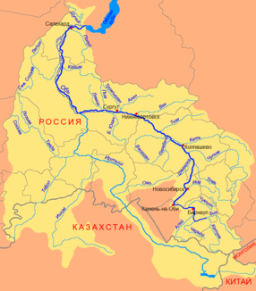
Course of the Tym (Тым) in the catchment area of the Ob |
||
The Tym ( Russian Тым ) is a 950-kilometer-long right tributary of the Ob in Western Siberia ( Russia , Asia ).
course
The Tym rises at a height of about 180 m in the southeastern part of the West Siberian lowlands , in the area of the flat, marshy watershed between Ob and Yenisei in the west of the Krasnoyarsk region . It initially flows through the lowlands in a westerly direction, reaches the northeast of Tomsk Oblast and turns there in a southwesterly direction, which it maintains until its mouth.
The tym meanders strongly throughout the course . It finally flows into the Ob near the village of Ust-Tym at a height of 42 m . Almost ten kilometers above, the Radaika estuary branches off, which joins the Milja arm a little further north .
The most important tributaries are the Wanschil, Podelga, Kossez and Sangilka from the right and the Polta from the left.
Hydrography
The catchment area of the Tym covers 32,300 km². Near the mouth, the river is almost 200 meters wide and three meters deep; the flow velocity is 0.8 m / s.
The Tym freezes from October / early November to the end of April / May and floods when the snowmelts in May to August. The mean water flow near the mouth is about 250 m³ / s; in the village of Napas located on the central reaches 272 kilometers above the estuary still 191 m³ / s, with a minimum monthly mean of 59.2 m³ / s in March and a maximum monthly mean of 628 m³ / s in June.
Infrastructure
The Tym is navigable for 560 kilometers from the confluence of the Wanschil and the Wanschil-Kynak weather station located there.
The river flows through very sparsely populated areas. A good half of the Selkupen , an indigenous Siberian people, live here. Between the already mentioned places Napas and Ust-Tymsk there are only the villages Molodjoschny and Negotka on the river, on the navigable tributary Sangilka a few kilometers away the village Tolparowo. Only in the area of these places there are few unpaved roads; there is no bridge.
Web links
Individual evidence
- ↑ a b Article Tym in the Great Soviet Encyclopedia (BSE) , 3rd edition 1969–1978 (Russian)
- ↑ a b Tym in the State Water Register of the Russian Federation (Russian)
- ↑ Tym at the Vanzhil-Kinak gauge - hydrographic data at R-ArcticNET
- ↑ a b Tym at the Napas gauge - hydrographic data at R-ArcticNET

