Uçhisar
| Uçhisar | ||||
|
||||
| Basic data | ||||
|---|---|---|---|---|
| Province (il) : | Nevşehir | |||
| Coordinates : | 38 ° 38 ' N , 34 ° 48' E | |||
| Height : | 1270 m | |||
| Residents : | 3,860 (2014) | |||
| Telephone code : | (+90) 384 | |||
| Postal code : | 50 xxx | |||
| License plate : | 50 | |||
| Structure and administration | ||||
| Mayor : | Ali Karaaslan | |||
| Website: | ||||

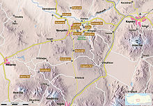
Uçhisar is a place in Cappadocia in the Nevşehir Province of Turkey . The place is 7 kilometers east of Nevşehir , 12 kilometers west of Ürgüp and 10 kilometers from Avanos in the south.
history
Uçhisar was first mentioned in a 14th century chronicle by Aziz Ibn Ardasir. The Hittites are said to have used the natural properties of the rocks as a location and retreat against possible attacks. A few years later, groups of Persians and Macedonians immigrated to the area. In the 15th century, the Byzantines established a so-called "filter zone" to prevent Islamic incursions. The special nature of the ground made defense easier, while the camouflaging of the buildings provided additional protection against attackers. After conquering the area, the Muslims also took advantage of the defensive possibilities by creating small centers with caravanserais in the zone.
Site and sights
Uçhisar is dominated by a 60 meter high castle rock, which is visible from a great distance. This rock is criss-crossed by numerous underground passages and rooms, most of which are now filled in or impassable. They served as living quarters, and in Byzantine times also as a monastery. Originally around 1000 people lived in the castle rock, but today this rock is uninhabited. Particular also from tuff existing fairy chimneys that dominate the surrounding landscape.
The greater roughness of the floor can still be seen today. The view from the west of the village is particularly impressive. From here you can see the citadel, which is the tallest building in Uçhisar and is reminiscent of the shape of a large, cylindrical tower. In the center of the town there is an underground gallery about 100 m long under some houses. It was built in older times in the tuff and probably served as a connecting element to the outside world in order to protect the fortress and its water supply during sieges.
The so-called "Valley of the Dovecotes" (Turkish Güverçin Vadisi ) is located near the village . Several dovecotes have been built on the rock faces of the valley over the years. These are buildings with large frontal areas. Inside these fields there are numerous niches for native bird species. The excrement produced by nesting is mainly used as fertilizer. Through the valley you get to Göreme in the northeast, about two hours away on foot from Uçhisar .
A large part of Uçhisar's population still lives from agriculture, but tourism is playing an increasingly important role. In particular, the French and Turks who have returned from France have started to transform the picturesque rock huts into tourist accommodation.
Apartment in the tuff
See also
literature
- Michael Bussmann, Gabrielle Tröger: Turkish Riviera, Cappadocia . Michael Müller Verlag, Erlangen 2003, ISBN 3-89953-108-6
- Peter Daners, Volher Ohl: Cappadocia . Dumont, 1996, ISBN 3-7701-3256-4
Web links
Individual evidence
- ↑ İşte Nevşehir'in İlçe Belde ve Köy Nüfusu
- ↑ Cappadocia - Copyright 1996 by Casa Editrice Bonechi, via Cairoli 18 / b, Florence - Italy (p. 12)


