Ustermer Aa
|
Ustermer Aa Aabach |
||
|
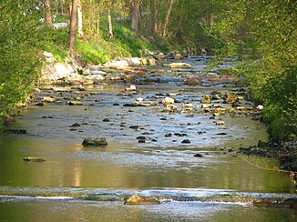
Ustermer Aa in Niederuster |
||
| Data | ||
| Water code | CH : 607 | |
| location | Canton of Zurich ; Switzerland | |
| River system | Rhine | |
| Drain over | Glatt → Rhine → North Sea | |
| source | from the Pfäffikersee 47 ° 20 ′ 22 ″ N , 8 ° 46 ′ 48 ″ E |
|
| Source height | 537 m above sea level M. | |
| muzzle | in the Greifensee coordinates: 47 ° 21 '6 " N , 8 ° 41' 20" E ; CH1903: 694 457 / 245 292 47 ° 21 '6 " N , 8 ° 41' 20" O |
|
| Mouth height | 435 m above sea level M. | |
| Height difference | 102 m | |
| Bottom slope | 9.4 ‰ | |
| length | 10.9 km | |
| Catchment area | 62.75 km² | |
| Discharge at the Niederuster A Eo gauge : 62.7 km² Location: 800 m above the mouth |
NNQ (1984) MQ 1980–2016 Mq 1980–2016 HHQ (1984) |
130 l / s 1.62 m³ / s 25.8 l / (s km²) 44.3 m³ / s |
| Left tributaries | Torrent | |
|
Discharge from the Pfäffikersee |
||
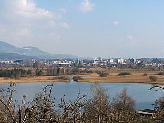
The Ustermer Aa or the Aabach (not to be confused with the Mönchaltorfer Aa ) is a 10.9 kilometer long stream in the canton of Zurich , which begins as an outflow of the Pfäffikersee ( 537 m above sea level ) and as a tributary of the Greifensee ( 435 m above sea level ) ends. At the beginning the Aa flows to Wetzikon to the southeast, turns there to the northwest, takes in the torrent , crosses the Oberustermer forest in the narrow Aatal and flows through Uster and near Niederuster into the Greifensee.
Industrial history
The Ustermer Aa loses 100 meters in altitude on its short run and therefore drove five mills in the Middle Ages. In the 19th century, the region along the brook became the center of the cotton industry in the Zurich Oberland . 15 spinning mills along the way turned it into a “stream of millions”. In the 20th century, the textile industry was concentrated in a few companies.
Industrial canal and renaturation
To protect against flooding the river was heavily built and channeled. Projects are currently being implemented to restore the course of the stream and enable fish to migrate in the Aa by means of fish ladders and reduced thresholds . In addition, the city of Uster would like to expand the parks along the course of the stream.
See also
literature
- The industrial revolution in the Zurich Oberland. J. Hanser, 1985
- The Zurich Oberland industrial nature trail. H.-P. Bärtschi, 1994
Web links
Individual evidence
- ↑ a b Geoserver of the Swiss Federal Administration ( information )
- ↑ Hydrological Atlas of Switzerland of the Federal Office for the Environment FOEN, Table_13
- ↑ Topographical catchment areas of Swiss waters: sub-catchment areas 2 km². Retrieved September 8, 2017 .
- ↑ Aabach-Niederuster 1980–2016. (PDF) Position 554: monthly samples. In: Office for Waste, Water, Energy and Air, Department of Water Protection. Retrieved August 9, 2017 .
- ^ Ueli Müller: Aa [Aabach]. In: Historical Lexicon of Switzerland .
- ^ Stefan Hotz: A popular body of water . In: Neue Zürcher Zeitung . No. 77 , April 2, 2014, p. 18 .

