Vejprnický potok
|
Vejprnický potok Weipernitzer Bach, Wiesenbach |
||
|
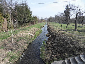
The Vejprnický potok shortly before its confluence with the Mže |
||
| Data | ||
| Water code | CZ : 1-10-01-187 | |
| location | Czech Republic | |
| River system | Elbe | |
| Drain over | Mže → Berounka → Moldau → Elbe → North Sea | |
| source | northeast of Radějovice in the Pilsen Hills 49 ° 41 ′ 51 ″ N , 13 ° 4 ′ 37 ″ E |
|
| Source height | approx. 405 m nm | |
| muzzle | west of the city center of Pilsen in the Mže coordinates: 49 ° 44 ′ 56 " N , 13 ° 21 ′ 39" E 49 ° 44 ′ 56 " N , 13 ° 21 ′ 39" E |
|
| Mouth height | 305 m nm | |
| Height difference | approx. 100 m | |
| Bottom slope | approx. 4.6 ‰ | |
| length | 21.6 km | |
| Catchment area | 77.6 km² | |
| Drain |
MQ |
170 l / s |
The Vejprnický potok (German Weipernitzer Bach , also Wiesenbach ) is a right tributary of the Mže in the Czech Republic .
course
The Vejprnický potok rises in the Pilsener hilly country 500 meters northeast of Radějovice in a pond. Its source is at the northwestern foot of the Železný vrch ( Hutberg or Eisenkopsa , 444 m nm). The stream flows through Horní Sekyřany and Dolní Sekyřany on its upper course, which initially leads northeast into the Wilkischer Mulde. At Přehýšov the Vejprnický potok takes an easterly direction and flows past Blatnice , the factory premises of DIOSS Nýřany as, Větrná Jáma, Humboldtka and Mexico through the former pond Jankov, on the area of which the brook from the disused connecting railway to DIOSS Nýřany, the motorway D 5 / E 50 and the Plzeň – Furth railway line in the forest . The Vejprnický potok releases two thirds of its water to the Luční potok via the Immerwassergraben . The stream then flows through Nýřany , where it turns its course to the northeast. Via Tlučná and Vejprnice , the Vejprnický potok near Nová Hospoda reaches the urban area of Pilsen . There the stream flows between the districts of Zátiší, Skvrňany and the Škoda works , where it is bridged by the Plzeň – Cheb railway at the Plzeň-Skvrňany stop . After 21.6 kilometers, the Vejprnický potok flows into the Mže west of the city center of Pilsen behind the central bus station.
Between Heřmanova Huť and Nýřany, the D 5 motorway follows the course of the brook. The Plzeň – Furth railway line runs from Nýřany to Plzeň-Skvrňany along the Vejprnický potok.
history
In the 19th and 20th centuries, mining on hard coal and iron ore was carried out on the upper reaches of the stream in the Wilkischer Mulde. Southwest of Nýřany was the largest pond in the region with an area of 130 hectares, the Jankow, until 1872. After the manor Chotěšov intended to drain the fish pond in 1870, the municipality of Úherce , where the main flow of the Jankow to Luční potok was located, asserted its rights to the water of the Vejprnický potok. After the water rights process had been decided in favor of Úherce in 1880, in 1884 the ever water canal to Luční potok was built in the pond , into which two thirds of the water from Vejprnický potok was diverted via a water divider.
Tributaries
- Hlubočka (l), in the Přehýšovský rybník
- Hněvnický potok (l), near Nýřany
Drains
- Always moat to Luční potok in the former Jankov pond near Nýřany
Flowing ponds
- Přehýšovský rybník, near Přehýšov
