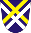
Vihula
| Vihula | |||
|
|||
| State : |
|
||
| Circle : |
|
||
| Coordinates : | 59 ° 33 ' N , 26 ° 9' E | ||
| Area : | 364.91 km² | ||
| Residents : | 2,009 (01/01/2010) | ||
| Population density : | 6 inhabitants per km² | ||
| Time zone : | EET (UTC + 2) | ||
| Website : | |||

|
|||
Vihula (German: Viol ) was a rural community in the Estonian district of Lääne-Viru with an area of 364.91 km². It had residents in 2009 (January 1, 2010).
Vihula was first mentioned in a document in 1241. 60% of the area belonged to the Lahemaa National Park . 72% of the area was covered by forests.
In addition to the main town Võsu ( Eng . Wösso ), the municipality included the villages Aasumetsa, Adaka, Altja , Andi, Annikvere, Eisma , Eru, Haili, Ilumäe, Joandu, Kakuvälja, Karepa, Karula, Käsmu , Kiva, Koljaku , Koolimäe, Korjuse, Kosta, Lahe, Lauli , Lobi, Metsanurga, Metsiku, Muike, Mustoja, Natturi, Noonu, Oandu, Paasi, Pajuveski, Palmse , Pedassaare, Pihlaspea, Rutja, Sagadi , Sakussaare, Salatse, Tepelvälja, Tidriku, Tiigi, Toolse , Tõriku Uusküla, Vainupea , Vatku, Vergi , Vihula, Villandi, Võhma and Võsupere.
The northernmost Estonian island, Vaindloo , with its famous lighthouse belonged to the municipality . The important and well-preserved former Baltic German manors of Palmse , Sagadi and Vihula are located on the former municipal area . The ruins of the Toolse Ordensburg (German: Toolsburg ) located on the Baltic Sea are particularly worth seeing . It was founded in 1471 by the order master Johann Wolthus von Herse († 1472) to protect the local harbor and destroyed in the Northern War at the beginning of the 18th century.
Web links
- Vihula municipality website (Estonian)
- Vihula manor complex (Estonian, English, Finnish)
- Historic jug from Altja
- Images of the Toolse ruins


