
Vlekkem
| Vlekkem | |||
|---|---|---|---|

|

|
||
|
|||
| State : |
|
||
| Region : | Flanders | ||
| Province : | East Flanders | ||
| District : | Aalst | ||
| Municipality : | Erpe-Mere | ||
| Coordinates : | 50 ° 56 ' N , 3 ° 57' E | ||
| Area : | 1.55 km² | ||
| Post Code: | 9420 | ||
| Prefix: | 053 | ||
| Location map |

|
||
| Site plan description | Location of Vlekkem in the municipality of Erpe-Mere in the arrondissement of Aalst in the province of East Flanders | ||
| Community plan |

|
||
| Community description | Location of Vlekkem in Erpe-Mere | ||

Vlekkem is a sub-municipality of Erpe-Mere on the Molenbeek in the Denderstreek in the Flanders region . It is located in the southeast of the province of East Flanders and belongs to the Arrondissement of Aalst . The sub-municipality is bounded by the hamlet of Egem in the sub-municipality Bambrugge , by the sub-municipality Ottergem and the municipal areas of Sint-Lievens-Houtem (sub-municipality Vlierzele and Zonnegem). Vlekkem has 292 inhabitants (January 1, 2003) and an area of 1.22 km². The population density is 240 inh / km².
history
The village of Vlekkem was first mentioned in an official document in 1036. In this charter of Emperor Koenraad II, who recognized the Abbey of St. Pietersabdij in Ghent and its possessions, one spoke of "et in Bursinghem et terram in Ottringhem et terram in Flachem". In 1209 people spoke of Vleckem. According to the historian Föstermann, the name is derived from a personal name. At the end of the 18th century, Vlekkem had 55 apartments and 275 inhabitants.
Attractions
The Sint-Lambertus Church is in Vlekkem. Vlekkem is part of the Lede dean's office.

The church of Vlekkem

The chapel on Keerstraat in Vlekkem

The Christ statue in the Keerstraat in Vlekkem


tourism
The Molenbeek route runs through Vlekkem. The Molenbeek route is a cycle path, known above all are the mills of the municipality of Erpe-Mere and two streams, both of which are named Molenbeek (Mühlenbach).

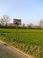
Beginning of a closed village in Vlekkem
End of a built-up village in Vlekkem


Sub-municipalities:
Aaigem |
Bambrugge |
Burst |
Erondegem |
Erpe |
Mere |
Ottergem |
Vlekkem
hamlet:
Egem
List of municipalities in Belgium | Arrondissement of Aalst | East Flanders | Flanders