Wary
| Wary | ||
| Вари | ||

|
|
|
| Basic data | ||
|---|---|---|
| Oblast : | Zakarpattia Oblast | |
| Rajon : | Berehove district | |
| Height : | 115 m | |
| Area : | 5.8 km² | |
| Residents : | 3,147 (2001) | |
| Population density : | 543 inhabitants per km² | |
| Postcodes : | 90255 | |
| Area code : | +380 03141 | |
| Geographic location : | 48 ° 8 ' N , 22 ° 43' E | |
| KOATUU : | 2120481601 | |
| Administrative structure : | 1 village | |
| Address: | вул. Маломут буд. 10 90255 с. Вари |
|
| Website : | City council website | |
| Statistical information | ||
|
|
||
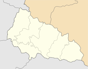
Wary ( Ukrainian Вари ; Russian Вары , Slovak Vary , Hungarian Mezővári ) is a village in the south of the Ukrainian Zakarpattia Oblast with about 3100 inhabitants (2001).
The village, first mentioned in writing in 1320, is the only village in the district council of the same name in the south of Berehove district .
The village lies at an altitude of 115 m at the mouth of the Borschawa in the Tisza , which is the border river to neighboring Hungary .
Wary is located 13 km south of the Rajonzentrum Berehove and 76 km southeast of the Oblastzentrum Uzhhorod .
Web links
Commons : Wary - collection of images, videos and audio files
- Local history Wary in the history of cities and villages of the Ukrainian SSR (Ukrainian)
- Mezővári location description (Hungarian)
- Village page on tt.org.ua (Ukrainian)
Individual evidence
- ↑ a b local website on the official website of the Verkhovna Rada ; accessed on January 25, 2019 (Ukrainian)
- ^ Website of the district council on the official website of the Verkhovna Rada; accessed on January 25, 2019 (Ukrainian)


