
Whittingham (Northumberland)
| Whittingham | |||
|---|---|---|---|
 |
|||
| Coordinates | 55 ° 24 ′ N , 1 ° 54 ′ W | ||
| OS National Grid | NU065115 | ||
|
|||
| Residents | 525 (as of ( 2011 Census )) | ||
| surface | 84.23 km² (32.52 mi² ) | ||
| Population density: | 6 inhabitants per km² | ||
| administration | |||
| Post town | ALNWICK | ||
| ZIP code section | NE66 | ||
| prefix | 01665 | ||
| Part of the country | England | ||
| region | North East England | ||
| Shire county | Northumberland | ||
| District | Alnwick | ||
| Civil Parish | Whittingham | ||
| British Parliament | Berwick-upon-Tweed | ||

Whittingham is a village in Northumberland , England .
location
Whittingham is on the eastern slopes of the Cheviot Hills in the valley of the River Aln . The next larger towns are in the south about 10 km away Rothbury , in the west 12 km away Alnwick and in the north the Wooler 20 km away . To the west are the higher elevations of the Cheviot Hills with the Northumberland National Park , only smaller villages like Alnham in the upper valley of the Aln can be found here .
history
The earliest traces of human settlement at Whittingham date back to the Neolithic . Several cup-and-ring markings , barrows and individual weapons and utensils have been found from the Bronze Age . There were two Roman roads in the parish , one from Corbridge to the northeast coast and a connecting road to Dere Street . There was a small Roman fort at the intersection of these two streets. The foundation of the church is to the early Middle Ages dated, in the following period of the emerged during wars between England and Scotland scattered fortifications to protect the local population. The community was consistently agricultural, as can be seen in the Eslington Park estate west of the village, which has been a local aristocratic seat since the 15th century.
Buildings
The Church of St Bartholomew dates back to the Anglo-Saxon period and, as a Grade I Listed Building, is classified as a building of extraordinary historical importance and has the highest English monument protection level . In the center of the village there is a peel tower from the 13th / 14th centuries. Century, which was converted into small apartments by Baron Ravensworth in the late 19th century . Outside the village there are historically significant buildings, including the Roman Catholic Church on the road to Glanton and the Bridge of Aln Hotel on the bridge of the trunk road over the Aln.
Economy and population
The majority of all employees work in agriculture, forestry or trade.
The average age of the population is 43 years, there are no ethnic minorities in the village.
Infrastructure
About 2 km from the center of the village, the A697 trunk road runs through the municipality from south to north . Until 1953 there was also a station on the railway line from Alnwick to Coldstream , of which remains are still present and which the name of the corresponding district "Whittingham Station" recalls.
photos

St Bartholomew Church with graveyard
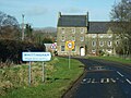
Entrance

Whittingham Tower

Callaly Road just before Lemington Bank

Remnants of the old train station


literature
- Samuel Lewis (Ed.): A Topographical Dictionary of England . London 1848, p. 557 ( online [accessed on March 5, 2020]).
Individual evidence
- ↑ a b c Local Area Report for Whittingham on the nomisweb information system of the Office for National Statistics ; accessed on March 4, 2020.
- ↑ St Bartholomew (Grade I) [1041257] ( English ) In: National Heritage List for England . Historic England . Retrieved March 5, 2020.
- ↑ Whittingham Tower (Grade II *) [1371450] ( English ) In: National Heritage List for England . Historic England . Retrieved March 5, 2020.
- ↑ St Mary (Grade II) [1371453] ( English ) In: National Heritage List for England . Historic England . Retrieved March 5, 2020.
- ↑ Bridge of Aln Hotel (Grade II) [1041292] ( English ) In: National Heritage List for England . Historic England . Retrieved March 5, 2020.
- ^ Whittingham Station (Grade II) [1155868] ( English ) In: National Heritage List for England . Historic England . Retrieved March 5, 2020.
Web links
- Whittingham history on keystofthepast.info , the Northumberland and Durham Counties history page.