Wickriede
| Wickriede | ||
|
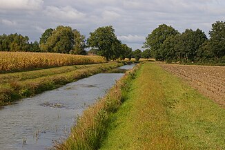
The Wickriede at the national border |
||
| Data | ||
| Water code | EN : 4764 | |
| location | Minden-Lübbecke district , North Rhine-Westphalia / Nienburg district and Diepholz district , Lower Saxony | |
| River system | Weser | |
| Drain over | Great Aue → Weser → North Sea | |
| source | in Frotheim , Espelkamp 52 ° 21 ′ 32 ″ N , 8 ° 41 ′ 4 ″ E |
|
| muzzle | in Ströhen in the Great Aue Coordinates: 52 ° 31 '8 " N , 8 ° 41' 26" E 52 ° 31 '8 " N , 8 ° 41' 26" E |
|
| Mouth height |
37 m above sea level NN
|
|
| length | about 23 km | |
The Wickriede is a 23 km long river in the districts of Minden-Lübbecke ( North Rhine-Westphalia ), Nienburg and Diepholz ( Lower Saxony ).
Its source is near Frotheim , a district of Espelkamp in the Minden-Lübbecke district. From there it flows first in an easterly direction and then largely in a northerly direction. It crosses Diepenau and is then the border river between the two federal states of North Rhine-Westphalia and Lower Saxony.
The Wickriede flows into the Große Aue at a height of 37 meters near Rehersort between Kattelingerort and Winkelerort, districts of Ströhen in the municipality of Wagenfeld .
West of Wick Riede is in the area of the city Rahden the 46.7 hectares large nature reserve White Moor .
