Woblitz
| Woblitz | ||
|
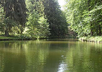
the Woblitz between Großem Lychensee and Haussee |
||
| Data | ||
| Water code | DE : 581291-5812999 | |
| location | Brandenburg , Germany | |
| River system | Elbe | |
| Drain over | Havel → Elbe → North Sea | |
| origin | Discharge of the Großer Lychensee 53 ° 11 ′ 27 ″ N , 13 ° 16 ′ 20 ″ E |
|
| muzzle | in the Stolpsee coordinates: 53 ° 10 ′ 30 ″ N , 13 ° 13 ′ 46 ″ E 53 ° 10 ′ 30 ″ N , 13 ° 13 ′ 46 ″ E
|
|
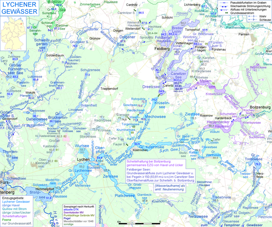
The Woblitz (from Voblica , Slavic for little Havel ) is a left tributary of the upper Havel in the north of Brandenburg, between Lychen and Himmelpfort . Together with a number of upper courses, it is also called the Lychener Waters hydrologically and is the core of the federal waterway of the same name.
It is not to be confused with the Wublitz , a former right tributary and today's tributary of the central Havel west of Berlin.
description
Their above-ground catchment area can reach as far as the Feldberger Lakes under certain storage conditions . Among other things, it flows through the Großer Lychensee west of Lychen , east of Himmelpfort the Haussee (referred to as stagnum Wublitz in 1299 ) and, after passing the Himmelpfort lock with the confluence with the Stolpsee, reaches the watercourse of the Havel at OHW -km 54.84.
In the southern bank area are the beech - sessile oak forests of the Himmelpforter Heide .
The Woblitz was transformed into a raft canal as early as the 18th century. Between 1879 and 1882 the river was expanded to make it navigable for Finowmeasure boats up to 220 t ( Lychen Canal ). For this purpose, a trench with the Himmelpfort lock was dug to the west of the natural outflow of the Haussee.
The Woblitz is part of the 8 km long federal waterway Lychener Gewässer (LyG) of waterway class I from Lychen to Himmelpfort, a side water of the Upper Havel waterway (OHW). The Eberswalde Waterways and Shipping Office is responsible .
Individual evidence
- ↑ Geoportal Brandenburg → data package gewnet25.zip → u. a. PDF: River directory, source data set gewnet25 Version 4.2
- ↑ a b Lengths (in km) of the main shipping lanes (main routes and certain secondary routes) of the federal inland waterways ( Memento of the original from January 21, 2016 in the Internet Archive ) Info: The archive link was automatically inserted and not yet checked. Please check the original and archive link according to the instructions and then remove this notice. , Federal Waterways and Shipping Administration
- ↑ Directory E, serial no. 39 of the Chronicle ( Memento of the original of July 22, 2016 in the Internet Archive ) Info: The archive link was inserted automatically and has not yet been checked. Please check the original and archive link according to the instructions and then remove this notice. , Federal Waterways and Shipping Administration

