Vodjane (Kamjanka-Dniprowska)
| Vodjane | ||
| Водяне | ||

|
|
|
| Basic data | ||
|---|---|---|
| Oblast : | Zaporizhia Oblast | |
| Rajon : | Kamjanka-Dniprovska district | |
| Height : | no information | |
| Area : | 10.31 km² | |
| Residents : | 5,921 (2004) | |
| Population density : | 574 inhabitants per km² | |
| Postcodes : | 71319 | |
| Area code : | +380 617 | |
| Geographic location : | 47 ° 29 ' N , 34 ° 30' E | |
| KOATUU : | 2322482401 | |
| Administrative structure : | 1 village | |
| Address: | вул. Миру 145 71316 с. Водяне |
|
| Statistical information | ||
|
|
||
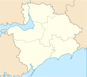
Vodjane ( Ukrainian Водяне ; Russian Водяное Vodjanoje ) is a village in the west of the Ukrainian Oblast of Zaporizhia with about 5900 inhabitants (2004).
geography
Wodjane is the only village in the district council of the same name in Kamjanka-Dniprovska district . It is located on the (left) south bank of the Dnepr , which is dammed up to the Kachowka reservoir , between the cities of Kamjanka-Dniprowska in the east and Enerhodar with the Zaporizhia nuclear power plant in the west. The town of Nikopol is located on the opposite shore of the lake .
Territorial road T – 08–05 runs through the municipality .
history
In 1780, Cossacks, fled serfs and deserted soldiers founded the village at the point where the trade route from the northern provinces of the Russian Empire to Perekop in the Crimea crossed the Dnieper. Numerous dirty, small and crooked streets were built in the haphazardly built settlement. In the middle of the 19th century the village already had 515 households in which more than 3000 people lived. In 1884 there were 868 households and a population of 5046 inhabitants.
Individual evidence
- ^ Website of the village on the website of the Verkhovna Rada ; accessed on July 27, 2017 (Ukrainian)
- ↑ Cities and Villages in Ukraine - Vodjane on imsu-zaporizhzhya.com ; accessed on July 27, 2017 (Ukrainian)

