
Wolfsbach (Krebsbach)
| Wolfsbach | ||
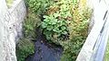
 The Wolfsbach at the Wolfsmühle near Rodishain (Nordhausen district / Thuringia) |
||
| Data | ||
| location | in the southern Harz in the district of Mansfeld-Südharz in Saxony-Anhalt and in the district of Nordhausen in Thuringia (Germany) | |
| River system | Elbe | |
| Drain over | Krebsbach → Thyra → Helme → Unstrut → Saale → Elbe → North Sea | |
| source | several at Südharz OT Hainfeld 51 ° 34 ′ 45 ″ N , 10 ° 54 ′ 23 ″ E |
|
| Source height | approx. 501 m above sea level NN | |
| muzzle | in Stempeda in the Krebsbach Coordinates: 51 ° 31 '34 " N , 10 ° 55' 17" E 51 ° 31 '34 " N , 10 ° 55' 17" E |
|
| Mouth height | approx. 227 m above sea level NN | |
| Height difference | approx. 274 m | |
| Bottom slope | approx. 33 ‰ | |
| length | approx. 8.2 km | |
| Left tributaries | Haarbach | |
| Right tributaries | Ronnebach | |
The Wolfsbach is a 8.2 km long, left tributary of the Krebsbach in the southern Harz in the districts of Mansfeld-Südharz in Saxony-Anhalt and Nordhausen in Thuringia in Germany .
course
The Wolfsbach rises from several sources near Hainfeld, a district of the city of Südharz in Saxony-Anhalt. Now it flows south in a densely wooded area and takes on the Haarbach , then it reaches the Free State of Thuringia . The first of two villages on the stream is Rodishain , where it splits into two arms and touches the former wolf mill. At the old water mill , which now houses an inn, its water drives a mill wheel, as it always does . After taking in the Ronnebach, it flows through Stempeda and flows into the Thyra tributary Krebsbach in the southwestern part of the village .
Picture gallery

The Wolfsbach at the Wolfmühle near Rodishain

The water wheel or mill wheel at the Wolfsmühle near Rodishain
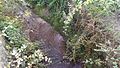
The overgrown mouth of the Ronnebach (from left) into the Wolfsbach (from top-right)
The Wolfsbach near Rodishain


Web links
Individual evidence
- ↑ a b http://www.mapcoordinates.net/
- ↑ Map from Google Earth