Wyspa Portowa
| Wyspa Portowa | ||
|---|---|---|
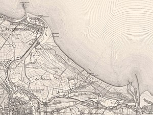
| Hafeninsel , Westerplatte and Holm on a map from 1901 | ||
| Waters | Gdańsk Bay , Dead and Bold Vistula | |
| Geographical location | 54 ° 22 '21 " N , 18 ° 42' 16" E | |
|
|
||
| length | 7.5 km | |
| width | 5 km | |
| surface | 26.4 km² | |
| Residents | 18,938 2011 717 inhabitants / km² |
|
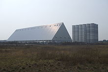
| main place | Stogi ( hay barn ) | |
As Wyspa Portowa is recently an island in the Gulf of Gdansk in the city of Gdansk ( Danzig ) , Pomorskie , Poland , respectively. After 1945 the Polish name was Wyspa Stogi , in the translation the names mean port island , after the north port , which was built in the 1970s , or Heubuder island after the main town Heubude (Stogi) . As part of the Danzig Spit , this island was only known as The Spit before 1945 . The Westerplatte peninsula and the Weichselmünde fortress are of historical importance .
geography
Size and location
The 26.4 km² island is bordered in the north by the Baltic Sea , on all other sides by the arms of the Vistula , in the west and south runs the Dead Vistula (Martwą Wisłą) and in the east the Bold Vistula (Wisłą Śmiałą). The island's eastern border was created between 1840 after a flood in which the river broke through the dunes of the Spit near Neufähr. The Westerplatte became a peninsula and was added a little later after the Dead Vistula was expanded into a port canal. The construction of the former imperial port finally separated the Holm ( Wyspa Ostrów ) from the spit by 1904 .
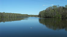
On the island are the 7.5 hectare Pusty Staw ( Great Heid Lake ), the Jezioro Zajęcze ( Little Heid Lake ) and the four hectare Jezioro Bursztynowe (" Amber Lake ").
history
The Weichselmünde fortress (Twierdza Wisłoujście) was built in the 15th century to protect the port of the Hanseatic city of Gdansk. The round tower was built in 1482 and served as a lighthouse until 1758 . The Pzerabka and the bank of the spit were an important storage area, where especially the large rafts of wood were dismantled. In Cracow and on Cracow Kämpe , an island that no longer exists, there were numerous sawmills and timber trading companies.
The densely wooded Westerplatte was expanded into a Baltic seaside resort for hot and cold seaside baths from around 1830 ; it could be reached via Neufahrwasser by tram or steamboat. At the end of the 19th century the seaside resorts of Weichselmünde and Heubude were created. Heubude received an upswing after a tram connection to the beach was established in the 1920s. Stogi beach is still very popular today, even though it was made smaller by the construction of the deep water harbor. Today the seaside resort is characterized by high-rise buildings. The former sewage fields of the city of Gdansk were laid out in the western part of today's island and have recently been built over with logistics centers.
The shelling of the Polish ammunition dump on Westerplatte on September 1, 1939 is considered to be the beginning of the Second World War . The Westerplatte memorial, inaugurated in 1966, commemorates the Polish defenders .
places
Administratively, the island is divided into three Gdańsk districts :
- Stogi: The district has 12,128 inhabitants and an area of 11 km², in 1910 Heubude had 3,114 inhabitants.
- Przeróbka ( Pzerabka ): The district in the west of the island has 4,816 inhabitants and 7.10 km², Troyl had 432 inhabitants in 1905. Weichselmünde (Wisłoujście, Kashubian Minda ) no longer exists, the place was abandoned when a sulfur factory was built.
- Krakowiec-Górki Zachodnie: The district in the east of the island with 1,994 inhabitants and an area of 8.38 km² includes the places Krakowiec ( Krakow , 1910: 536 inhabitants) and Górki Zachodnie ( Westlich Neufähr , 1905: 727 inhabitants).
The places were incorporated between 1907 and 1914.
traffic
The island is connected to the city's road and rail network by several bridges. In April 2016, was Tadeusz Gocłowskiego - Tunnel opened to traffic under the Dead Vistula.
economy
- Extensive oil storage of the LOTOS Grupa refinery
- Port Północny (Gdansk North Harbor)
- Deepwater Container Terminal (DCT)
- Logistics centers and freight yard
- several shipyards


