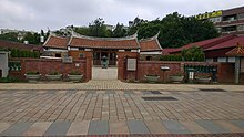
Xinwu
|
Xinwu 新屋 區 |
||
 Location within Taoyuan City |
||
| State : |
|
|
| Coordinates : | 24 ° 59 ' N , 121 ° 4' E | |
| Area : | 85.0166 km² | |
| Residents : | 48,687 (July 2016) | |
| Population density : | 573 inhabitants per km² | |
| Time zone : | UTC + 8 (Chungyuan time) | |
| Postal code : | 327 | |
| ISO 3166-2 : | TW-TAO | |
| Community type : | Municipality of Taoyuan | |
| Website : | ||
|
|
||
Xinwu ( Chinese 新屋 區 , Pinyin Xīnwū Qū , Hakka Sîn-vuk-khî , Pe̍h-ōe-jī Sin-ok-khu ) is a district in the west of the government-direct city of Taoyuan in Taiwan .
Location and importance
Xinwu is located on the Taiwan Strait ; to the north, east and west it is bordered by the neighboring districts of Guanyin , Zhongli and Yangmei, as well as Hsinchu County . Xinwu has the largest agricultural area among the districts of the metropolis Taoyuan, with the focus on rice cultivation . Xinwu is one of the most important rice-growing areas in northern Taiwan. The formerly flourishing fishery is, however, only of minor importance today. The Yong'an fishing port , opened in 1953, is a popular tourist destination.
history
The area of today's district has been settled and arable for agriculture by Chinese immigrants, especially the Hakka ethnic group, since the end of the 18th century . The originally resident aborigines were pushed to the east. 90% of the population today are Hakka, buildings from the early days of settlement are now historical sights, such as B. the "Fanjiang Family Ancestral Hall" ( Fanjiang Zutang ).


