
Talk:John De Andrea and Enfield, Connecticut: Difference between pages
m moved Talk:John DeAndrea to Talk:John De Andrea: To correct the spelling of the last name; De Andrea has a space between the De and the Andrea |
m Reverted edits by 198.7.241.82 (talk) to last version by Moonriddengirl |
||
| Line 1: | Line 1: | ||
{{Infobox Settlement |
|||
{{WPBiography |
|||
|official_name = Enfield, Connecticut |
|||
|class=stub |
|||
|settlement_type = [[New England town|Town]] |
|||
|priority= |
|||
|image_skyline = Town Hall.jpg |
|||
|auto=yes |
|||
|imagesize = |
|||
|image_caption = Thompsonville district |
|||
|image_map = US-CT-Enfield.png |
|||
|mapsize = 250x200px |
|||
|map_caption = Location in [[Connecticut]] |
|||
|established_title = Incorporated (Massachusetts) |
|||
|established_date = 1683 |
|||
|established_title2 = Annexed by Connecticut |
|||
|established_date2 = 1749 |
|||
|image_map1 = |
|||
|mapsize1 = |
|||
|map_caption1 = |
|||
|subdivision_type = [[NECTA]] |
|||
|subdivision_name = Springfield MA |
|||
|subdivision_type1 = |
|||
|subdivision_name1 = [[Connecticut]] |
|||
|subdivision_type2 = Region |
|||
|subdivision_name2 = Capitol Region |
|||
|government_type = [[Council-manager]] |
|||
|leader_title = Town manager |
|||
|leader_name = Matthew Coppler |
|||
|leader_title1 = Town Council |
|||
|leader_name1 = '''Dist 3 & Mayor'''<br />Scott Kaupin<br />'''Deputy Mayor'''<br />Kenneth R Nelson Jr<br />'''District Councilmen'''<br />Joseph Bosco, Dist 1<br />William Edgar, Dist 2<br />Clem Dumont, Dist 4<br />'''Council At-Large'''<br />Patrick J. Crowley<br />Jason M. Jones<br />David Kiner<br />William F. Lee<br />Cynthia Mangini<br />William Ragno<br /> |
|||
|area_magnitude = |
|||
|area_total_km2 = 88.6 |
|||
|area_land_km2 = 86.5 |
|||
|area_water_km2 = 2.2 |
|||
|area_total_sq_mi = 34.2 |
|||
|population_as_of = 2005 |
|||
|population_total = 45441 |
|||
|population_density_km2 = 525 |
|||
|population_density_sq_mi = 1361 |
|||
|timezone = [[Eastern Standard Time Zone|Eastern]] |
|||
|utc_offset = -5 |
|||
|timezone_DST = [[Eastern Standard Time Zone|Eastern]] |
|||
|utc_offset_DST = -4 |
|||
|area_land_sq_mi = 33.4 |
|||
|area_water_sq_mi = 0.8 |
|||
|elevation_m = 17 |
|||
|elevation_ft = 56 |
|||
|latd = 41 |latm = 58 |lats = 30 |latNS = N |
|||
|longd = 72 |longm = 32 |longs = 58 |longEW = W |
|||
|region = |
|||
|postal_code_type = ZIP code |
|||
|postal_code = 06082 |
|||
|website = http://www.enfield.org/ |
|||
|area_code = [[Area code 860|860]] |
|||
|blank_name = [[Federal Information Processing Standard|FIPS code]] |
|||
|blank_info = 09-25990 |
|||
|blank1_name = [[Geographic Names Information System|GNIS]] feature ID |
|||
|blank1_info = 0212332 |
|||
|footnotes = |
|||
}} |
}} |
||
'''Enfield''' is a [[New England town|town]] located in [[Hartford County, Connecticut|Hartford County]], [[Connecticut]], [[United States]]. The population was 45,212 at the [[2000 United States Census|2000 census]]. It sits on the border with [[Longmeadow, Massachusetts|Longmeadow]], [[Massachusetts]] to the north, [[Somers, Connecticut|Somers]] to the east, [[East Windsor, Connecticut|East Windsor]] and [[Windsor Locks]] to the south and the [[Connecticut River]] and [[Suffield, Connecticut|Suffield]], [[Connecticut]] to the west. |
|||
== History == |
|||
Enfield was originally inhabited by the [[Pocomtuc]] tribe, and contained their two villages of Scitico and Nameroke. Enfield was settled in 1679 by settlers from [[Salem, Massachusetts|Salem]], [[Massachusetts]]. Enfield was incorporated in Massachusetts in 1683. In 1749, following the settlement of a lawsuit in which it was determined that a surveyor's error placed a section of present-day Hartford County (including Enfield) within the boundaries of Massachusetts, the town seceded and became part of Connecticut. |
|||
[[Jonathan Edwards (theologian)|Jonathan Edwards]] preached his famous sermon, "[[Sinners in the Hands of an Angry God]]" in Enfield. This sermon is one of the most famous sermons ever scripted. It was part of the [[Great Awakening]] Revival that struck New England in the mid-1700s and spread throughout Western civilization. |
|||
The modern town of Enfield was formed through the merging of Enfield, [[Thompsonville, Connecticut|Thompsonville]], and [[Hazardville]]. Hazardville was named for Colonel Augustus George Hazard (1802-1868), whose company manufactured gun powder in a part of the town known as Powder Hollow from the 1830s to the 1910s. In fact, in the 1989 film ''[[Glory (film)|Glory]],'' boxes of gun powder can be seen with the words ''Enfield, CT'' printed on the sides. Also, in an episode in the 1970s cop-drama ''[[Hawaii Five-O]]'', Jack Lord's character Steve McGarrett traces explosives back to "The Hazard Gunpowder Company- Enfield, CT". Most of the gunpowder that the Union used in the Civil War was made in Enfield.{{Fact|date=April 2007}} Over 60 people died in explosions in Powder Hollow during the years when gun powder was manufactured there. The mill blew up several times, but was set up so that if one building blew up, the rest would not follow in a chain reaction. The ruins of these buildings and the dams are open to the public. Powder Hollow is now home to baseball fields and hiking trails. |
|||
===Enfield Shaker village=== |
|||
In 1793, a historic [[Shaker]] village, one of nineteen scattered from [[Maine]] to [[Kentucky]], was established in the town. The [[Utopia]]n religious [[sect]] practiced celibate, [[communal]] living, and is today renowned for its simple [[architecture]] and [[furniture]]. Membership eventually dwindled, however, and the village disbanded. The property has since been redeveloped by the ''Enfield Correctional Institution,'' still located on "Shaker Road." |
|||
* [http://www.cr.nps.gov/nr/travel/shaker/ect.htm Enfield (CT) Shaker Village'', Shaker Historic Trail] |
|||
The presumption that Enfield was named for the town near London is incorrect. According to Dr. Frank Taylor, a noted historian of the town, Enfield was named, in a pattern similar to its neighboring towns of Springfield, Massachusetts (once Northfield) and Suffield, Connecticut (once Southfield). The neighborhood of ''Old Enfield'' in [[Austin, Texas|Austin]], [[Texas]] is a namesake of Enfield, Connecticut, largely named by the family of [[Elisha M. Pease]] former governor of Texas who was born in Enfield, and whose great-great grandfather helped found Enfield as part of Massachusetts in the late seventeenth century. |
|||
<gallery> |
|||
Image:Enfield, CT Shakers.jpg|Enfield (CT) Shaker Village |
|||
Image:Enfield CT Shakers.jpg|Enfield (CT) Shaker Village c. 1910 |
|||
</gallery> |
|||
<!-- Unsourced image removed: [[Image:Enfield Town Seal.jpg|thumb|right|Enfield Town Seal.]] --> |
|||
== Industry == |
|||
{{Col-begin}} |
|||
{{Col-break}} |
|||
Enfield is home to the U.S. headquarters of Danish plastic building toy manufacturer [[LEGO]], which is also the town's largest employer. In June 2006, the company announced that they would be laying off over 290 employees and begin outsourcing jobs to Mexico. [[Hallmark Cards]] is the second-largest employer. |
|||
In the past, Enfield manufactured [[carpets]] and [[gunpowder]]. |
|||
The town contains several shopping centers, including [[Enfield Square Mall]]. |
|||
{{Col-end}} |
|||
== Neighborhoods == |
|||
The neighborhoods of Enfield, CT are as follows: |
|||
'''Enfield Historical District'''- Listed in the National Register of Historical Districts, the Enfield Historical District runs along [[Enfield Street]] ([[U.S. Route 5]]). Many old homes dating back to the mid-1700s were built from 1106-1492 Enfield Street. Varying [[styles of architecture]] are noted including [[Victorian Architecture|Late Victorian]], [[Georgian Architecture|Georgian]] and [[Colonial Revival|19th Century Revival]]. The [[Enfield Town Hall museum]] as well as one of the oldest [[Congregational Churches]] in America can be found here. |
|||
'''[[Hazardville]]''' - Named after General Hazard, this neighborhood encompasses a few smaller burbs, including Powder Hollow, and more recently, the center of Enfield has began to encroach on this historical area. The center of Hazardville is located between the streets of Park Street and North Street on Hazard Avenue. Notable small shops include Gayle's Thyme Herbal Apothecary, The Cranberry Scoop Gift Shop, Smoke n' Leather, and numerous pizzarias. The Powder Hollow Park is located in the Hazardville neighborhood district.{{POV-statement|date=December 2007}} |
|||
'''North Thompsonville''' - Contains mostly residential and partially commercial areas of Enfield with many parks and schools. |
|||
'''Presidential Section''' - This entirely residential area contain streets that are all named after former Presidents of The United States of America. Houses are mid-sized to large in this area. |
|||
'''Scitico''' - Scitico is on the eastern end of town. Green Manor is considered part of Scitico. This is a suburb in the purest sense, with winding roads, sidewalks, a park, and cul-de-sacs. Green Manor is approximately 4.5 miles from the main highway Interstate 91 and borders [[Somers, Connecticut|Somers]], [[Connecticut]]. Across from the elementary school [[Nathan Hale Elementary School]] is a residential park with tennis court, skate boarding ramps, and a playground for younger kids. Green Manor Park did contain a pool at one time but was removed due to the lack of maintenance by the town. |
|||
'''Shaker Pines''' - This Neighborhood consists mostly of tall pine trees towering above the quaint lakeside houses (hence the name). Shaker Pines was originally part of the Shaker settlement in Enfield. The lake was built by the Shakers to power a mill. The mill stood, vacant, at the dam located at the end of the lake into the late 1990s. This mill provided shelter for Frederick Merrill in 1987 after he escaped from the local high security prison. He was dubbed "The Peanut Butter Bandit" after his mother sneaked him supplies for his first prison escape in 1968 in a jar of peanut butter. The mill was subsequently torn down for safety reasons. |
|||
'''[[Sherwood Manor, Connecticut|Sherwood Manor]]''' |
|||
'''[[Southwood Acres]]''' - A village contained within the town of Enfield. This neighborhood is almost entirely residential. |
|||
'''[[Thompsonville, Connecticut|Thompsonville]]''' - Named after Orrin Thompson, Thompsonville is the town center of Enfield with a more urban environment. In the past few years, there has been an attempt to revitalize the downtown area.<ref>{{cite web| title=Constituents Make A Pitch | author=Lightman, David and Larry Smith | date=2007-04-14 | publisher=The Hartford Courant | url=http://www.courant.com/news/politics/hc-dclobbyists0414.artapr14,0,732726.story?coll=hc-big-headlines-breaking | accessdate=2007-04-21}}</ref> On the southbound portion of Pearl Street there are many old [[Victorian Architecture|Victorians]]. There are also many boat launches onto the bordering [[Connecticut River]]. Planning has started for renovating an old building into a [[commuter rail]] station on the not yet built [[New Haven-Hartford-Springfield Line]]. |
|||
<gallery> |
|||
Image:GrandView Dr.jpg| |
|||
Image:Thompsonville.jpg|Thompsonville Village |
|||
Image:Clinton rd.jpg|Presidential Section |
|||
Image:Patricia Street.jpg| |
|||
</gallery> |
|||
== Parks and recreation == |
|||
{{Expand-section|date=June 2008}} |
|||
*[[Connecticut River]] |
|||
*Hazardville Park: off Hazard Avenue, features playscapes, basketball courts, covered picnic area |
|||
*Scantic River Recreational Area: near South Maple Street Bridge, rapids for canoeing and kayaking, fishing |
|||
*Green Manor Recreational Area: off Taylor Road, features playscape, skate park |
|||
*Mark Twain Recreational Area: off South Road, features tennis courts, ball fields |
|||
*Brainard Park: off Brainard Road, features softball fields, children's swing sets |
|||
Enfield is also home base of the New England Lightning girls AAU basketball program. Enfield is also home to EUFA |
|||
==Demographics== |
|||
According to the [[United States Census Bureau]], the town has a total area of 34.2 [[square mile]]s (88.6 [[km²]]), of which, 33.4 square miles (86.5 km²) of it is land and 0.8 square miles (2.1 km²) of it (2.43%) is water. |
|||
As of the [[census]]{{GR|2}} of 2000, there were 45,212 people, 16,418 households, and 11,394 families residing in the town. The [[population density]] was 1,354.3 people per square mile (523.0/km²). There were 17,043 housing units at an average density of 510.5/sq mi (197.1/km²). The racial makeup of the town was 89.74% [[White (U.S. Census)|White]], 5.61% [[African American (U.S. Census)|African American]], 0.20% [[Native American (U.S. Census)|Native American]], 1.34% [[Asian (U.S. Census)|Asian]], 0.02% [[Pacific Islander (U.S. Census)|Pacific Islander]], 1.57% from [[Race (United States Census)|other races]], and 1.54% from two or more races. [[Hispanic (U.S. Census)|Hispanic]] or [[Latino (U.S. Census)|Latino]] of any race were 3.74% of the population. |
|||
There were 16,418 households out of which 31.1% had children under the age of 18 living with them, 55.7% were [[Marriage|married couples]] living together, 10.2% had a female householder with no husband present, and 30.6% were non-families. 25.0% of all households were made up of individuals and 9.5% had someone living alone who was 65 years of age or older. The average household size was 2.53 and the average family size was 3.04. |
|||
In the town the population was spread out with 22.6% under the age of 18, 7.6% from 18 to 24, 34.2% from 25 to 44, 21.9% from 45 to 64, and 13.7% who were 65 years of age or older. The median age was 37 years. For every 100 females there were 110.2 males. For every 100 females age 18 and over, there were 112.7 males. |
|||
The median income for a household in the town was $52,810, and the median income for a family was $60,528. Males had a median income of $42,335 versus $31,082 for females. The [[per capita income]] for the town was $21,967. About 2.8% of families and 4.0% of the population were below the [[poverty line]], including 3.4% of those under age 18 and 5.7% of those age 65 or over. |
|||
Because of its location between Hartford and Springfield, Enfield is an ideal location for numerous upper middle class families who work in the neighboring towns and cities, providing a stable income for spouses and children. |
|||
{| class=wikitable |
|||
! colspan = 6 | Voter Registration and Party Enrollment as of October 25, 2005<ref>{{cite web|title = Registration and Party Enrollment Statistics as of October 25, 2005 | publisher = Connecticut Secretary of State | format = PDF | accessdate = 2006-10-02 | url = http://www.sots.ct.gov/ElectionsServices/lists/2005OctRegEnrollStats.pdf}}</ref> |
|||
|- |
|||
! colspan = 2 | Party |
|||
! Active Voters |
|||
! Inactive Voters |
|||
! Total Voters |
|||
! Percentage |
|||
{{American politics/party colours/Democratic/row}} |
|||
| [[Democratic Party (United States)|Democratic]] |
|||
| align = center | 9,137 |
|||
| align = center | 200 |
|||
| align = center | 9,337 |
|||
| align = center | 34.67% |
|||
{{American politics/party colours/Republican/row}} |
|||
| [[Republican Party (United States)|Republican]] |
|||
| align = center | 4,765 |
|||
| align = center | 312 |
|||
| align = center | 5,077 |
|||
| align = center | 18.85% |
|||
{{American politics/party colours/Independent/row}} |
|||
| Unaffiliated |
|||
| align = center | 11,997 |
|||
| align = center | 497 |
|||
| align = center | 12,494 |
|||
| align = center | 46.40% |
|||
{{American politics/party colours/Libertarian/row}} |
|||
| Minor Parties |
|||
| align = center | 21 |
|||
| align = center | 0 |
|||
| align = center | 21 |
|||
| align = center | 0.08% |
|||
|- |
|||
! colspan = 2 | Total |
|||
! align = center | 25,920 |
|||
! align = center | 1,009 |
|||
! align = center | 26,929 |
|||
! align = center | 100% |
|||
|} |
|||
== Education system == |
|||
===Elementary=== |
|||
The Enfield Elementary School System runs from kindergarten through grade 6. <div style="background: white; padding: 1em;"> |
|||
{| class="wikitable" style="text-align:left" |
|||
! School Name !! Students* !! Namesake |
|||
|- |
|||
| Edgar H. Parkman School [http://www.enfieldschools.org/our_schools/edgar_h__parkman/index.html] ||style="text-align:center"|460|| [[Edgar H. Parkman]] |
|||
|- |
|||
| Eli Whitney School [http://www.enfieldschools.org/our_schools/eli_whitney/index.html] ||style="text-align:center"|440|| [[Eli Whitney]], inventor and manufacturer |
|||
|- |
|||
| Enfield Street School [http://www.enfieldschools.org/our_schools/enfield_street/index.html] ||style="text-align:center"|320|| street on which the school is located (Route 5) |
|||
|- |
|||
| Harriet Beecher Stowe School [http://www.enfieldschools.org/our_schools/harriet_beecher_stowe/index.html] ||style="text-align:center"|280 || [[Harriet Beecher Stowe]], writer and abolitionist |
|||
|- |
|||
| Hazardville Memorial School [http://www.enfieldschools.org/our_schools/hazardville_memorial/index.html] ||style="text-align:center"|450 || [[Hazardville]], the neighborhood in which the school is located, itself named for Augustus G. Hazard, Civil War gunpowder manufacturer whose company was located in town. |
|||
|- |
|||
| Henry Barnard School [http://www.enfieldschools.org/our_schools/henry_barnard/index2.html] ||style="text-align:center"|450 || [[Henry Barnard]], who helped to reform Connecticut's schools |
|||
|- |
|||
| Nathan Hale School [http://www.enfieldschools.org/our_schools/nathan_hale/index.html]||style="text-align:center"|310 || [[Nathan Hale]], the famed [[American Revolutionary War]] captain |
|||
|- |
|||
| Prudence Crandall School [http://www.enfieldschools.org/our_schools/prudence_crandall/index.html] ||style="text-align:center"|490 || [[Prudence Crandall]], who created the first integrated classroom |
|||
|- |
|||
| Thomas G. Alcorn School** [http://www.enfieldschools.org/our_schools/thomas_alcorn/index.html]||style="text-align:center"|323 || [[Thomas G. Alcorn]], town physician |
|||
|- |
|||
| '''TOTAL STUDENTS*''' ||style="text-align:center"|3,523|| |
|||
|} |
|||
<nowiki>*</nowiki> Approximate enrollment counts as of 2005<br /> |
|||
<nowiki>**</nowiki> Thomas G. Alcorn School originally a high school until it was converted to an elementary school when the current high school was opened. It was later extensively renovated in 1993. |
|||
</div> |
|||
===Junior high school=== |
|||
The Enfield School Junior High School System runs from grade 7 through grade 8. |
|||
<div style="background: white; padding: 1em;"> |
|||
{| class="wikitable" style="text-align:left" |
|||
! School Name !! Students* !! Namesake |
|||
|- |
|||
| John F. Kennedy [http://www.enfieldschools.org/our_schools/john_f__kennedy/index.html] ||style="text-align:center"|1,087|| Former U.S. President [[John F. Kennedy]] |
|||
|} <nowiki>*</nowiki> Approximate enrollment count as of 2005 |
|||
</div> |
|||
Until the early 1980s, JFK's crosstown rival was [[Kosciuscko Junior High]], a school named for a hero of the American Revolution. |
|||
It closed down as the demographics of the town changed and two distinct junior highs became clearly unnecessary. The facility of Kosciuscko Junior High School is now used as Enfield's Asnuntuck Community College. |
|||
===High school=== |
|||
The Enfield School Senior High School System runs from grade 9 through grade 12. |
|||
<div style="background: white; padding: 1em;"> |
|||
{| class="wikitable" style="text-align:left" |
|||
! School Name !! Students* !! Namesake |
|||
|- |
|||
| [[Enfield High School]]||style="text-align:center"|922|| The town itself |
|||
|- |
|||
| [[Enrico Fermi High School]] [http://www.enfieldschools.org/our_schools/fermi_high/index.html] ||style="text-align:center"|1,196|| Italian physicist [[Enrico Fermi]] |
|||
|} <nowiki>*</nowiki> Approximate enrollment counts as of 2005 |
|||
</div> |
|||
===Parochial schools=== |
|||
<div style="background: white; padding: 1em;"> |
|||
{| class="wikitable" style="text-align:left" |
|||
! School Name !! Address !! Grade(s) |
|||
|- |
|||
| Saint Bernard School [http://www.sbs-enfield.com/index.htm] || 232 Pearl Street || Kindergarten through Grade 8 |
|||
|- |
|||
|Saint Martha School [http://www.stmarthaschool-ct.org/] || 214 Brainard Road || Kindergarten through Grade 8 |
|||
|- |
|||
|Enfield Montessori School [http://enfieldmontessorischool.org/] || 1370 Enfield Street || Kindergarten through Grade 6 |
|||
|- |
|||
|Little Angels Catholic Pre-School* [http://www.enfieldcatholicschools.org/preschool.htm] || 90 Alden Avenue || Pre-Kindergarten |
|||
|- |
|||
|} <nowiki>*</nowiki> The building formerly housed Saint Adalbert School (K-8th grade), which was closed in June 2006. Starting in September 2006, the building reopened as a combined Catholic schools Pre-Kindergarten program for 3 and 4-year-olds, as well as a day care. |
|||
</div> |
|||
==Notable residents, past and present== |
|||
# Jeremiah Mervin Allen, (1833-1903), born in Enfield, noted educator, engineer, and president of the [[YMCA]].<ref name="Marquis 1607-1896"> {{cite book | title = Who Was Who in America, Historical Volume, 1607-1896 | publisher = Marquis Who's Who | location = Chicago | date= 1963}}</ref> |
|||
# [[Johnny April]], bassist for the alternative metal/hard rock band Staind. |
|||
# [[John Ashton (actor)|John Ashton]], actor, attended Enfield High School (former resident). |
|||
# [[Elijah Churchill]], soldier in the [[American Revolutionary War]] and recipient of the medal later known as the [[Purple Heart]]. |
|||
# [[Paul Herscu]], [[Naturopathic medicine|naturopathic doctor]] noted for his homeopathic work. |
|||
# [[Craig Janney]], Olympian and professional ice hockey center (former resident). |
|||
# [[Peter King (sportswriter)|Peter King]], football columnist for [[Sports Illustrated]] and author. |
|||
# [[Elisha M. Pease]], politician and two-term Governor of Texas (elected in 1853 and 1855). |
|||
# [[Paul Robeson]], singer and actor (former resident). |
|||
# [[Karen Scavotto]], Olympic archer. |
|||
# [[Bill Spanswick]], baseball pitcher for the [[Boston Red Sox all-time roster#S|Boston Red Sox]].<ref>http://marian.creighton.edu/~besser/baseball/nsl1958.html</ref> |
|||
# [[Nathaniel Terry]], Representative from Connecticut in the [[15th United States Congress]] (served 1817-1819). |
|||
# [[The Last Goodnight]], Upcoming band originally from Enfield and formerly called Renata, attended [[Enfield High School]]. |
|||
==Notable historical sites== |
|||
# The Strand Theater: Most prominently active in the '40s and '50s, in the '70s the Strand had to resort to X-rated films. It is no longer active. |
|||
==Sister cities== |
|||
Enfield has two official [[town twinning|sister cities]] as designated by [[Sister Cities International]] [http://www.sister-cities.org/icrc/directory/usa/CT]: |
|||
*{{flagicon|ROC}} [[Jhongli City]], [[Taiwan]] ([[ROC]]). |
|||
*{{flagicon|SWE}} [[Ronneby, Sweden|Ronneby]], [[Sweden]]. |
|||
==References== |
|||
{{reflist}} |
|||
==External links== |
|||
* [http://www.enfield.org Town of Enfield, Connecticut ''Official Website''] |
|||
* [http://home.att.net/~mkm-of-enfct/EHS/EHSaboutUs.html Enfield Historical Society] |
|||
* [http://www.enfieldschools.org/ Enfield Public Schools ''Official Website''] |
|||
* [http://www.homes101.net/connecticut-schools/enfield-school-district-d5618/ Enfield School District Information] |
|||
* [http://www.nationalregisterofhistoricplaces.com/ct/Hartford/districts.html National Register of Historical Districts, Hartford County, Connecticut] |
|||
*[http://www.enjoycentralct.com/index.cfm Central Regional Tourism District] |
|||
*[http://www.enfield-ct.com/ Enfield CT Photographic Tour and History] |
|||
*[http://www.courant.com/community/news/en/ Enfield News from Hartford Courant] |
|||
*[http://blogs.courant.com/itowns_en/ Hartford Courant: Enfield iTowns Blog] |
|||
{{Connecticut}} |
|||
{{Hartford County, Connecticut}} |
|||
[[Category:Enfield, Connecticut|*]] |
|||
[[Category:Hartford County, Connecticut]] |
|||
[[Category:Towns in Connecticut]] |
|||
[[Category:Utopian communities]] |
|||
[[Category:Settlements on the Connecticut River]] |
|||
[[fr:Enfield (Connecticut)]] |
|||
[[ht:Enfield, Connecticut]] |
|||
[[sv:Enfield, Connecticut]] |
|||
[[vo:Enfield (Connecticut)]] |
|||
Revision as of 22:47, 12 October 2008
Enfield, Connecticut | |
|---|---|
 Thompsonville district | |
 Location in Connecticut | |
| NECTA | Springfield MA |
| Region | Capitol Region |
| Incorporated (Massachusetts) | 1683 |
| Annexed by Connecticut | 1749 |
| Government | |
| • Type | Council-manager |
| • Town manager | Matthew Coppler |
| • Town Council | Dist 3 & Mayor Scott Kaupin Deputy Mayor Kenneth R Nelson Jr District Councilmen Joseph Bosco, Dist 1 William Edgar, Dist 2 Clem Dumont, Dist 4 Council At-Large Patrick J. Crowley Jason M. Jones David Kiner William F. Lee Cynthia Mangini William Ragno |
| Area | |
| • Total | 88.6 km2 (34.2 sq mi) |
| • Land | 86.5 km2 (33.4 sq mi) |
| • Water | 2.2 km2 (0.8 sq mi) |
| Elevation | 17 m (56 ft) |
| Population (2005) | |
| • Total | 45,441 |
| • Density | 525/km2 (1,361/sq mi) |
| Time zone | UTC-5 (Eastern) |
| • Summer (DST) | UTC-4 (Eastern) |
| ZIP code | 06082 |
| Area code | 860 |
| FIPS code | 09-25990 |
| GNIS feature ID | 0212332 |
| Website | http://www.enfield.org/ |
Enfield is a town located in Hartford County, Connecticut, United States. The population was 45,212 at the 2000 census. It sits on the border with Longmeadow, Massachusetts to the north, Somers to the east, East Windsor and Windsor Locks to the south and the Connecticut River and Suffield, Connecticut to the west.
History
Enfield was originally inhabited by the Pocomtuc tribe, and contained their two villages of Scitico and Nameroke. Enfield was settled in 1679 by settlers from Salem, Massachusetts. Enfield was incorporated in Massachusetts in 1683. In 1749, following the settlement of a lawsuit in which it was determined that a surveyor's error placed a section of present-day Hartford County (including Enfield) within the boundaries of Massachusetts, the town seceded and became part of Connecticut.
Jonathan Edwards preached his famous sermon, "Sinners in the Hands of an Angry God" in Enfield. This sermon is one of the most famous sermons ever scripted. It was part of the Great Awakening Revival that struck New England in the mid-1700s and spread throughout Western civilization.
The modern town of Enfield was formed through the merging of Enfield, Thompsonville, and Hazardville. Hazardville was named for Colonel Augustus George Hazard (1802-1868), whose company manufactured gun powder in a part of the town known as Powder Hollow from the 1830s to the 1910s. In fact, in the 1989 film Glory, boxes of gun powder can be seen with the words Enfield, CT printed on the sides. Also, in an episode in the 1970s cop-drama Hawaii Five-O, Jack Lord's character Steve McGarrett traces explosives back to "The Hazard Gunpowder Company- Enfield, CT". Most of the gunpowder that the Union used in the Civil War was made in Enfield.[citation needed] Over 60 people died in explosions in Powder Hollow during the years when gun powder was manufactured there. The mill blew up several times, but was set up so that if one building blew up, the rest would not follow in a chain reaction. The ruins of these buildings and the dams are open to the public. Powder Hollow is now home to baseball fields and hiking trails.
Enfield Shaker village
In 1793, a historic Shaker village, one of nineteen scattered from Maine to Kentucky, was established in the town. The Utopian religious sect practiced celibate, communal living, and is today renowned for its simple architecture and furniture. Membership eventually dwindled, however, and the village disbanded. The property has since been redeveloped by the Enfield Correctional Institution, still located on "Shaker Road."
The presumption that Enfield was named for the town near London is incorrect. According to Dr. Frank Taylor, a noted historian of the town, Enfield was named, in a pattern similar to its neighboring towns of Springfield, Massachusetts (once Northfield) and Suffield, Connecticut (once Southfield). The neighborhood of Old Enfield in Austin, Texas is a namesake of Enfield, Connecticut, largely named by the family of Elisha M. Pease former governor of Texas who was born in Enfield, and whose great-great grandfather helped found Enfield as part of Massachusetts in the late seventeenth century.
-
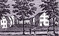 Enfield (CT) Shaker Village
 -
 Enfield (CT) Shaker Village c. 1910


Industry
|
Enfield is home to the U.S. headquarters of Danish plastic building toy manufacturer LEGO, which is also the town's largest employer. In June 2006, the company announced that they would be laying off over 290 employees and begin outsourcing jobs to Mexico. Hallmark Cards is the second-largest employer. In the past, Enfield manufactured carpets and gunpowder. The town contains several shopping centers, including Enfield Square Mall. |
Neighborhoods
The neighborhoods of Enfield, CT are as follows:
Enfield Historical District- Listed in the National Register of Historical Districts, the Enfield Historical District runs along Enfield Street (U.S. Route 5). Many old homes dating back to the mid-1700s were built from 1106-1492 Enfield Street. Varying styles of architecture are noted including Late Victorian, Georgian and 19th Century Revival. The Enfield Town Hall museum as well as one of the oldest Congregational Churches in America can be found here.
Hazardville - Named after General Hazard, this neighborhood encompasses a few smaller burbs, including Powder Hollow, and more recently, the center of Enfield has began to encroach on this historical area. The center of Hazardville is located between the streets of Park Street and North Street on Hazard Avenue. Notable small shops include Gayle's Thyme Herbal Apothecary, The Cranberry Scoop Gift Shop, Smoke n' Leather, and numerous pizzarias. The Powder Hollow Park is located in the Hazardville neighborhood district.[neutrality is disputed]
North Thompsonville - Contains mostly residential and partially commercial areas of Enfield with many parks and schools.
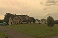
Presidential Section - This entirely residential area contain streets that are all named after former Presidents of The United States of America. Houses are mid-sized to large in this area.
Scitico - Scitico is on the eastern end of town. Green Manor is considered part of Scitico. This is a suburb in the purest sense, with winding roads, sidewalks, a park, and cul-de-sacs. Green Manor is approximately 4.5 miles from the main highway Interstate 91 and borders Somers, Connecticut. Across from the elementary school Nathan Hale Elementary School is a residential park with tennis court, skate boarding ramps, and a playground for younger kids. Green Manor Park did contain a pool at one time but was removed due to the lack of maintenance by the town.
Shaker Pines - This Neighborhood consists mostly of tall pine trees towering above the quaint lakeside houses (hence the name). Shaker Pines was originally part of the Shaker settlement in Enfield. The lake was built by the Shakers to power a mill. The mill stood, vacant, at the dam located at the end of the lake into the late 1990s. This mill provided shelter for Frederick Merrill in 1987 after he escaped from the local high security prison. He was dubbed "The Peanut Butter Bandit" after his mother sneaked him supplies for his first prison escape in 1968 in a jar of peanut butter. The mill was subsequently torn down for safety reasons.
Southwood Acres - A village contained within the town of Enfield. This neighborhood is almost entirely residential.
Thompsonville - Named after Orrin Thompson, Thompsonville is the town center of Enfield with a more urban environment. In the past few years, there has been an attempt to revitalize the downtown area.[1] On the southbound portion of Pearl Street there are many old Victorians. There are also many boat launches onto the bordering Connecticut River. Planning has started for renovating an old building into a commuter rail station on the not yet built New Haven-Hartford-Springfield Line.
-
-
 Thompsonville Village
 -
 Presidential Section


Parks and recreation
This section needs expansion. You can help by adding to it. (June 2008) |
- Connecticut River
- Hazardville Park: off Hazard Avenue, features playscapes, basketball courts, covered picnic area
- Scantic River Recreational Area: near South Maple Street Bridge, rapids for canoeing and kayaking, fishing
- Green Manor Recreational Area: off Taylor Road, features playscape, skate park
- Mark Twain Recreational Area: off South Road, features tennis courts, ball fields
- Brainard Park: off Brainard Road, features softball fields, children's swing sets
Enfield is also home base of the New England Lightning girls AAU basketball program. Enfield is also home to EUFA
Demographics
According to the United States Census Bureau, the town has a total area of 34.2 square miles (88.6 km²), of which, 33.4 square miles (86.5 km²) of it is land and 0.8 square miles (2.1 km²) of it (2.43%) is water.
As of the censusTemplate:GR of 2000, there were 45,212 people, 16,418 households, and 11,394 families residing in the town. The population density was 1,354.3 people per square mile (523.0/km²). There were 17,043 housing units at an average density of 510.5/sq mi (197.1/km²). The racial makeup of the town was 89.74% White, 5.61% African American, 0.20% Native American, 1.34% Asian, 0.02% Pacific Islander, 1.57% from other races, and 1.54% from two or more races. Hispanic or Latino of any race were 3.74% of the population.
There were 16,418 households out of which 31.1% had children under the age of 18 living with them, 55.7% were married couples living together, 10.2% had a female householder with no husband present, and 30.6% were non-families. 25.0% of all households were made up of individuals and 9.5% had someone living alone who was 65 years of age or older. The average household size was 2.53 and the average family size was 3.04.
In the town the population was spread out with 22.6% under the age of 18, 7.6% from 18 to 24, 34.2% from 25 to 44, 21.9% from 45 to 64, and 13.7% who were 65 years of age or older. The median age was 37 years. For every 100 females there were 110.2 males. For every 100 females age 18 and over, there were 112.7 males.
The median income for a household in the town was $52,810, and the median income for a family was $60,528. Males had a median income of $42,335 versus $31,082 for females. The per capita income for the town was $21,967. About 2.8% of families and 4.0% of the population were below the poverty line, including 3.4% of those under age 18 and 5.7% of those age 65 or over.
Because of its location between Hartford and Springfield, Enfield is an ideal location for numerous upper middle class families who work in the neighboring towns and cities, providing a stable income for spouses and children.
| Voter Registration and Party Enrollment as of October 25, 2005[2] | |||||||||||||||||||||||||
|---|---|---|---|---|---|---|---|---|---|---|---|---|---|---|---|---|---|---|---|---|---|---|---|---|---|
| Party | Active Voters | Inactive Voters | Total Voters | Percentage | Democratic | 9,137 | 200 | 9,337 | 34.67% | Republican | 4,765 | 312 | 5,077 | 18.85% | Unaffiliated | 11,997 | 497 | 12,494 | 46.40% | Minor Parties | 21 | 0 | 21 | 0.08% | |
| Total | 25,920 | 1,009 | 26,929 | 100% | |||||||||||||||||||||
Education system
Elementary
The Enfield Elementary School System runs from kindergarten through grade 6.
| School Name | Students* | Namesake |
|---|---|---|
| Edgar H. Parkman School [1] | 460 | Edgar H. Parkman |
| Eli Whitney School [2] | 440 | Eli Whitney, inventor and manufacturer |
| Enfield Street School [3] | 320 | street on which the school is located (Route 5) |
| Harriet Beecher Stowe School [4] | 280 | Harriet Beecher Stowe, writer and abolitionist |
| Hazardville Memorial School [5] | 450 | Hazardville, the neighborhood in which the school is located, itself named for Augustus G. Hazard, Civil War gunpowder manufacturer whose company was located in town. |
| Henry Barnard School [6] | 450 | Henry Barnard, who helped to reform Connecticut's schools |
| Nathan Hale School [7] | 310 | Nathan Hale, the famed American Revolutionary War captain |
| Prudence Crandall School [8] | 490 | Prudence Crandall, who created the first integrated classroom |
| Thomas G. Alcorn School** [9] | 323 | Thomas G. Alcorn, town physician |
| TOTAL STUDENTS* | 3,523 |
* Approximate enrollment counts as of 2005
** Thomas G. Alcorn School originally a high school until it was converted to an elementary school when the current high school was opened. It was later extensively renovated in 1993.
Junior high school
The Enfield School Junior High School System runs from grade 7 through grade 8.
| School Name | Students* | Namesake |
|---|---|---|
| John F. Kennedy [10] | 1,087 | Former U.S. President John F. Kennedy |
Until the early 1980s, JFK's crosstown rival was Kosciuscko Junior High, a school named for a hero of the American Revolution.
It closed down as the demographics of the town changed and two distinct junior highs became clearly unnecessary. The facility of Kosciuscko Junior High School is now used as Enfield's Asnuntuck Community College.
High school
The Enfield School Senior High School System runs from grade 9 through grade 12.
| School Name | Students* | Namesake |
|---|---|---|
| Enfield High School | 922 | The town itself |
| Enrico Fermi High School [11] | 1,196 | Italian physicist Enrico Fermi |
Parochial schools
| School Name | Address | Grade(s) |
|---|---|---|
| Saint Bernard School [12] | 232 Pearl Street | Kindergarten through Grade 8 |
| Saint Martha School [13] | 214 Brainard Road | Kindergarten through Grade 8 |
| Enfield Montessori School [14] | 1370 Enfield Street | Kindergarten through Grade 6 |
| Little Angels Catholic Pre-School* [15] | 90 Alden Avenue | Pre-Kindergarten |
Notable residents, past and present
- Jeremiah Mervin Allen, (1833-1903), born in Enfield, noted educator, engineer, and president of the YMCA.[3]
- Johnny April, bassist for the alternative metal/hard rock band Staind.
- John Ashton, actor, attended Enfield High School (former resident).
- Elijah Churchill, soldier in the American Revolutionary War and recipient of the medal later known as the Purple Heart.
- Paul Herscu, naturopathic doctor noted for his homeopathic work.
- Craig Janney, Olympian and professional ice hockey center (former resident).
- Peter King, football columnist for Sports Illustrated and author.
- Elisha M. Pease, politician and two-term Governor of Texas (elected in 1853 and 1855).
- Paul Robeson, singer and actor (former resident).
- Karen Scavotto, Olympic archer.
- Bill Spanswick, baseball pitcher for the Boston Red Sox.[4]
- Nathaniel Terry, Representative from Connecticut in the 15th United States Congress (served 1817-1819).
- The Last Goodnight, Upcoming band originally from Enfield and formerly called Renata, attended Enfield High School.
Notable historical sites
- The Strand Theater: Most prominently active in the '40s and '50s, in the '70s the Strand had to resort to X-rated films. It is no longer active.
Sister cities
Enfield has two official sister cities as designated by Sister Cities International [16]:
 Jhongli City, Taiwan (ROC).
 Ronneby, Sweden.
References
- ^ Lightman, David and Larry Smith (2007-04-14). "Constituents Make A Pitch". The Hartford Courant. Retrieved 2007-04-21.
- ^ "Registration and Party Enrollment Statistics as of October 25, 2005" (PDF). Connecticut Secretary of State. Retrieved 2006-10-02.
- ^ Who Was Who in America, Historical Volume, 1607-1896. Chicago: Marquis Who's Who. 1963.
- ^ http://marian.creighton.edu/~besser/baseball/nsl1958.html
External links
- Town of Enfield, Connecticut Official Website
- Enfield Historical Society
- Enfield Public Schools Official Website
- Enfield School District Information
- National Register of Historical Districts, Hartford County, Connecticut
- Central Regional Tourism District
- Enfield CT Photographic Tour and History
- Enfield News from Hartford Courant
- Hartford Courant: Enfield iTowns Blog
Municipalities and communities of Hartford County, Connecticut, United States | ||
|---|---|---|
| Cities |  | |
| Towns | ||
| CDPs | ||
| Other communities | ||