
Glendive, Montana: Difference between revisions
Walterrs220 (talk | contribs) →Notable people: updated timeline for Rosendale term |
m v2.05b - Bot T20 CW#61 - Fix errors for CW project (Reference before punctuation) |
||
| (28 intermediate revisions by 23 users not shown) | |||
| Line 1: | Line 1: | ||
{{Short description|City in Montana, United States}} |
{{Short description|City in Montana, United States}} |
||
{{Use mdy dates|date=January 2024}} |
|||
{{Infobox settlement |
{{Infobox settlement |
||
|official_name |
| official_name = |
||
|settlement_type |
| settlement_type = [[City]] |
||
|nickname |
| nickname = Gate City |
||
|motto |
| motto = Good People Surrounded by Badlands |
||
<!-- Images --> |
<!-- Images -->| image_skyline = Glendive city hall.jpg |
||
| |
| imagesize = 250px |
||
| image_caption = Glendive City Hall |
|||
|imagesize = 250px |
|||
| |
| image_flag = |
||
| |
| image_seal = <!-- Maps --> |
||
| image_map = Dawson_County_Montana_Incorporated_and_Unincorporated_areas_Glendive_Highlighted.svg |
|||
|image_seal = |
|||
| mapsize = 250px |
|||
<!-- Maps --> |
|||
| map_caption = Location of Glendive, Montana |
|||
|image_map = Dawson_County_Montana_Incorporated_and_Unincorporated_areas_Glendive_Highlighted.svg |
|||
| |
| image_map1 = |
||
| |
| mapsize1 = |
||
| |
| map_caption1 = |
||
| |
| pushpin_map = USA |
||
| pushpin_map_caption = Location in the United States |
|||
|map_caption1 = |
|||
<!-- Location -->| subdivision_type = Country |
|||
|pushpin_map = USA |
|||
| |
| subdivision_name = United States |
||
| subdivision_type1 = [[U.S. state|State]] |
|||
<!-- Location --> |
|||
| subdivision_name1 = [[Montana]] |
|||
|subdivision_type = Country |
|||
| subdivision_type2 = [[List of counties in Montana|County]] |
|||
|subdivision_name = United States |
|||
| subdivision_name2 = [[Dawson County, Montana|Dawson]] |
|||
|subdivision_type1 = [[U.S. state|State]] |
|||
| government_footnotes = |
|||
|subdivision_name1 = [[Montana]] |
|||
| government_type = |
|||
|subdivision_type2 = [[List of counties in Montana|County]] |
|||
| leader_title = |
|||
|subdivision_name2 = [[Dawson County, Montana|Dawson]] |
|||
| |
| leader_name = |
||
| |
| leader_title1 = |
||
| |
| leader_name1 = |
||
| established_title = |
|||
|leader_name = |
|||
| established_date = 1880 |
|||
|leader_title1 = |
|||
<!-- Area -->| unit_pref = Imperial |
|||
| area_footnotes = <ref name="TigerWebMapServer">{{cite web|title=ArcGIS REST Services Directory|url=https://tigerweb.geo.census.gov/arcgis/rest/services/TIGERweb/Places_CouSub_ConCity_SubMCD/MapServer|publisher=United States Census Bureau|accessdate=September 5, 2022}}</ref> |
|||
|established_title = |
|||
| area_magnitude = |
|||
|established_date = 1880 |
|||
| area_total_km2 = 9.06 |
|||
<!-- Area --> |
|||
| |
| area_land_km2 = 9.00 |
||
| area_water_km2 = 0.06 |
|||
|area_footnotes = <ref name="CenPopGazetteer2019">{{cite web|title=2019 U.S. Gazetteer Files|url=https://www2.census.gov/geo/docs/maps-data/data/gazetteer/2019_Gazetteer/2019_gaz_place_30.txt|publisher=United States Census Bureau|access-date=July 26, 2020}}</ref> |
|||
| area_total_sq_mi = 3.50 |
|||
|area_magnitude = |
|||
| area_land_sq_mi = 3.47 |
|||
|area_total_km2 = 9.06 |
|||
| area_water_sq_mi = 0.02 |
|||
|area_land_km2 = 9.00 |
|||
<!-- Population -->| population_as_of = [[2020 United States Census|2020]] |
|||
|area_water_km2 = 0.06 |
|||
| population_est = |
|||
|area_total_sq_mi = 3.50 |
|||
| |
| pop_est_as_of = |
||
| pop_est_footnotes = |
|||
|area_water_sq_mi = 0.02 |
|||
| population_footnotes = |
|||
<!-- Population --> |
|||
| population_total = 4873 |
|||
|population_as_of = [[2010 United States Census|2010]] |
|||
| population_density_km2 = 541.60 |
|||
|population_est = 4910 |
|||
| population_density_sq_mi = 1402.71 |
|||
|pop_est_as_of = 2019 |
|||
<!-- General information -->| timezone = [[Mountain Time Zone|Mountain (MST)]] |
|||
|pop_est_footnotes = <ref name="USCensusEst2019CenPopScriptOnlyDirtyFixDoNotUse"/> |
|||
| utc_offset = −7 |
|||
|population_footnotes = <ref name ="wwwcensusgov"/> |
|||
| |
| timezone_DST = MDT |
||
| utc_offset_DST = −6 |
|||
|population_density_km2 = 545.72 |
|||
| elevation_footnotes = |
|||
|population_density_sq_mi = 1413.36 |
|||
| elevation_m = 629 |
|||
<!-- General information --> |
|||
| elevation_ft = 2064 |
|||
|timezone = [[Mountain Time Zone|Mountain (MST)]] |
|||
| coordinates = {{coord|47|6|31|N|104|42|38|W|region:US-MT_type:city|display=inline,title}} |
|||
|utc_offset = −7 |
|||
| postal_code_type = [[ZIP code]] |
|||
|timezone_DST = MDT |
|||
| |
| postal_code = 59330 |
||
| area_code = [[Area code 406|406]] |
|||
|elevation_footnotes = |
|||
| blank_name = [[Federal Information Processing Standards|FIPS]] code |
|||
|elevation_m = 629 |
|||
| |
| blank_info = {{FIPS|30|31450}} |
||
| blank1_name = [[Geographic Names Information System|GNIS]] feature ID |
|||
|coordinates = {{coord|47|6|31|N|104|42|38|W|region:US-MT_type:city|display=inline,title}} |
|||
| |
| blank1_info = {{GNIS4|0771800}} |
||
| |
| website = {{URL|http://www.cityofglendive.us/}} |
||
| footnotes = |
|||
|area_code = [[Area code 406|406]] Exchanges: 359,367 |
|||
| |
| name = Glendive, Montana |
||
|blank_info = {{FIPS|30|31450}} |
|||
|blank1_name = [[Geographic Names Information System|GNIS]] feature ID |
|||
|blank1_info = {{GNIS4|0771800}} |
|||
|website = {{URL|http://www.cityofglendive.us/}} |
|||
|footnotes = |
|||
}} |
}} |
||
'''Glendive''' is a city in and the [[county seat]] of [[Dawson County, |
'''Glendive''' is a city in and the [[county seat]] of [[Dawson County, Montana]], United States, and home to [[Dawson Community College]].<ref name="GR6">{{cite web|url=http://www.naco.org/Counties/Pages/FindACounty.aspx |access-date=June 7, 2011 |title=Find a County |publisher=National Association of Counties |url-status=dead |archive-url=https://web.archive.org/web/20110531210815/http://www.naco.org/Counties/Pages/FindACounty.aspx |archive-date=May 31, 2011 }}</ref> Glendive was established by the [[Northern Pacific Railway]] when they built the [[transcontinental railroad]] across the northern tier of the western United States from [[Minnesota]] to the [[West Coast of the United States|Pacific Coast]]. The town was the headquarters for the Yellowstone Division that encompassed {{convert|875|miles|km|adj=pre| route }}; {{convert|546|miles|km|abbr=values}} in main line and {{convert|328|miles|km|abbr=values}} in branches with the main routes from [[Mandan, North Dakota]], to [[Billings, Montana]], and from Billings to [[Livingston, Montana|Livingston]]. The town of Glendive is an agricultural and ranching hub of eastern Montana sited between the [[Yellowstone River]] and the [[Badlands]]. [[Makoshika State Park]] is located just east of Glendive. |
||
The population was 4, |
The population was 4,873 at the [[2020 United States Census|2020 census]].<ref name ="wwwcensusgov">{{cite web|title=U.S. Census website|url=https://data.census.gov/cedsci/|publisher=[[United States Census Bureau]]|access-date=November 2, 2021}}</ref> |
||
==History== |
==History== |
||
{{Expand section|date=February 2021}} |
{{Expand section|date=February 2021}} |
||
Glendive was established by the [[Northern Pacific Railway]] during the building of the railroad line.<ref name="mhs">{{cite web |title=Glendive |url=http://mtplacenames.org/ |website=Montana Place Names Companion |publisher=Montana Historical Society |access-date= |
Glendive was established by the [[Northern Pacific Railway]] during the building of the railroad line.<ref name="gcc-1922">{{cite web |title=Glendive and the Northern Pacific Railway |url=https://www.mtmemory.org/nodes/view/6207 |website=Montana Memory Project |publisher=Glendive Chamber of Commerce |date=December 20, 1922 |via=Montana State Library}}</ref><ref name="mhs">{{cite web |title=Glendive |url=http://mtplacenames.org/ |website=Montana Place Names Companion |publisher=Montana Historical Society |access-date=April 3, 2021}}</ref> The settlement mainly consisted of tents and log cabins until a building boom ensued with the arrival of first load of lumber in 1881.{{r|NRHP}} |
||
The Montana territorial legislature created Dawson County in 1869 but did not name a county seat, instead placing it administratively under [[Meagher County, Montana|Meagher County]]. In 1881, Glendive citizens petitioned to name it the county seat.<ref name="mhs" /> |
The Montana territorial legislature created Dawson County in 1869 but did not name a county seat, instead placing it administratively under [[Meagher County, Montana|Meagher County]]. In 1881, Glendive citizens petitioned to name it the county seat.<ref name="mhs" /> |
||
In January 2015, Glendive was the site of a [[Yellowstone River#2015 oil spill|major oil spill]] from a pipeline which also contaminated drinking water.<ref name=Muskal/> |
In January 2015, Glendive was the site of a [[Yellowstone River#2015 oil spill|major oil spill]] from a pipeline which also contaminated drinking water.<ref name=Muskal/> |
||
On October 24, 2023, a fire destroyed the Jordan Inn and the Rose Theater,<ref name="KFYR">{{cite web |last1=Anthony |first1=Michael |title=Cleanup, monitoring continues following old Glendive hotel fire |url=https://www.kfyrtv.com/2023/10/31/cleanup-monitoring-continues-following-old-glendive-hotel-fire/ |publisher=KFYR TV |access-date=January 3, 2024 |date=October 31, 2023}}</ref> both located in the [[Merrill Avenue Historic District (Glendive, Montana)|Merrill Avenue Historic District]]. The Inn was a complete loss.<ref name="KULR">{{cite web |last1=Warren |first1=Bradley |title=Massive fire breaks out in Glendive, Jordan Inn a total loss |url=https://www.kulr8.com/news/massive-fire-breaks-out-in-glendive-jordan-inn-a-total-loss/article_be5dbf74-7329-11ee-8708-7f76ab13c07c.html |publisher=KULR8 |access-date=January 3, 2024 |date=October 25, 2023}}</ref> |
|||
==Geography== |
==Geography== |
||
| Line 92: | Line 90: | ||
===Climate=== |
===Climate=== |
||
Glendive experiences a [[semi-arid climate]] ([[Köppen climate classification|Köppen]] ''BSk'') with long, cold, dry winters and hot, wetter summers. Together with Medicine Lake, the town holds the state's all-time-high record of 117 |
Glendive experiences a [[semi-arid climate]] ([[Köppen climate classification|Köppen]] ''BSk'') with long, cold, dry winters and hot, wetter summers. Together with Medicine Lake, the town holds the state's all-time-high record of 117 °F (47 °C), which was recorded on July 20, 1893, in Glendive and on July 5, 1937, in Medicine Lake. On June 29, 1961, an [[Fujita scale|F4]] [[tornado]] struck Glendive, causing between $500,000 and $5 million in damage.<ref>{{Cite web |url=http://www.tornadohistoryproject.com/tornado/19610629.30.2 |title=Tornado History Project: 19610629.30.2 |access-date=May 22, 2017 |archive-date=January 8, 2020 |archive-url=https://web.archive.org/web/20200108171542/http://www.tornadohistoryproject.com/tornado/19610629.30.2 |url-status=dead }}</ref> |
||
{{Weather box |
{{Weather box |
||
|location = Glendive, Montana |
|location = Glendive, Montana, 1991–2020 normals, extremes 1893–present |
||
|single line = |
|single line = Yes |
||
|Jan record high F = 64 |
|Jan record high F = 64 |
||
|Feb record high F = 73 |
|Feb record high F = 73 |
||
| Line 109: | Line 108: | ||
|Nov record high F = 80 |
|Nov record high F = 80 |
||
|Dec record high F = 72 |
|Dec record high F = 72 |
||
|year record high F= 117 |
|||
|Jan high F = |
|Jan avg record high F = 50.3 |
||
|Feb high F = |
|Feb avg record high F = 54.4 |
||
|Mar high F = |
|Mar avg record high F = 69.8 |
||
|Apr high F = |
|Apr avg record high F = 80.6 |
||
|May high F = |
|May avg record high F = 87.6 |
||
|Jun high F = |
|Jun avg record high F = 96.0 |
||
|Jul high F = |
|Jul avg record high F = 101.0 |
||
|Aug high F = |
|Aug avg record high F = 100.6 |
||
|Sep high F = |
|Sep avg record high F = 95.7 |
||
|Oct high F = |
|Oct avg record high F = 82.8 |
||
|Nov high F = |
|Nov avg record high F = 65.0 |
||
|Dec high F = |
|Dec avg record high F = 51.6 |
||
|year high F = |
|year avg record high F = 103.0 |
||
|Jan mean F = 18.5 |
|||
| |
|Jan high F = 29.0 |
||
| |
|Feb high F = 33.8 |
||
| |
|Mar high F = 46.2 |
||
| |
|Apr high F = 58.9 |
||
| |
|May high F = 69.1 |
||
| |
|Jun high F = 78.5 |
||
| |
|Jul high F = 87.7 |
||
| |
|Aug high F = 87.2 |
||
| |
|Sep high F = 76.3 |
||
| |
|Oct high F = 59.5 |
||
| |
|Nov high F = 43.5 |
||
| |
|Dec high F = 32.0 |
||
| |
|year high F = |
||
|Feb low F = 12.1 |
|||
| |
|Jan mean F = 19.1 |
||
| |
|Feb mean F = 23.1 |
||
| |
|Mar mean F = 34.6 |
||
| |
|Apr mean F = 46.5 |
||
| |
|May mean F = 56.9 |
||
| |
|Jun mean F = 66.4 |
||
| |
|Jul mean F = 74.0 |
||
| |
|Aug mean F = 72.5 |
||
| |
|Sep mean F = 62.1 |
||
| |
|Oct mean F = 47.7 |
||
| |
|Nov mean F = 33.6 |
||
| |
|Dec mean F = 22.7 |
||
| |
|year mean F = |
||
|Apr record low F = −6 |
|||
|Jan low F = 9.2 |
|||
|Feb low F = 12.5 |
|||
|Mar low F = 23.0 |
|||
|Apr low F = 34.2 |
|||
|May low F = 44.7 |
|||
|Jun low F = 54.3 |
|||
|Jul low F = 60.3 |
|||
|Aug low F = 57.8 |
|||
|Sep low F = 47.9 |
|||
|Oct low F = 35.9 |
|||
|Nov low F = 23.7 |
|||
|Dec low F = 13.3 |
|||
|year low F = |
|||
|Jan avg record low F = -20.2 |
|||
|Feb avg record low F = -12.5 |
|||
|Mar avg record low F = -2.1 |
|||
|Apr avg record low F = 18.2 |
|||
|May avg record low F = 30.1 |
|||
|Jun avg record low F = 43.1 |
|||
|Jul avg record low F = 50.1 |
|||
|Aug avg record low F = 44.9 |
|||
|Sep avg record low F = 33.3 |
|||
|Oct avg record low F = 18.8 |
|||
|Nov avg record low F = 1.7 |
|||
|Dec avg record low F = -14.1 |
|||
|year avg record low F = -26.4 |
|||
|Jan record low F = -48 |
|||
|Feb record low F = -50 |
|||
|Mar record low F = -30 |
|||
|Apr record low F = -6 |
|||
|May record low F = 16 |
|May record low F = 16 |
||
|Jun record low F = 29 |
|Jun record low F = 29 |
||
| Line 157: | Line 188: | ||
|Aug record low F = 32 |
|Aug record low F = 32 |
||
|Sep record low F = 14 |
|Sep record low F = 14 |
||
|Oct record low F = |
|Oct record low F = -13 |
||
|Nov record low F = |
|Nov record low F = -27 |
||
|Dec record low F = |
|Dec record low F = -42 |
||
|year record low F= −50 |
|||
| |
|precipitation colour = green |
||
| |
|Jan precipitation inch = 0.42 |
||
| |
|Feb precipitation inch = 0.36 |
||
| |
|Mar precipitation inch = 0.52 |
||
| |
|Apr precipitation inch = 1.50 |
||
| |
|May precipitation inch = 2.57 |
||
| |
|Jun precipitation inch = 2.40 |
||
| |
|Jul precipitation inch = 2.20 |
||
| |
|Aug precipitation inch = 1.53 |
||
| |
|Sep precipitation inch = 1.43 |
||
| |
|Oct precipitation inch = 1.09 |
||
| |
|Nov precipitation inch = 0.46 |
||
| precipitation |
|Dec precipitation inch = 0.41 |
||
|year precipitation inch = |
|||
|source 1= NOAA (normals, 1981–2010) <ref name= NCDC >{{Cite web |url=http://cdo.ncdc.noaa.gov/climatenormals/clim81/MTnorm.pdf |title=Climatography of the United States NO.81 |publisher=[[National Oceanic and Atmospheric Administration]] |access-date=December 24, 2018 |archive-url=https://web.archive.org/web/20140715211333/http://cdo.ncdc.noaa.gov/climatenormals/clim81/MTnorm.pdf |archive-date=July 15, 2014 |url-status=dead }}</ref> |
|||
|source 2= The Weather Channel (Records) <ref name= WC >{{Cite web |url=http://www.weather.com/outlook/travel/businesstraveler/wxclimatology/monthly/USMT0141 |title=Monthly Averages for Glendive, MT |publisher=[[The Weather Channel]] |access-date=January 15, 2011 }}</ref> |
|||
|unit precipitation days = 0.01 in |
|||
|date=December 24, 2018}} |
|||
|Jan precipitation days = 6.1 |
|||
|Feb precipitation days = 5.9 |
|||
|Mar precipitation days = 6.0 |
|||
|Apr precipitation days = 7.9 |
|||
|May precipitation days = 11.4 |
|||
|Jun precipitation days = 11.7 |
|||
|Jul precipitation days = 9.2 |
|||
|Aug precipitation days = 7.0 |
|||
|Sep precipitation days = 6.7 |
|||
|Oct precipitation days = 7.5 |
|||
|Nov precipitation days = 5.1 |
|||
|Dec precipitation days = 6.0 |
|||
|Jan snow inch = 4.0 |
|||
|Feb snow inch = 5.3 |
|||
|Mar snow inch = 3.1 |
|||
|Apr snow inch = 2.0 |
|||
|May snow inch = 0.5 |
|||
|Jun snow inch = 0.0 |
|||
|Jul snow inch = 0.0 |
|||
|Aug snow inch = 0.0 |
|||
|Sep snow inch = 0.0 |
|||
|Oct snow inch = 1.4 |
|||
|Nov snow inch = 2.0 |
|||
|Dec snow inch = 4.3 |
|||
|year snow inch = |
|||
|unit snow days = 0.1 in |
|||
|Jan snow days = 4.5 |
|||
|Feb snow days = 4.0 |
|||
|Mar snow days = 2.9 |
|||
|Apr snow days = 0.9 |
|||
|May snow days = 0.2 |
|||
|Jun snow days = 0.0 |
|||
|Jul snow days = 0.0 |
|||
|Aug snow days = 0.0 |
|||
|Sep snow days = 0.0 |
|||
|Oct snow days = 0.6 |
|||
|Nov snow days = 2.2 |
|||
|Dec snow days = 3.5 |
|||
|source 1 = NOAA<ref name = NOAA> |
|||
{{cite web |
|||
|url = https://www.ncei.noaa.gov/access/services/data/v1?dataset=normals-monthly-1991-2020&stations=USC00243581&format=pdf&dataTypes=MLY-TMAX-NORMAL,MLY-TMIN-NORMAL,MLY-TAVG-NORMAL,MLY-PRCP-NORMAL,MLY-SNOW-NORMAL |
|||
|publisher = National Oceanic and Atmospheric Administration |
|||
|title = U.S. Climate Normals Quick Access – Station: Glendive, MT |
|||
|access-date = April 11, 2023 |
|||
}} |
|||
</ref> |
|||
|source 2 = National Weather Service<ref name = NOWData> |
|||
{{cite web |
|||
|url = https://www.weather.gov/wrh/climate?wfo=ggw |
|||
|publisher = National Weather Service |
|||
|title = NOAA Online Weather Data – NWS Glasgow |
|||
|access-date = April 11, 2023 |
|||
}} |
|||
</ref> |
|||
}} |
|||
==Etymology== |
==Etymology== |
||
| Line 200: | Line 289: | ||
|2000= 4729 |
|2000= 4729 |
||
|2010= 4935 |
|2010= 4935 |
||
|2020= 4873 |
|||
|estyear=2019 |
|||
|footnote=source:<ref>Moffatt, Riley. ''Population History of Western U.S. Cities & Towns, 1850-1990''. [[Lanham, Maryland|Lanham]]: Scarecrow, 1996, 131.</ref><br /><br />U.S. Decennial Census<ref>{{cite web|url=https://www.census.gov/programs-surveys/decennial-census.html|title=Census of Population and Housing|author=United States Census Bureau|author-link=United States Census Bureau|access-date=August 14, 2013}}</ref><ref name ="wwwcensusgov"/> |
|||
|estimate=4910 |
|||
|estref=<ref name="USCensusEst2019CenPopScriptOnlyDirtyFixDoNotUse">{{cite web|url=https://www.census.gov/programs-surveys/popest/data/tables.2019.html|date=May 24, 2020|title=Population and Housing Unit Estimates|publisher=United States Census Bureau|access-date=May 27, 2020}}</ref> |
|||
|footnote=source:<ref>Moffatt, Riley. ''Population History of Western U.S. Cities & Towns, 1850-1990''. [[Lanham, Maryland|Lanham]]: Scarecrow, 1996, 131.</ref><center>U.S. Decennial Census<ref>{{cite web|url=https://www.census.gov/programs-surveys/decennial-census.html|title=Census of Population and Housing|author=United States Census Bureau|author-link=United States Census Bureau|access-date=August 14, 2013}}</ref><br>2019 Estimate<ref name="USCensusEst2019CenPopScriptOnlyDirtyFixDoNotUse"/></center> |
|||
}} |
}} |
||
===2010 census=== |
===2010 census=== |
||
As of the [[census]]<ref name =" |
As of the [[census]]<ref name ="2010 Census">{{cite web|title=U.S. Census website|url=https://www.census.gov|publisher=[[United States Census Bureau]]|access-date=December 18, 2012}}</ref> of 2010, there were 4,935 people, 2,060 households, and 1,190 families living in the city. The [[population density]] was {{convert|1486.4|PD/sqmi|PD/km2|1}}. There were 2,267 housing units at an average density of {{convert|682.8|/sqmi|/km2|1}}. The racial makeup of the city was 94.4% [[White (U.S. Census)|White]], 0.5% [[African American (U.S. Census)|African American]], 2.4% [[Native American (U.S. Census)|Native American]], 0.4% [[Asian (U.S. Census)|Asian]], 0.1% [[Race (U.S. Census)|Pacific Islander]], 0.3% from [[Race (U.S. Census)|other races]], and 1.8% from two or more races. [[Hispanic (U.S. Census)|Hispanic]] or [[Latino (U.S. Census)|Latino]] of any race were 2.4% of the population. |
||
There were 2,060 households, of which 25.8% had children under the age of 18 living with them, 45.4% were [[Marriage|married couples]] living together, 8.3% had a female householder with no husband present, 4.1% had a male householder with no wife present, and 42.2% were non-families. 37.9% of all households were made up of individuals, and 17% had someone living alone who was 65 years of age or older. The average household size was 2.15 and the average family size was 2.84. |
There were 2,060 households, of which 25.8% had children under the age of 18 living with them, 45.4% were [[Marriage|married couples]] living together, 8.3% had a female householder with no husband present, 4.1% had a male householder with no wife present, and 42.2% were non-families. 37.9% of all households were made up of individuals, and 17% had someone living alone who was 65 years of age or older. The average household size was 2.15 and the average family size was 2.84. |
||
| Line 214: | Line 301: | ||
===2000 census=== |
===2000 census=== |
||
As of the [[census]] of 2000, there were 4,729 people, 1,983 households, and 1,229 families living in the city. The |
As of the [[census]] of 2000, there were 4,729 people, 1,983 households, and 1,229 families living in the city. The population density was {{convert|1,419.0|PD/sqmi|PD/km2|sp=us|adj=off}}. There were 2,204 housing units at an average density of {{convert|661.4|/sqmi|/km2|sp=us|adj=off}}. The racial makeup of the city was 97.38% White, 0.30% [[African American (U.S. Census)|African American]],1.21% [[Native American (U.S. Census)|Native American]], 0.11% [[Asian (U.S. Census)|Asian]], 0.36% from [[Race (United States Census)|other races]], and 0.66% from two or more races. [[Hispanic (U.S. Census)|Hispanic]] or [[Latino (U.S. Census)|Latino]] of any race were 1.02% of the population. |
||
There were 1,983 households, out of which 27.4% had children under the age of 18 living with them, 50.7% were [[Marriage|married couples]] living together, 8.3% had a female householder with no husband present, and 38.0% were non-families. 34.2% of all households were made up of individuals, and 14.9% had someone living alone who was 65 years of age or older. The average household size was 2.22 and the average family size was 2.86. |
There were 1,983 households, out of which 27.4% had children under the age of 18 living with them, 50.7% were [[Marriage|married couples]] living together, 8.3% had a female householder with no husband present, and 38.0% were non-families. 34.2% of all households were made up of individuals, and 14.9% had someone living alone who was 65 years of age or older. The average household size was 2.22 and the average family size was 2.86. |
||
| Line 223: | Line 310: | ||
==Education== |
==Education== |
||
Glendive Public Schools educates students from kindergarten through 12th grade.<ref name="gps">{{cite web |title=Glendive Public Schools |url=https://www.glendiveschools.com/ |access-date= |
Glendive Public Schools educates students from kindergarten through 12th grade.<ref name="gps">{{cite web |title=Glendive Public Schools |url=https://www.glendiveschools.com/ |access-date=April 13, 2021}}</ref> [[Dawson County High School (Glendive, Montana)|Dawson County High School]]'s team name is the Red Devils.<ref>{{cite web |title=Member Schools |url=https://www.mhsa.org/memberschools |publisher=Montana High School Association |access-date=April 19, 2021}}</ref> |
||
Glendive is home to Dawson Community College, a 2-year college formed in 1940 to meet the educational needs of eastern Montana.<ref name="dcc">{{cite web |title=Dawson Community College |url=https://www.dawson.edu/ |access-date= |
Glendive is home to Dawson Community College, a 2-year college formed in 1940 to meet the educational needs of eastern Montana.<ref name="dcc">{{cite web |title=Dawson Community College |url=https://www.dawson.edu/ |access-date=April 13, 2021}}</ref> The college offers Associate of Arts, Associate of Science, and Associate of Applied Science degrees as well as certificate programs. Dawson Community College is an open-access college. |
||
Glendive Public Library serves the area.<ref>{{cite web |title=Glendive Public Library |url=https://www.glendivelibrary.com/ |access-date= |
Glendive Public Library serves the area.<ref>{{cite web |title=Glendive Public Library |url=https://www.glendivelibrary.com/ |access-date=April 13, 2021}}</ref> |
||
==Infrastructure== |
==Infrastructure== |
||
[[Dawson Community Airport]] is five miles northwest of Glendive. |
[[Dawson Community Airport]] is five miles northwest of Glendive. |
||
Intercity bus service to the city is provided by [[Jefferson Lines]].<ref>{{cite web|url=https://www.jeffersonlines.com/bus-stops/montana/|title=Montana Bus Stops|access-date=July 20, 2023}}</ref> |
|||
==Media== |
==Media== |
||
[[Image:Kxgn glendive studio.jpg|thumb|right|upright=1.36|[[KXGN-TV]] is the only television station in the Glendive television [[Designated Market Area|market]]|alt=Refer to caption]] |
|||
Glendive is the smallest US television market (or [[Designated Market Area|DMA]]), as identified by [[Nielsen Media Research|Nielsen]].<ref name="Nielsen">{{cite news |title=U.S. Local TV Market Rankings As of September 27, 2014 |work=The Nielsen Company |url= http://www.tvb.org/media/file/Nielsen_2014-2015_DMA_Ranks.pdf }}</ref> |
Glendive is the smallest US television market (or [[Designated Market Area|DMA]]), as identified by [[Nielsen Media Research|Nielsen]].<ref name="Nielsen">{{cite news |title=U.S. Local TV Market Rankings As of September 27, 2014 |work=The Nielsen Company |url= http://www.tvb.org/media/file/Nielsen_2014-2015_DMA_Ranks.pdf }}</ref> |
||
| Line 244: | Line 334: | ||
K13PL channel 13, a [[broadcast translator|translator]] (low-powered rebroadcaster) of [[Williston, North Dakota]]'s [[NBC]] affiliate [[KUMV]] was also available until 2013; KUMV is still carried on area cable systems. |
K13PL channel 13, a [[broadcast translator|translator]] (low-powered rebroadcaster) of [[Williston, North Dakota]]'s [[NBC]] affiliate [[KUMV]] was also available until 2013; KUMV is still carried on area cable systems. |
||
The Glendive Ranger-Review is the local paper.<ref>{{cite web |title=Glendive Ranger-Review |url=https://www.rangerreview.com/ |publisher=Glendive Ranger Review |access-date= |
The ''Glendive Ranger-Review'' is the local paper.<ref>{{cite web |title=Glendive Ranger-Review |url=https://www.rangerreview.com/ |publisher=Glendive Ranger Review |access-date=April 16, 2021}}</ref> |
||
==Notable people== |
==Notable people== |
||
* [[Herbert Aldinger]], author |
|||
* [[Tim M. Babcock]], 16th Governor of Montana, grew up on a ranch and later a house in Glendive, graduate of Dawson County High School in Glendive |
* [[Tim M. Babcock]], 16th Governor of Montana, grew up on a ranch and later a house in Glendive, graduate of Dawson County High School in Glendive |
||
* [[Kamran Ince]], Turkish-American music composer |
* [[Kamran Ince]], Turkish-American music composer |
||
| Line 253: | Line 344: | ||
* [[Alfred E. Perlman]], President, [[New York Central Railroad]], President [[Western Pacific Railroad]] |
* [[Alfred E. Perlman]], President, [[New York Central Railroad]], President [[Western Pacific Railroad]] |
||
* [[Mike Person]], offensive lineman for the [[San Francisco 49ers]] |
* [[Mike Person]], offensive lineman for the [[San Francisco 49ers]] |
||
* [[Matt Rosendale]], Montana State Auditor, 2018 Republican nominee for U.S. Senate in Montana, and U.S. Representative for [[Montana's at-large congressional district]] (2020–) |
* [[Matt Rosendale]], Montana State Auditor, 2018 Republican nominee for U.S. Senate in Montana, and U.S. Representative for [[Montana's at-large congressional district]] (2020–)<ref>{{Cite news |last=Cates-Carney |first=Corin |date=September 18, 2018 |title=Candidate Profile: Matt Rosendale |url=https://www.mtpr.org/post/candidate-profile-matt-rosendale |access-date=June 24, 2020 |work=Montana Public Radio |language=en}}</ref> |
||
* [[Diana Thomas]], mathematician and nutritionist<ref>{{cite news |last1=Herbaugh |first1=Hunter |title=Glendive native published in JAMA |url=https://www.rangerreview.com/glendive-native-published-jama |access-date= |
* [[Diana Thomas (mathematician)|Diana Thomas]], mathematician and nutritionist<ref>{{cite news |last1=Herbaugh |first1=Hunter |title=Glendive native published in JAMA |url=https://www.rangerreview.com/glendive-native-published-jama |access-date=February 7, 2021 |agency=Glendive Ranger Review |date=June 21, 2020}}</ref> |
||
* [[Joyce Woodhouse]], Democratic member of the Nevada Senate |
* [[Joyce Woodhouse]], Democratic member of the Nevada Senate |
||
* [[Hank Worden]], born Norton Earl Worden, cowboy actor |
* [[Hank Worden]], born Norton Earl Worden, cowboy actor |
||
*[[Adam Morrison]], NBA Basketball Player |
|||
==See also== |
==See also== |
||
| Line 264: | Line 356: | ||
==References== |
==References== |
||
{{Reflist|refs= |
{{Reflist|refs= |
||
<ref name=NRHP>{{cite web|url={{NRHP url|id=64000429 }}|title=National Register of Historic Places Inventory/Nomination: Historic Resources of Glendive, Montana |publisher=[[National Park Service]]|author=William A. Babcock |
<ref name=NRHP>{{cite web|url={{NRHP url|id=64000429 }}|title=National Register of Historic Places Inventory/Nomination: Historic Resources of Glendive, Montana |publisher=[[National Park Service]]|author=William A. Babcock Jr. |date=August 1987 |accessdate=July 27, 2017}}</ref> |
||
}} |
}} |
||
| Line 274: | Line 366: | ||
{{Commons category|Glendive, Montana}} |
{{Commons category|Glendive, Montana}} |
||
{{wikivoyage|Glendive}} |
{{wikivoyage|Glendive}} |
||
* {{official|http://www.cityofglendive.us/}} |
* {{official website|http://www.cityofglendive.us/}} |
||
* [http://www.glendivechamber.com/ Glendive Chamber of Commerce] |
* [http://www.glendivechamber.com/ Glendive Chamber of Commerce] |
||
* [http://visitglendive.com/ Visit Glendive] |
* [http://visitglendive.com/ Visit Glendive] |
||
* [http://www.dawson.edu/ Dawson Community College] |
* [http://www.dawson.edu/ Dawson Community College] |
||
* [http://www.midrivers.com/~airport/ Dawson Community Airport] |
* [http://www.midrivers.com/~airport/ Dawson Community Airport] {{Webarchive|url=https://web.archive.org/web/20141221060839/http://www.midrivers.com/~airport/ |date=December 21, 2014 }} |
||
{{Glendive TV}} |
{{Glendive TV}} |
||
Latest revision as of 03:55, 9 January 2024
Glendive, Montana | |
|---|---|
 Glendive City Hall | |
| Nickname: Gate City | |
| Motto: Good People Surrounded by Badlands | |
 Location of Glendive, Montana | |
 Glendive, Montana Location in the United States | |
| Coordinates: 47°6′31″N 104°42′38″W / 47.10861°N 104.71056°W | |
| Country | United States |
| State | Montana |
| County | Dawson |
| Area | |
| • Total | 3.50 sq mi (9.06 km2) |
| • Land | 3.47 sq mi (9.00 km2) |
| • Water | 0.02 sq mi (0.06 km2) |
| Elevation | 2,064 ft (629 m) |
| Population (2020) | |
| • Total | 4,873 |
| • Density | 1,402.71/sq mi (541.60/km2) |
| Time zone | UTC−7 (Mountain (MST)) |
| • Summer (DST) | UTC−6 (MDT) |
| ZIP code | 59330 |
| Area code | 406 |
| FIPS code | 30-31450 |
| GNIS feature ID | 0771800 |
| Website | www |
Glendive is a city in and the county seat of Dawson County, Montana, United States, and home to Dawson Community College.[2] Glendive was established by the Northern Pacific Railway when they built the transcontinental railroad across the northern tier of the western United States from Minnesota to the Pacific Coast. The town was the headquarters for the Yellowstone Division that encompassed 875 route miles (1,408 km); 546 (879) in main line and 328 (528) in branches with the main routes from Mandan, North Dakota, to Billings, Montana, and from Billings to Livingston. The town of Glendive is an agricultural and ranching hub of eastern Montana sited between the Yellowstone River and the Badlands. Makoshika State Park is located just east of Glendive.
The population was 4,873 at the 2020 census.[3]
History[edit]
This section needs expansion. You can help by adding to it. (February 2021) |
Glendive was established by the Northern Pacific Railway during the building of the railroad line.[4][5] The settlement mainly consisted of tents and log cabins until a building boom ensued with the arrival of first load of lumber in 1881.[6]
The Montana territorial legislature created Dawson County in 1869 but did not name a county seat, instead placing it administratively under Meagher County. In 1881, Glendive citizens petitioned to name it the county seat.[5]
In January 2015, Glendive was the site of a major oil spill from a pipeline which also contaminated drinking water.[7]
On October 24, 2023, a fire destroyed the Jordan Inn and the Rose Theater,[8] both located in the Merrill Avenue Historic District. The Inn was a complete loss.[9]
Geography[edit]
The elevation of the city is 2,064 feet (629 m).[10] Interstate 94 passes through town with access from exits 215, 224 and 231. Montana Highway 16 begins in West Glendive. The Yellowstone River cuts through town.
According to the U.S. Census Bureau, the city has a total area of 3.35 square miles (8.68 km2), of which 3.32 square miles (8.60 km2) is land and 0.03 square miles (0.08 km2) is water.[11]
Climate[edit]
Glendive experiences a semi-arid climate (Köppen BSk) with long, cold, dry winters and hot, wetter summers. Together with Medicine Lake, the town holds the state's all-time-high record of 117 °F (47 °C), which was recorded on July 20, 1893, in Glendive and on July 5, 1937, in Medicine Lake. On June 29, 1961, an F4 tornado struck Glendive, causing between $500,000 and $5 million in damage.[12]
| Climate data for Glendive, Montana, 1991–2020 normals, extremes 1893–present | |||||||||||||
|---|---|---|---|---|---|---|---|---|---|---|---|---|---|
| Month | Jan | Feb | Mar | Apr | May | Jun | Jul | Aug | Sep | Oct | Nov | Dec | Year |
| Record high °F (°C) | 64 (18) |
73 (23) |
85 (29) |
94 (34) |
104 (40) |
110 (43) |
117 (47) |
113 (45) |
106 (41) |
95 (35) |
80 (27) |
72 (22) |
117 (47) |
| Mean maximum °F (°C) | 50.3 (10.2) |
54.4 (12.4) |
69.8 (21.0) |
80.6 (27.0) |
87.6 (30.9) |
96.0 (35.6) |
101.0 (38.3) |
100.6 (38.1) |
95.7 (35.4) |
82.8 (28.2) |
65.0 (18.3) |
51.6 (10.9) |
103.0 (39.4) |
| Mean daily maximum °F (°C) | 29.0 (−1.7) |
33.8 (1.0) |
46.2 (7.9) |
58.9 (14.9) |
69.1 (20.6) |
78.5 (25.8) |
87.7 (30.9) |
87.2 (30.7) |
76.3 (24.6) |
59.5 (15.3) |
43.5 (6.4) |
32.0 (0.0) |
58.5 (14.7) |
| Daily mean °F (°C) | 19.1 (−7.2) |
23.1 (−4.9) |
34.6 (1.4) |
46.5 (8.1) |
56.9 (13.8) |
66.4 (19.1) |
74.0 (23.3) |
72.5 (22.5) |
62.1 (16.7) |
47.7 (8.7) |
33.6 (0.9) |
22.7 (−5.2) |
46.6 (8.1) |
| Mean daily minimum °F (°C) | 9.2 (−12.7) |
12.5 (−10.8) |
23.0 (−5.0) |
34.2 (1.2) |
44.7 (7.1) |
54.3 (12.4) |
60.3 (15.7) |
57.8 (14.3) |
47.9 (8.8) |
35.9 (2.2) |
23.7 (−4.6) |
13.3 (−10.4) |
34.7 (1.5) |
| Mean minimum °F (°C) | −20.2 (−29.0) |
−12.5 (−24.7) |
−2.1 (−18.9) |
18.2 (−7.7) |
30.1 (−1.1) |
43.1 (6.2) |
50.1 (10.1) |
44.9 (7.2) |
33.3 (0.7) |
18.8 (−7.3) |
1.7 (−16.8) |
−14.1 (−25.6) |
−26.4 (−32.4) |
| Record low °F (°C) | −48 (−44) |
−50 (−46) |
−30 (−34) |
−6 (−21) |
16 (−9) |
29 (−2) |
37 (3) |
32 (0) |
14 (−10) |
−13 (−25) |
−27 (−33) |
−42 (−41) |
−50 (−46) |
| Average precipitation inches (mm) | 0.42 (11) |
0.36 (9.1) |
0.52 (13) |
1.50 (38) |
2.57 (65) |
2.40 (61) |
2.20 (56) |
1.53 (39) |
1.43 (36) |
1.09 (28) |
0.46 (12) |
0.41 (10) |
14.89 (378.1) |
| Average snowfall inches (cm) | 4.0 (10) |
5.3 (13) |
3.1 (7.9) |
2.0 (5.1) |
0.5 (1.3) |
0.0 (0.0) |
0.0 (0.0) |
0.0 (0.0) |
0.0 (0.0) |
1.4 (3.6) |
2.0 (5.1) |
4.3 (11) |
22.6 (57) |
| Average precipitation days (≥ 0.01 in) | 6.1 | 5.9 | 6.0 | 7.9 | 11.4 | 11.7 | 9.2 | 7.0 | 6.7 | 7.5 | 5.1 | 6.0 | 90.5 |
| Average snowy days (≥ 0.1 in) | 4.5 | 4.0 | 2.9 | 0.9 | 0.2 | 0.0 | 0.0 | 0.0 | 0.0 | 0.6 | 2.2 | 3.5 | 18.8 |
| Source 1: NOAA[13] | |||||||||||||
| Source 2: National Weather Service[14] | |||||||||||||
Etymology[edit]
Sir George Gore, a wealthy Irish sportsman,[15] named his favorite hunting area "Glendive" in 1855, from the Irish gleann 'valley' and dubh 'black'.[citation needed]
Demographics[edit]


Glendive was briefly an oil boom town after the discovery of oil in the Williston Basin in the early 1950s. Moving the oil out of the area was difficult and expensive though; the boom ended by 1954 and only a small reserve existed locally. The community has been impacted in the 2000s by the North Dakota oil boom which spurred a modest increase in the population.[7]
| Census | Pop. | Note | %± |
|---|---|---|---|
| 1880 | 500 | — | |
| 1890 | 720 | 44.0% | |
| 1900 | 1,200 | 66.7% | |
| 1910 | 2,428 | 102.3% | |
| 1920 | 3,816 | 57.2% | |
| 1930 | 4,629 | 21.3% | |
| 1940 | 4,524 | −2.3% | |
| 1950 | 5,254 | 16.1% | |
| 1960 | 7,058 | 34.3% | |
| 1970 | 6,305 | −10.7% | |
| 1980 | 5,978 | −5.2% | |
| 1990 | 4,802 | −19.7% | |
| 2000 | 4,729 | −1.5% | |
| 2010 | 4,935 | 4.4% | |
| 2020 | 4,873 | −1.3% | |
| source:[16] U.S. Decennial Census[17][3] | |||
2010 census[edit]
As of the census[18] of 2010, there were 4,935 people, 2,060 households, and 1,190 families living in the city. The population density was 1,486.4 inhabitants per square mile (573.9/km2). There were 2,267 housing units at an average density of 682.8 per square mile (263.6/km2). The racial makeup of the city was 94.4% White, 0.5% African American, 2.4% Native American, 0.4% Asian, 0.1% Pacific Islander, 0.3% from other races, and 1.8% from two or more races. Hispanic or Latino of any race were 2.4% of the population.
There were 2,060 households, of which 25.8% had children under the age of 18 living with them, 45.4% were married couples living together, 8.3% had a female householder with no husband present, 4.1% had a male householder with no wife present, and 42.2% were non-families. 37.9% of all households were made up of individuals, and 17% had someone living alone who was 65 years of age or older. The average household size was 2.15 and the average family size was 2.84.
The median age in the city was 41.2 years. 19.9% of residents were under the age of 18; 12% were between the ages of 18 and 24; 22.7% were from 25 to 44; 26.5% were from 45 to 64; and 18.8% were 65 years of age or older. The gender makeup of the city was 50.4% male and 49.6% female.
2000 census[edit]
As of the census of 2000, there were 4,729 people, 1,983 households, and 1,229 families living in the city. The population density was 1,419.0 inhabitants per square mile (547.9/km2). There were 2,204 housing units at an average density of 661.4 per square mile (255.4/km2). The racial makeup of the city was 97.38% White, 0.30% African American,1.21% Native American, 0.11% Asian, 0.36% from other races, and 0.66% from two or more races. Hispanic or Latino of any race were 1.02% of the population.
There were 1,983 households, out of which 27.4% had children under the age of 18 living with them, 50.7% were married couples living together, 8.3% had a female householder with no husband present, and 38.0% were non-families. 34.2% of all households were made up of individuals, and 14.9% had someone living alone who was 65 years of age or older. The average household size was 2.22 and the average family size was 2.86.
In the city, the population was spread out, with 21.7% under the age of 18, 10.6% from 18 to 24, 23.3% from 25 to 44, 23.6% from 45 to 64, and 20.7% who were 65 years of age or older. The median age was 42 years. For every 100 females there were 92.5 males. For every 100 females age 18 and over, there were 91.6 males.
The median income for a household in the city was $30,943, and the median income for a family was $40,313. Males had a median income of $30,977 versus $20,132 for females. The per capita income for the city was $15,544. About 11.6% of families and 14.8% of the population were below the poverty line, including 17.8% of those under age 18 and 10.3% of those age 65 or over.
Education[edit]
Glendive Public Schools educates students from kindergarten through 12th grade.[19] Dawson County High School's team name is the Red Devils.[20]
Glendive is home to Dawson Community College, a 2-year college formed in 1940 to meet the educational needs of eastern Montana.[21] The college offers Associate of Arts, Associate of Science, and Associate of Applied Science degrees as well as certificate programs. Dawson Community College is an open-access college.
Glendive Public Library serves the area.[22]
Infrastructure[edit]
Dawson Community Airport is five miles northwest of Glendive.
Intercity bus service to the city is provided by Jefferson Lines.[23]
Media[edit]

Glendive is the smallest US television market (or DMA), as identified by Nielsen.[24]
The Glendive market has three local radio stations:
Glendive is the smallest of the 210 designated markets for broadcast television in the United States as designated by Nielsen Media Research,[24] with one station—KXGN channel 5—carrying a CBS affiliation along with state and local news broadcasts for a small potential audience of several thousand people (county population is 9,059). Until September 2009, KXGN also carried selected prime-time NBC programming in its schedule, making it the last "Big 3" affiliate to offer programming from more than one network on a single feed. In late June 2010, KXGN moved their NBC programming to a DT2 digital subchannel, rejoining the network.
K13PL channel 13, a translator (low-powered rebroadcaster) of Williston, North Dakota's NBC affiliate KUMV was also available until 2013; KUMV is still carried on area cable systems.
The Glendive Ranger-Review is the local paper.[25]
Notable people[edit]
- Herbert Aldinger, author
- Tim M. Babcock, 16th Governor of Montana, grew up on a ranch and later a house in Glendive, graduate of Dawson County High School in Glendive
- Kamran Ince, Turkish-American music composer
- Clyde Lamb, cartoonist
- John Patton, Wyoming state legislator
- Alfred E. Perlman, President, New York Central Railroad, President Western Pacific Railroad
- Mike Person, offensive lineman for the San Francisco 49ers
- Matt Rosendale, Montana State Auditor, 2018 Republican nominee for U.S. Senate in Montana, and U.S. Representative for Montana's at-large congressional district (2020–)[26]
- Diana Thomas, mathematician and nutritionist[27]
- Joyce Woodhouse, Democratic member of the Nevada Senate
- Hank Worden, born Norton Earl Worden, cowboy actor
- Adam Morrison, NBA Basketball Player
See also[edit]
References[edit]
- ^ "ArcGIS REST Services Directory". United States Census Bureau. Retrieved September 5, 2022.
- ^ "Find a County". National Association of Counties. Archived from the original on May 31, 2011. Retrieved June 7, 2011.
- ^ a b "U.S. Census website". United States Census Bureau. Retrieved November 2, 2021.
- ^ "Glendive and the Northern Pacific Railway". Montana Memory Project. Glendive Chamber of Commerce. December 20, 1922 – via Montana State Library.
- ^ a b "Glendive". Montana Place Names Companion. Montana Historical Society. Retrieved April 3, 2021.
- ^ William A. Babcock Jr. (August 1987). "National Register of Historic Places Inventory/Nomination: Historic Resources of Glendive, Montana". National Park Service. Retrieved July 27, 2017.
- ^ a b Muskal, Michael (January 20, 2015) "Water supply off-limits in Montana town after Yellowstone River oil spill" Los Angeles Times
- ^ Anthony, Michael (October 31, 2023). "Cleanup, monitoring continues following old Glendive hotel fire". KFYR TV. Retrieved January 3, 2024.
- ^ Warren, Bradley (October 25, 2023). "Massive fire breaks out in Glendive, Jordan Inn a total loss". KULR8. Retrieved January 3, 2024.
- ^ "Glendive". Geographic Names Information System. United States Geological Survey, United States Department of the Interior.
- ^ "US Gazetteer files 2010". United States Census Bureau. Archived from the original on January 12, 2012. Retrieved December 18, 2012.
- ^ "Tornado History Project: 19610629.30.2". Archived from the original on January 8, 2020. Retrieved May 22, 2017.
- ^ "U.S. Climate Normals Quick Access – Station: Glendive, MT". National Oceanic and Atmospheric Administration. Retrieved April 11, 2023.
- ^ "NOAA Online Weather Data – NWS Glasgow". National Weather Service. Retrieved April 11, 2023.
- ^ "The Glendive, MT Historical Marker" Montana Historical Markers Waymarking.com
- ^ Moffatt, Riley. Population History of Western U.S. Cities & Towns, 1850-1990. Lanham: Scarecrow, 1996, 131.
- ^ United States Census Bureau. "Census of Population and Housing". Retrieved August 14, 2013.
- ^ "U.S. Census website". United States Census Bureau. Retrieved December 18, 2012.
- ^ "Glendive Public Schools". Retrieved April 13, 2021.
- ^ "Member Schools". Montana High School Association. Retrieved April 19, 2021.
- ^ "Dawson Community College". Retrieved April 13, 2021.
- ^ "Glendive Public Library". Retrieved April 13, 2021.
- ^ "Montana Bus Stops". Retrieved July 20, 2023.
- ^ a b "U.S. Local TV Market Rankings As of September 27, 2014" (PDF). The Nielsen Company.
- ^ "Glendive Ranger-Review". Glendive Ranger Review. Retrieved April 16, 2021.
- ^ Cates-Carney, Corin (September 18, 2018). "Candidate Profile: Matt Rosendale". Montana Public Radio. Retrieved June 24, 2020.
- ^ Herbaugh, Hunter (June 21, 2020). "Glendive native published in JAMA". Glendive Ranger Review. Retrieved February 7, 2021.
Further reading[edit]
"A Guide to Historic Glendive" Montana Historical Society (1998)
External links[edit]
- Official website
- Glendive Chamber of Commerce
- Visit Glendive
- Dawson Community College
- Dawson Community Airport Archived December 21, 2014, at the Wayback Machine
Municipalities and communities of Dawson County, Montana, United States | ||
|---|---|---|
| City | 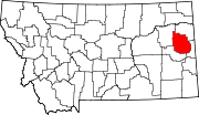 | |
| Town | ||
| CDPs | ||
| Authority control databases: Geographic |
|---|