Cabezabellosa: Difference between revisions
Appearance
Content deleted Content added
clarify info |
Alvarote1998 (talk | contribs) Village Info Tags: nowiki added Visual edit |
||
| Line 1: | Line 1: | ||
{{Infobox settlement |
{{Infobox settlement |
||
| official_name = Cabezabellosa |
| official_name = Cabezabellosa |
||
| settlement_type = |
| settlement_type = [[Municipalities of Spain|Municipality]] |
||
| image_skyline = Panorámica de Cabezabellosa.jpg |
| image_skyline = Panorámica de Cabezabellosa.jpg |
||
| image_caption = Panoramic View of Cabezabellosa |
| image_caption = Panoramic View of Cabezabellosa |
||
| image_flag = |
| image_flag = |
||
| image_seal = [[file:Escudo_de_Cabezabellosa_(Cáceres).svg|70px]] |
| image_seal = [[file:Escudo_de_Cabezabellosa_(Cáceres).svg|70px]] |
||
| nickname = |
| nickname = |
||
| pushpin_map = Spain |
| pushpin_map = Spain#Spain Extremadura |
||
| pushpin_map_caption = Location in Spain. |
| pushpin_map_caption = Location in Spain. |
||
| coordinates = |
| coordinates = {{coord|40|7|59|N|6|0|0|W|region:ES|display=inline,title}}<nowiki>}}</nowiki> |
||
| subdivision_type = [[List of sovereign states|Country]] |
| subdivision_type = [[List of sovereign states|Country]] |
||
| subdivision_name = [[Spain]] |
| subdivision_name = [[Spain]] |
||
| subdivision_type1 = [[Autonomous communities of Spain|Autonomous community]] |
| subdivision_type1 = [[Autonomous communities of Spain|Autonomous community]] |
||
| subdivision_name1 = [[ |
| subdivision_name1 = [[Extremadura]] |
||
| subdivision_type2 = [[Provinces of Spain|Province]] |
| subdivision_type2 = [[Provinces of Spain|Province]] |
||
| subdivision_name2 = |
| subdivision_name2 = [[Cáceres (province)|Cáceres]] |
||
| subdivision_type3 = |
| subdivision_type3 = [[List of municipalities in Cáceres|Municipality]] |
||
| subdivision_name3 = |
| subdivision_name3 = Cabezabellosa |
||
| leader_title = |
| leader_title = [[Alcalde|Mayor]] |
||
| leader_name = |
| leader_name = [[María Ángeles Talaván]] |
||
| area_total_km2 = 33.56 |
| area_total_km2 = 33.56 |
||
| area_land_km2 = |
| area_land_km2 = |
||
| area_water_km2 = |
| area_water_km2 = |
||
| elevation_m = 836 |
| elevation_m = 836 |
||
| population_as_of = {{Spain metadata Wikidata|population_as_of}} |
| population_as_of = {{Spain metadata Wikidata|population_as_of}} |
||
| population_footnotes = {{Spain metadata Wikidata|population_footnotes}} |
| population_footnotes = {{Spain metadata Wikidata|population_footnotes}} |
||
| population_total = {{Spain metadata Wikidata|population_total}} |
| population_total = {{Spain metadata Wikidata|population_total}} |
||
| population_density_km2 = auto |
| population_density_km2 = auto |
||
| population_demonym = |
| population_demonym = |
||
| timezone = [[Central European Time|CET]] |
| timezone = [[Central European Time|CET]] |
||
| utc_offset = +1 |
| utc_offset = +1 |
||
| timezone_DST = [[Central European Summer Time|CEST]] |
| timezone_DST = [[Central European Summer Time|CEST]] |
||
| utc_offset_DST = +2 |
| utc_offset_DST = +2 |
||
| website = [http://www.cabezabellosa.es/ www.cabezabellosa.es] |
| website = [http://www.cabezabellosa.es/ www.cabezabellosa.es] |
||
| footnotes = |
| footnotes = |
||
| postal_code = 10729 |
|||
}} |
}} |
||
{{Expand Spanish|topic=geo|date=August 2011|Cabezabellosa}} |
{{Expand Spanish|topic=geo|date=August 2011|Cabezabellosa}} |
||
Revision as of 19:34, 17 November 2021
Cabezabellosa | |
|---|---|
 Panoramic View of Cabezabellosa | |
| Coordinates: 40°7′59″N 6°0′0″W / 40.13306°N 6.00000°W}} | |
| Country | Spain |
| Autonomous community | Extremadura |
| Province | Cáceres |
| Municipality | Cabezabellosa |
| Government | |
| • Mayor | María Ángeles Talaván |
| Area | |
| • Total | 33.56 km2 (12.96 sq mi) |
| Elevation | 836 m (2,743 ft) |
| Population (2018)[1] | |
| • Total | 349 |
| • Density | 10/km2 (27/sq mi) |
| Time zone | UTC+1 (CET) |
| • Summer (DST) | UTC+2 (CEST) |
| Website | www.cabezabellosa.es |
You can help expand this article with text translated from the corresponding article in Spanish. (August 2011) Click [show] for important translation instructions.
|
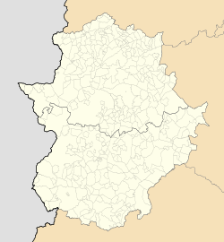
Cabezabellosa is a village in the province of Cáceres and autonomous community of Extremadura, Spain. The municipality covers an area of 34 square kilometres (13 sq mi) and as of 2011 had a population of 408 people.[2]
References
- ^ Municipal Register of Spain 2018. National Statistics Institute.
- ^ "Cáceres: Población por municipios y sexo:Cifras oficiales de población resultantes de la revisión del Padrón municipal a 1 de enero de 2011". Instituto Nacional de Estadística. Archived from the original on 21 May 2012. Retrieved 26 May 2012.
40°07′59″N 6°00′00″W / 40.13306°N 6.00000°W{{#coordinates:}}: cannot have more than one primary tag per page


