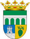
Talayuela
| Talayuela municipality | ||
|---|---|---|
 Talayuela - Iglesia San Martín de Tours
|
||
| coat of arms | Map of Spain | |

|
|
|
| Basic data | ||
| Autonomous Community : | Extremadura | |
| Province : | Cáceres | |
| Comarca : | Campo Arañuelo | |
| Coordinates | 39 ° 59 ′ N , 5 ° 37 ′ W | |
| Height : | 290 msnm | |
| Area : | 228.64 km² | |
| Residents : | 7,371 (Jan 1, 2019) | |
| Population density : | 32.24 inhabitants / km² | |
| Postal code : | 10310 | |
| Municipality number ( INE ): | 10180 | |
| administration | ||
| Website : | Talayuela | |
Talayuela is a Spanish town and municipality ( municipio ) with 7,371 inhabitants (as of 2019) in the province of Cáceres ( Extremadura ). The community includes several villages (aldeas) , hamlets (pedanías) and individual farms (fincas) .
location
The small town of Talayuela is about 5 km south of the Río Tiétar at an altitude of approximately 290 m above sea level. d. M. The distance to the provincial capital Cáceres is about 125 km (driving distance) in a south-westerly direction; the city of Toledo is a good 160 km to the east. The climate is temperate to warm; Rain (approx. 390 mm / year) falls mainly in the winter half-year.
Population development
| year | 1857 | 1900 | 1950 | 2000 | 2017 |
| Residents | 672 | 417 | 1,387 | 9,444 | 7,338 |
The significant population growth since the 1950s is mainly due to the rapid development of tobacco growing in the area. The city has almost 30% foreigners (including 90% Moroccans); Immigrants within Spain make up another 50% of the population.
economy
In earlier centuries, the cultivation of barley , wheat and other crops served mainly for self-sufficiency . Today the most important sources of income of the place are the cultivation and processing of tobacco as well as the handicrafts necessary for the operation of the machines. In addition, the construction industry experienced a steady upswing.
history
The swampy area around Talayuela was infested with malaria for centuries ; so the place was only founded in the 16th century as a subsidiary of the city of Plasencia .
Attractions
- The Iglesia de San Martín de Tours , built of granite rubble, dates from the 16th century. Only the corner stones , the two lateral portal zones, the bell tower and the buttresses are mostly made of sandstone . On the south side of the church there is a sundial carved into the stone .
- The Nuestra Señora de la Asunción church is modern.
Web links
Individual evidence
- ↑ Cifras oficiales de población resultantes de la revisión del Padrón municipal a 1 de enero . Population statistics from the Instituto Nacional de Estadística (population update).
- ↑ Talayuela - Map with altitude information
- ↑ Talayuela - climate tables
- ^ Talayuela - population development
- ↑ Talayuela - Composition of the population
- ↑ Talayuela - Church
