
Park City, Utah
Park City, Utah | |
|---|---|
.jpg) Park City in 2006 | |
 Location of Park City, Utah | |
| Country | United States |
| State | Utah |
| Counties | Summit, Wasatch |
| Area | |
| • Total | 9.4 sq mi (24.4 km2) |
| • Land | 9.4 sq mi (24.4 km2) |
| • Water | 0.0 sq mi (0.0 km2) |
| Elevation | 7,000 ft (2,134 m) |
| Population (2000) | |
| • Total | 7,731 |
| • Density | 781/sq mi (301.7/km2) |
| Time zone | UTC-7 (Mountain) |
| • Summer (DST) | UTC-6 (Mountain) |
| ZIP codes | 84060, 84068, 84098 |
| Area code | 435 |
| FIPS code | 49-58070Template:GR |
| GNIS feature ID | 1444206Template:GR |
| Website | http://www.parkcity.org/ |

.jpg)

Park City is a city in Summit and Wasatch counties in the U.S. state of Utah. It is one of two major resort towns in Utah, the other being Moab. It is considered to be part of the Wasatch Back and a part of the Salt Lake City metropolitan area. The city is 32 miles (48 km) east of downtown Salt Lake City and 15 miles (24km) from Salt Lake City's east edge of Sugar House along Interstate 80. The population was 7,371 at the 2000 census. On average, the tourist population greatly exceeds the number of permanent residents.
After a population decline following the shutdown of the area's mining industry, the city rebounded during the 1980s and 1990s through an expansion of its tourism business. The city has three major ski resorts: Park City Mountain Resort, Deer Valley Resort, and The Canyons Resort. The Park City and Deer Valley ski resorts were the major locations for ski and snowboarding events at the 2002 Winter Olympics. Although they receive less snow and have a shorter ski season than do their counterparts in Salt Lake County, such as Snowbird resort, they are much easier to access.
Additionally the city is the main location of the United States' largest independent film festival, the Sundance Film Festival, home of the United States Ski Team, training centre for members of the Australian Freestyle Ski Team, the largest collection of factory outlet stores in northern Utah, the 2002 Olympic bobsled/skeleton/luge track at the Utah Olympic Park, and golf courses. Some scenes from 1994's Dumb and Dumber were shot in the city. Outdoor-oriented businesses such as backcountry.com and Rossignol[citation needed] have their headquarters based in Park City. The city has many upscale luxury national retailers, clubs, bars, and restaurants, and has nearby reservoirs, hot springs, forests, and hiking and biking trails. Park City is also the original home of the Mrs. Fields Cookies chain.
In the summertime many valley residents of the Wasatch Front visit the town to escape high temperatures. Park City is usually 11°F (6°C) cooler than Salt Lake City[citation needed], as it lies mostly above 7,000 above sea level, while Salt Lake City is situated at an altitude of about 4,000 feet. It is one of the wealthiest cities in the United States and is notable for having a large number of Northern and Central European immigrants.
History
The city was settled as a mining community in 1870, following the discovery of lead, gold, and silver in the area. The city became heavily populated to such an extent that many people thought it would replace Salt Lake City as the primary city in Utah. However, the mines penetrated the water table and were flooded, and the city nearly became a ghost town. Skiing began to come to the city in the 1950s, but the city did not recover until the 1970s, when growth finally came. Growth has accelerated in the last few decades, and it now stands as one of the most affluent and lively resort towns in the United States.[citation needed]
One of the few Utah towns established by non-Mormons, it once had 27 saloons lining the street, with an accompanying wager, apparently never won, that no one could take a drink at each one in a single night and end up standing. Getting a drink in this part of Utah was never a problem. Hence the town's slogan: "At the base of a 3100 ft vertical drop, you'll find an extraordinary place to land." [citation needed]
Once the site of the largest silver-mining camp in the country, the town was virtually destroyed by fire in 1898. Tragedy struck again in 1902 when 34 miners were killed in an explosion in the Day West Mine. The mining community never fully recovered. A collapse in silver prices and the economic consequences of the first world war exacerbated the town's decline. Half a century ago Park City was listed as one of the ghost towns of the west. [citation needed]
Skiing, however, helped drive the phantoms away. Particularly gung-ho is the terrain around Jupiter Peak, where, over the years, more than $400 million worth of silver ore was mined, creating the 23 millionaires, including George Hearst, founder of the news dynasty. Roger J. Traynor was born in Park City in 1900 and raised there; he went on to become Chief Justice of the California Supreme Court. [citation needed]
As long ago as the 1920s, miners in Park City were using underground trains and shafts to gain access to the mountain for skiing. When the slopes opened to the public in 1963 as Treasure Mountain, skiers were transported nearly three miles into the mountain on the Spiro Tunnel mine train and then lifted 1800 ft (548 m) to the slopes on a mine hoist elevator. Aerial trams once used for hauling ore were converted into chairlifts. To this day, there are still more than 1000 miles (1609 km) of old silver-mine workings and tunnels beneath the slopes at Park City Mountain Resort and neighboring Deer Valley. [citation needed]
Park City might be a fairly nondescript-appearing town were it not for its colorful and evocative Main Street, where 64 Victorian buildings are listed in the National Register of Historic Places. Other relics from its past have been left near the slopes. Old mine buildings, mineshafts, and hoists, including the weathered remains of the Walker Webster Silver Mine and the water towers once used to hydrate one of the biggest mines, the Silver King, rear out of the snow to give the skiing a dash of history.[citation needed]
Geography and climate
Park City is located at 40°39′34″N 111°29′59″W / 40.65944°N 111.49972°WInvalid arguments have been passed to the {{#coordinates:}} function (40.659306, -111.499828)Template:GR. According to the United States Census Bureau, the city has a total area of 9.4 square miles (24.4 km²). None of the area is covered with water.[citation needed]
Park City is located at the south end of Snyderville Basin and climbs steep mountains to the southeast, south, and west. It is accessed by State Route 224 from Interstate 80 to the north and State Route 248, which heads east to U.S. Route 40 and on to Kamas.[citation needed]
| Jan | Feb | Mar | Apr | May | Jun | Jul | Aug | Sep | Oct | Nov | Dec | ||
|---|---|---|---|---|---|---|---|---|---|---|---|---|---|
| Park City Daily Maximum | °F | 27 | 31 | 36 | 48 | 59 | 70 | 79 | 78 | 68 | 53 | 39 | 31 |
| Park City Daily Minimum | °F | 7 | 10 | 16 | 24 | 32 | 39 | 48 | 47 | 37 | 24 | 17 | 12 |
| Data is for Park City | |||||||||||||
Demographics
As of the censusTemplate:GR of 2000, there were 7,371 people, 2,705 households, and 1,687 families residing in the city. The population density was 781.4 people per square mile (301.8/km²). There were 6,661 housing units at an average density of 706.1/sq mi (272.7/km²). The racial makeup of the city was 80.50% White, 0.42% African American, 0.30% Native American, 1.86% Asian, 0.01% Pacific Islander, 15.71% from other races, and 1.19% from two or more races. Hispanic or Latino of any race were 19.64% of the population.[citation needed]
There were 2,705 households out of which 32.2% had children under the age of 18 living with them, 51.9% were married couples living together, 7.2% had a female householder with no husband present, and 37.6% were non-families. 21.4% of all households were made up of individuals and 3.0% had someone living alone who was 65 years of age or older. The average household size was 2.72 and the average family size was 3.11.[citation needed]
In the city the population was spread out with 23.3% under the age of 18, 11.4% from 18 to 24, 35.1% from 25 to 44, 25.6% from 45 to 64, and 4.6% who were 65 years of age or older. The median age was 33 years. For every 100 females there were 118.7 males. For every 100 females age 18 and over, there were 118.9 males.[citation needed]
The median income for a household in the city was $65,800, and the median income for a family was $77,137. Males had a median income of $40,032 versus $26,341 for females. The per capita income for the city was $45,164. About 5.3% of families and 10.0% of the population were below the poverty line, including 11.6% of those under age 18 and 6.6% of those age 65 or over.[citation needed]
Notable residents
- George Hearst: founder of the news dynasty [citation needed]
- Roger J. Traynor: Chief Justice of the California Supreme Court [citation needed]
- Alexa Wilkinson: American singer-songwriter, moved to Park City aged 12[citation needed]
- Bill Engvall: Blue Collar comedian[citation needed]
- Tanner Hall: freeskier
Trivia
- Singer-songwriter Josh Kelley and actress Katherine Heigl were married in Park City on December 23, 2007[1].
Sister Cities
See also
References
External links
Municipalities and communities of Summit County, Utah, United States | ||
|---|---|---|
| Cities |  | |
| Towns | ||
| CDPs | ||
| Unincorporated communities | ||
| Ghost towns | ||
| Footnotes | ‡This populated place also has portions in an adjacent county or counties | |
Municipalities and communities of Wasatch County, Utah, United States | ||
|---|---|---|
| Cities | 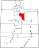 | |
| Towns | ||
| CDP | ||
| Unincorporated community | ||
| Indian reservation | ||
| Ghost towns | ||
| Footnotes | ‡This populated place also has portions in an adjacent county or counties | |