Samuel de Champlain Provincial Park: Difference between revisions
clean up template field names using AWB |
Citation bot (talk | contribs) Add: title. Changed bare reference to CS1/2. | Use this bot. Report bugs. | Suggested by Mako001 | Linked from User:Mako001/Missingtitle3 | #UCB_webform_linked 389/2741 |
||
| (23 intermediate revisions by 19 users not shown) | |||
| Line 1: | Line 1: | ||
{{short description|Provincial park in Ontario, Canada}} |
|||
| ⚫ | |||
{{refimprove|date=April 2023}} |
|||
| ⚫ | |||
| name = Samuel de Champlain Provincial Park |
| name = Samuel de Champlain Provincial Park |
||
| iucn_category = II |
| iucn_category = II |
||
| Line 5: | Line 7: | ||
| photo_width = 230 |
| photo_width = 230 |
||
| photo_caption = |
| photo_caption = |
||
| locator_x = |
|||
| locator_y = |
|||
| location = [[Ontario]], [[Canada]] |
| location = [[Ontario]], [[Canada]] |
||
| nearest_city = [[Mattawa, Ontario]] |
| nearest_city = [[Mattawa, Ontario]] |
||
| ⚫ | |||
| lat_d = |
|||
| |
| map = Ontario |
||
| ⚫ | |||
| lat_s = |
|||
| lat_NS = |
|||
| long_d = |
|||
| long_m = |
|||
| long_s = |
|||
| long_EW = |
|||
| ⚫ | |||
| established = |
| established = |
||
| visitation_num = |
| visitation_num = |
||
| Line 23: | Line 17: | ||
| governing_body = [[Ontario Parks]] |
| governing_body = [[Ontario Parks]] |
||
}} |
}} |
||
'''Samuel de Champlain Provincial Park''' is a [[provincial park]] in [[Ontario]], [[Canada]]. |
|||
| ⚫ | |||
The park spans both sides of the [[Mattawa River]]. It has an area of {{convert|25.5|km2|sqmi}} and is about {{convert|14|km}} west of [[Mattawa, Ontario]], Canada. It is administered by [[Ontario Parks]], which classifies it as a ''natural environment'' park. |
|||
This park is popular in the summer with [[camping|campers]], providing many recreational activities such as [[canoeing]], swimming, [[hiking]], wildlife viewing, and other family activities. The visitors centre houses the Voyageur Heritage Centre which highlights the historic importance of the Mattawa River to the [[fur trade]] through interactive exhibits. The park is also home to the [[Canadian Ecology Centre]], an [[outdoor education]] centre which provides educational programs on [[sustainable forestry]]. |
This park is popular in the summer with [[camping|campers]], providing many recreational activities such as [[canoeing]], swimming, [[hiking]], wildlife viewing, and other family activities.<ref>{{cite web | url=https://www.explore-mag.com/Paddling-the-Mattawa-River-Pimisi-Bay-to-Samuel-de-Champlain-Provincial-Park | title=Explore Magazine }}</ref> The visitors centre houses the Voyageur Heritage Centre, which highlights the historic importance of the Mattawa River to the [[fur trade]] through interactive exhibits. The park is also home to the [[Canadian Ecology Centre]], an [[outdoor education]] centre, which provides educational programs on [[sustainable forestry]]. |
||
The park is named after [[Samuel de Champlain]], one of the first French explorers of Canada of the 17th century. |
The park is named after [[Samuel de Champlain]], one of the first French explorers of Canada of the 17th century. |
||
| ⚫ | |||
==References== |
|||
{{reflist}} |
|||
==External links== |
==External links== |
||
*{{Commons category-inline}} |
|||
*[http://www.ontarioparks.com/english/samu.html Official Park Website] |
|||
*{{official website|https://www.ontarioparks.com/park/samueldechamplain}} |
|||
{{Ontario parks}} |
{{Ontario parks}} |
||
| ⚫ | |||
| ⚫ | |||
| ⚫ | |||
[[Category:Protected areas established in 1990]] |
|||
[[Category:1990 establishments in Ontario]] |
|||
| ⚫ | |||
| ⚫ | |||
{{Ontario-geo-stub}} |
{{Ontario-geo-stub}} |
||
{{Canada-protected-area-stub}} |
|||
Latest revision as of 07:51, 16 April 2023
This article needs additional citations for verification. (April 2023) |
| Samuel de Champlain Provincial Park | |
|---|---|
 | |
| Location | Ontario, Canada |
| Nearest city | Mattawa, Ontario |
| Coordinates | 46°17′30″N 78°52′30″W / 46.29167°N 78.87500°W |
| Area | 25.5 km2 (9.8 sq mi) |
| Governing body | Ontario Parks |
Samuel de Champlain Provincial Park is a provincial park in Ontario, Canada.
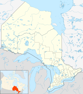
The park spans both sides of the Mattawa River. It has an area of 25.5 square kilometres (9.8 sq mi) and is about 14 kilometres (8.7 mi) west of Mattawa, Ontario, Canada. It is administered by Ontario Parks, which classifies it as a natural environment park.
This park is popular in the summer with campers, providing many recreational activities such as canoeing, swimming, hiking, wildlife viewing, and other family activities.[1] The visitors centre houses the Voyageur Heritage Centre, which highlights the historic importance of the Mattawa River to the fur trade through interactive exhibits. The park is also home to the Canadian Ecology Centre, an outdoor education centre, which provides educational programs on sustainable forestry.
The park is named after Samuel de Champlain, one of the first French explorers of Canada of the 17th century.
References[edit]
External links[edit]
 Media related to Samuel de Champlain Provincial Park at Wikimedia Commons
- Official website


