
Liancourt Rocks
This article's factual accuracy is disputed. |
Template:Move and semi protected


The Liancourt Rocks are a group of small islets in the Sea of Japan (East Sea). Sovereignty over the islands is disputed between Japan and South Korea.[1] South Korea has controlled them since July 1954.[2]
Its name derives from Le Liancourt, the name of the French whaling ship whose crew almost crashed on the rocks in 1849.[3] The islets are also known as Dokdo (or Tokto) (독도/獨島, literally "solitary island") in Korean and as Takeshima (竹島, , literally "bamboo island") in Japanese.[4]
The Liancourt Rocks are comprised of two main islets and 35 smaller rocks. Their total surface is 187,450 square metres (46 acres) and their highest elevation is 169 metres (554 feet).[5] They are currently inhabited by two permanent Korean citizens, Kim Seong-do (김성도) and Kim Shin-yeol (김신열), a small Korean police detachment, administrative personnel and lighthouse staff.[6]
Korea administers the islands as part of Ulleung County, North Gyeongsang Province. Japan classifies them as part of Okinoshima, Oki District, Shimane Prefecture.
The islands lie in rich fishing grounds which could also contain large gas deposits.[7]
Geography

The Liancourt Rocks are composed mainly of two islets, 150 metres apart[5] ( Nishi-jima and Higashi-jima in Japanese, Seodo and Dongdo in Korean; both literally meaning western island 서도/西島 and eastern island 동도/東島, respectively). The western islet is the larger of the two islets. Altogether, there are about 90 islets and reefs,[8] volcanic rocks formed in the Cenozoic era.[9] A total of 37 of these islets are recognized as permanent land.[8] In 2006, a geologist reported that the islets formed 4.5 million years ago and are quickly eroding.[10]
The total area of the islets is about 187,450 square metres (46 acres), with their highest point at 169 metres (554 ft) in the western islet.[5] The western islet is about 88,640 square metres (22 acres) in area; the eastern islet about 73,300 square metres (18 acres).[8] Liancourt Rocks is located at about 131°52´ East longitude and about 37°14´ North latitude.[8] The western islet is located at 37°14′31″N 131°51′55″E / 37.24194°N 131.86528°E and the eastern islet is located at 37°14′27″N 131°52′10″E / 37.24083°N 131.86944°E. The islets are 217 km (135 mi) from mainland Korea and 250 km (150 mi) from mainland Japan.[5]
The nearest Korean territory (Ulleung-do) is 87 km (54 mi) away (it can be visible on clear days) and the nearest Japanese territory (Oki Islands) is 157 km (98 mi) away.[5][8] The western islet consists of a single peak and features many caves along the coastline. The cliffs of the eastern islet are about 10 to 20 metres high. There are two large caves giving access to the sea, as well as a crater.[9][11]
Climate
Due to their location and extremely small size, the Liancourt Rocks sometimes have harsh weather. At times, ships are unable to dock because of strong northwestern winds in winter.[5][11] Overall, the climate is warm and humid, and heavily influenced by warm sea currents. Precipitation is high throughout the year (annual average—1324 mm), with occasional snowfall.[11] Fog is also a common sight. In the summer, southerly winds dominate.[11] The water around the islets is about 10 degrees Celsius in spring, when the water is coolest. It warms to about 25 degrees Celsius in August.[11]
Ecology
The islets are volcanic rocks, with only a thin layer of soil and moss.[8] About 80 species of plants, over 22 species of birds, and 37 species of insects have been recorded on the islets, in addition to the local maritime life.[5] The islets are too small to have any significant amount of fresh water. In the early 1970s trees and some types of flowers were planted.[5] Trees are required under international law for the islets to be recognized as natural islands rather than reefs.[6][11]
Demographics
There are two permanent Korean citizens, Kim Sung-do (김성도) and Kim Shin-yeol (김신열), living on the islets. In addition to these residents, there are 37 South Korean police officers (독도경비대/獨島警備隊) who take residence on guard duty. There are also three Ministry of Maritime Affairs and Fisheries personnel, and three lighthouse keepers living on the islets in rotation. In the past, several fishermen also lived on the islets temporarily.[6] For many years, civilian travel was subject to Korean government approval because the island group is designated as a nature reserve. Tourist boats carrying 1,597 visitors were allowed to land in 2004. Since mid-March 2005, more tourists have been allowed to land, up to 70 tourists are permitted at any one time. Tour companies charge around 350,000 Korean won per person.[6]
International dispute
Liancourt Rocks is visible in the distance in this picture.
"Liancourt Rocks is a visible by naked eyes from Korean territory[12]
--- Photographed by MBC Broadcast"
Currently, both South Korea,[13][14] and Japan[15] are claiming sovereignty over Liancourt Rocks. There are conflicting interpretations about the state of sovereignty over the islands in pre-modern times. A Korean claim is partly based on references to a Korean island called Usan-do (우산, 于山) in various historical records, geographies, maps, and encyclopedia such as Samguk Sagi, Annals of Joseon Dynasty, Dongguk Yeoji Seungnam, and Dongguk munhon bigo. According to the Korean view, these refer to today's Liancourt Rocks, while the Japanese views variously argue that they refer to either Juksoe (竹嶼; Korean Jukdo or Dae'soem), Kwanumdo (觀音島, 島項; Korean Seommok, G'aksae), Ulleungdo, or a non-existent island. [16]
1696 Murakami Document
Korean historical sources state that the administrator of Tokugawa shogunate reaffirmed in January 1696 that Ulleungdo and Dokdo belonged to Korea quoting An Yong Bok's testimony. [17] [18] [19]. The dispute about the ownership of Ulleung-do between Chosun Korea and Tokugawa Japan ignited when Korean fishermen clashed with Japanese fisherment on Ulleungdo waters in 1692. The following year, An Yong-Bok and Park Eo-dun, representing Korean fishing communities, are variously said to have visited, drifted, or even abducted by Japanese fishermen, arriving at Oki island in 1693. Taking this occasion, An discussed territorial title matters with a Japanese governmental official, reminding him that Ulleungdo and Jasando (sic; a scribal corruption of Usan-do 于山島/亐山島) are Korean territory. As a result, the bakufu issued prohibitions banning Japanese fishermen from travelling to said waters. This is called the 1st An Yong-bok incident.
An, on being released from a two-year exile on charges of traveling to a foreign country without permission, made a second trip to Japan together with a group of Koreans from Dongnae and other maritime regions in 1696 with documents and a map to reconfirm his original claim . Accordingly, Japan nullified "Permission to cross to Takeshima (Ulleund-do)". Although Japan did not mention Matsushima (Liancourt Rocks) on the prohibition papers, no Japanese could legitimately travel to either Takeshima or Matsushima until the end of the bakufu period. This document from An's secopnd trip[20] relays An's words that Ulleungdo, geographically subordinate to Gangwon province, is administered by Dongnae-bu. The document records the distance between Takeshima (Ulleungdo) and Matsushima (Liancourt Rocks) as 50 ri, and also states in a rough copy of An's map of Korea that stated the two islands belonged to Korea's Gangwon province. [1] In the Annals of King Sukjong, the official governmental chronicle, An is reported to have stated that Jasan-do 子山島(sic) was what the Japanese called Matsu-shima 松島 at that time. [21]
![[1]](https://en.wikipedia.org/wiki/Image:Dok02_05.jpg)
1697 Korea's official decision regarding Tsushima's request
In 1697, the Korean government reached a decision to reject Tsushima clan's request to emend a previous letter that mentioned Korea's Ulleungdo, and that An Yong-Bok's visit to Japan to raise a legal case does not require a written response from Korea since the Royal Court had no foreknowledge, and that these facts be conveyed to the Tsushima envoy's house orally. [22] [2]
1785 Map of Three Adjoining Countries
A Japanese scholar of practical science Hayashi Shihei published 『Map of Three Adjoining Countries』(三國接壤地圖)in 1785, which showed each country in distinct colors; Joseon (old name of Korea) in yellow, Japan in green. In it, Uleungdo and a small islet in the middle of the East Sea were not only colored in yellow but marked, "As Korean territories (朝鮮ノ持ニ)".[3]
![[3]](https://en.wikipedia.org/wiki/Image:Dok1785.jpg)
1877 Daijō-kan order
In 1877, the Japanese Supreme Council Daijō-kan issued an order[23] stating that Ulleungdo (then called "Takeshima 竹島", now called Matsushima 松島 by Japan) and another island (外一島) are not under Japanese rule [24] [25]. Korea claims that "another island" (外一島) besides Ulleungdo refers to Liancourt Rocks [26] [27] [28] and considers this order as an evidence that Liancourt Rocks was under the control of Korea. The Japanese government has not made any comment on this point whereas some Japanese consider that "another island" (外一島) does not refer to Liancourt Rocks.[29] [30]
1900 Korean Imperial Decree No. 41
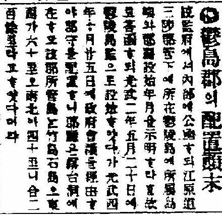
In the year 1900, Korea issued Imperial Decree No. 41 of Oct 25, 1900, which was published to the international community in Official Gazette No. 1716 (관보 제1716호) on Oct 27.[31] [32] This decree states that Ulleungdo be renamed to Uldo (mod. Ulleungdo), and that the county hall shall govern the whole island of Ulleungdo, Jukdo, and Sokdo. [33] [34] Japan claims that there is no evidence to identify the island "Sokdo" as Liancourt Rocks, [35] [36] and that there is no record that proves the effective occupation by Korea before Japanese Cabinet decision of Jan 28, 1905. Korea claims that the island "Sokdo" mentioned in this document is Liancourt Rocks, and thus Liancourt Rocks was still officially part of Korea as an ancient territory since 512. Korea claims that Ulleungdo islanders who called Dokdo as Dokseom (or Dolseom, both literally meaning "rocky island"), the name "Seokdo" (literally "rocky island") in the Ordinance refers to Dokdo. [37]
Korea also claims Liancourt Rocks was effectively occupied by seasonal fishermen and divers in recent times as a result of King Gojong's Ulleungdo Reclamation Program (鬱陵島開拓令) issued in Dec 1881. [38] A South Korean scholar claims to have uncovered evidence that Korean fishermen engaged in "whaling" in Liancourt Rocks waters in the 1880's and that sea lions were hunted and sea-lion-derived products were exported to Japan in 1904 prior to the Japanese Cabinet decision of 1905 to incorporate a supposed terra nullius. [39]
1904 Japan-Korea treaty
The Japan-Korea Protocol of 1904 signed between Japan and Korea on February 23, 1904 (Japanese 日韓議定書, Nikkan Giteisho; Korean 韓日議定書, 한일의정서, Han'il uijongso) stipulates in article 3 that Japan shall guarantee the territorial integrity of Korea. It further stipulates in article 4 that, in case the territorial integrity of Korea is endangered by aggression of a third power, Korea shall give full facilities to promote the action of Japan, and that Japan may occupy, when the circumstances require, such places as may be necessary for strategic reasons.
Article 4 of the treaty has been quoted as giving Japan full authorisation in terms of international law in taking Liancourt Rocks as a strategic surveillence point during the Russo-Japanese War.[40] Article 3, however, has been quoted as preventing Japan from appropriating Liancourt Rocks post bellum, and hence ruling the 1905 Shimane incorporation illegal after the end of the war.[citation needed] [41] Although the watch tower on Liancourt Rocks was demolished, suggesting the necessity on strategic resaons had disappeared, the Cabinet Decision to incorporate Liancourt Rocks had not been revoked in violation of the treaty. This suggests the military threat in Article 4 was not the primary ground of incorporating Liancourt Rocks.[citation needed]
1905 Japanese Incorporation of Liancourt Rocks
The imperial government of Japan incorporated Liancourt Rocks as a result of a Cabinet decision in early 1905. Three motives are commonly cited for it cause: civilian occupation of said islets by a Japanese citizen from Oki, Nakai Yozaburo (中井養三郎; 1864-1934), practical necessities arising from the armed conflict with Russia, and Japan's foreign policy regarding Korea as its western frontier to fend off encroaching foreign powers. The incorporation was conducted incognito to foreign nations including Korea as the decision had never been announced by the central government to the international community. The Korean response to reports of the verbal notice by a local Japanese official was one of shock and disbelief, and orders were issued to investigate the truth of the report. While the result of the investigation is obscured in silence, apparently lending momentum to the Japanese claim, the Japanese Resident-General residing in Seoul, in 1906, makes an inquiry into which islands are administered by Ulleungdo (sic.), in the older designation before the 1900 Korean Imperial Decree No 40, to which the Internal Ministry relays facts consistent with the 1900 Imperial Decree No 41, that Uldo County administers Uldo proper, Jukdo, and Seokdo.
1903-1904 Nakai's Fishing Enterprise
On September 29, 1904, Nakai Yozaburo (中井養三郎; 1864-1934) of Saigo, Shimane Prefecture, experimenting with sea lion hunting business in the summers of 1903 and 1904, and wanting to protect his investment, submitted a petition to incorporate Liancourt Rocks and to issue exclusive license to hunt sea lions for ten years. The petition was submitted to the Home Ministry, the Ministry of Foreign Affairs, and the Ministry of Agriculture and Commerce. Nakai, initially believing Liancourt Rocks to be Korean territory, had planned to ask for a lease from the Korean government via the Ministry of Trade and Commerce. An officer of the Minstry of Home Affairs considered it unwise to incorporate Liancourt Rocks suspected to be Korean territory, but the Navy and the Foreign Ministry advised incorporation would be profitable, and that there would arise no diplomatic repercussions. [42] [43] [44] [45] [46] [47] [48]
1905 Japanese Cabinet Decision on Liancourt Rocks
On Jan 28, 1905, the Cabinet decided (明治三十八年一月二十八日閣議決定), "There is no evidence to recognise that this uninhabited island was ever occupied by a foreign country... As evidenced through relevant records that a person by the name of Nakai Yozaburo (中井養三郞) has relocated to said island in 1903 (Meiji 36) and practiced fishing there since, we recognise the fact that occupation has occurred in terms of international law."[49] Japanese government's official view has evolved since 1905. In 1905, the Japanese government claimed the incorporation was valid on grounds that the incorporation of Liancourt Rocks was a prior occupation of a terra nullius under international law. [50] [51] [52] [53] Since 1954, the Japanese government's claim shifted to effective occupation based on the same Cabinet decision while carefully avoiding its previous claims of incorporation on grounds of prior occupation of a terra nullius. [54] Korea also claims that Japan's 1905 claim to terra nullius conflicts with its previous recognition of the islets as Korean territory. [55] [56] [57]
1905 Shimane Notice 40
Japan claims to have enforced its Cabinet decision of Jan 28, 1905 to incorporate the "unclaimed" islands as part of Shimane Prefecture (島根縣) in Shimane Prefectural Notice No. 40 of Feb 22, 1905 (島根縣告示第40號) [58] [59] [60]. The decision was reported in a newspaper, San-in Shimbun, on Feb 24, 1905.[61] [62] [63] [64]
Korea claims that the decision was not reported in a official gazette. The decision was reported a one minor local newspaper only. There is no evidence that decision reported in a government gazette. Moreover, There is no evidence that decision reported to a central government of Japan at one time, also the decision was not noticed by central government. Japan was not notice to neighbor country. Korea claims that it was a almost impossible that tiny sized notice of local newspaper (3.4 cm[65][66]) recognized by foreign. Korea claims that the decision was a nothing but a "document occupation", and its procedure was a secret. Therefore, Korea claims that the decision was not fulfil the necessary conditions of territory's incorporation by international law. [67] [68] Korea also claims that 'Shimane Notice 40' was not announced to public. [69]
The incorporation came in the heat of the Russo-Japanese War and before the Eulsa Treaty of November 17, 1905, when Korea became Japan's protectorate. A temporary watchtower was erected on the islands for anti-Russian surveillance purposes, which was demolished after Japan's victory in the war.
1906 Verbal Notification of Incorporation and Korean Response
Japanese claims the incorporation was legitimate in that Korea did not dispute the incorporation when the news was published. Korea claims the incorporation was invalid in that the Feb 24 San-in Shimbun report lacked official status as its circulation was limited to the Shimane prefectural region. Korea claims neither the decision of the Japanese Cabinet, the order of Ministry of Home Affairs, nor the Shimane Notice had been announced, until March 28, 1906, to the Korean government to which many Japanese, including petitioner Nakai Yozaburo (中井養三郞) and certain governmental officials believed the title of Liancourt Rocks belonged.
On that date, a party of 44 officials from Shimane Prefecture visited Ulleungdo. The Japanese officials, including Kanda Yoshitaro, traveled to Ulleungdo by way of Dokdo, and informed Sim Heung-taek, then Magistrate of Ulleungdo, that Dokdo had been incorporated into Japan.
Stunned by this announcement, Sim sent word, the next day to Yi Myeong-nae, then Governor of Gangwon Province. Yi, in turn, recognizing the urgency and gravity of the matter, forwarded the report to the State Council Minister of the Korean Empire.
State Council Minister Bak Je-sun, in Directive No. 3 issued on May 20, 1906, stated, “It is totally groundless that Dokdo has become Japanese territory,” and went on to order “an investigation and report on the situation and on what the Japanese have done.”[70] The Eulsa Treaty stripped Korea of all its diplomatic rights on 17 November 1905.[71][72] Five years later, Korea was fully annexed by Japan.
1906 Communication between Japanese Resident-General and the Korean Government
A curious inquiry and reply are exchanged between Japanese and Korean officials, the result of which is reported in July 13 edition of Hwangseong Shinmun. In the letter, says the report, the Japanese Resident-General asks which islands are administered by Ulleung Is. The Korean Home Ministry simply lists the same islands as in the 1900 Decree specifying Seokdo, which Korea claims to be Liancourt Rocks. It also adds a physical measurement of what is believed to be Ulleung Is.[73] [74] [75] [76]
The Japanese inquiry is not current with the 1900 Korean Decree in its inaccurate designation of place names and offices, while the Korean reply remains silent on the rumour of incorporation of Liancourt Rocks of which it had not been officially notified. The details of the reasons for the Resident-General's inquiry and the Korean government's judgement regarding the inquiry are not known. [77] [78]
Prior to the Resident-General's inquiry and the Korean government's response reported on July 13, daily newspapers Hwangseong Shinmun (May 9, 1906) and Daehan Maeil Sinbo (May 1, 1906) had denied the rumoured Japanese local official's claim of incorporating Liancourt Rocks. "their claim to Dokdo as Japanese territory is totally groundless; the story is really shocking." [79] Although Hwangseong Shinmun had clearly declared that rumours of the Japanese incorporation of Liancourt Rocks were baseless two months before the July communication[80], and although the July communication reminded the Resident-General, Ito Hirobumi, of the 1900 Imperial Decree reaffirming Korea's state authority over Liancourt Rocks, there is no evidence that the then Resident-General or any other representation of Imperial Japan raised a formal objection to it.
1920 Provisional Government of the Republic of Korea in exile
In a memorial speech at the first anniversary of the 1919 March 1st Movement, Prime Minister Yi Dongnyeong accused Japanese government's illegal incorporation of Liancourt Rocks of 1905. [81]
Post World War II era
The recent dispute stems largely from conflicting interpretations of whether Japan's renunciation of sovereignty over its occupied territories after World War II was supposed to cover the Liancourt Rocks as well.
Supreme Commander of the Allied Powers Instruction #677 of January 29, 1946, listed the Liancourt Rocks, along with many other islands, as part of those territories over which Japanese administration was to be suspended.[82] In the first to fifth drafts of the Treaty of San Francisco between Japan and the Allied powers, Liancourt Rocks was described as part of Korea.
The sixth and seventh drafts, made on Dec 29, 1949, and Aug 7, 1950, respectively, ruled that Liancourt Rocks belonged to Japan.
The U.K. draft reflecting the views of Commonwealth nations[83] submitted April 7, 1951, demarked Liancourt Rocks as Korean territory.
The final version did not mention Liancourt Rocks in the article2 which defined the territory renounced by Japan. Consequtnly, the territorial title of Liancourt Rocks was left undefined between signatory states and Japan
Early Japanese efforts to claim Liancourt Rocks
Both countries submitted petitions and documents to pursuade the Allied Powers to rule Liancourt Rocks in their favour. The Japanese government's Foreign Office submitted a series of documents, issued from November 1946 to June 1947, entitled Minor Islands Adjacent to Japan Proper; Parts I-IV, of which Part IV, Minor Islands in the Pacific, Minor Islands in the Sea of Japan described Utsuryo-shima (Ulleungdo) and Take-shima (Dokdo, Liancourt Rocks) as Japanese territory. [84] [85] [86] [87]
Early Korean efforts to claim Liancourt Rocks
A corresponding Korean effort came from a private organisation self-styled "Patriotic Old Men's Association" led by a former military leader of the Korean Government in Exile, Cho Sung Hwan, on August 5, 1948, ten days before the inauguration of the South Korean government. They petitioned the sovereignty of Docksum(Liancourt Rocks) , Ullung Do, Tsushima and Parang islands [88]
First US bombing incident over Liancourt Rocks
The US designated Liancourt Rocks as a bombing range(SCAPIN#1778), and notified Japanese government on Sep 16, 1947. On June 8, 1948, twenty-nine US B-29 bombers from Kadena, Okinawa, flew over Liancourt Rocks in a bombing excercise dropping seventy-six bombs causing civilian casualties. [89] According to a South Korean government announcement, 30 some civilians were killed by this military drill, but higher estimates run up to ten times that figure. One researcher estimates damages somewhere between 30 and 80 fishing boats and civilian deaths between 30 and 100. [90]
Classified US communication to Korean Government
On Aug 10, 1951, a notification currently known as Rusk documents was sent to South Korea as a final U.S. Government reply on the issue of sovereignty between South Korea and Japan, and it states that Liancourt Rocks are territory of Japan.
Korea announces state intention to resume administration
On January 18, 1952, South Korea, a non-signatory state to the San Francisco Peace Treaty, announced the Presidential Declaration of Sovereignty over Adjacent Seas (Peace Line, Rhee Line) including Liancourt Rocks within Korean territory along the expiring MacArthur Line (SCAPIN#1033; June 22, 1946 - April 1952) before the Peace Treaty came into force on April 28.
On July 18, 1952, South Korea issued a presidential order to seize all illegal foreign vessels engaging in fishing in breach of the Peace Line.
Second US bombing incident over Liancourt Rocks raises doubts
On September 15, 1952, a South Korean scientific expedition aboard Chinnam-ho and a fishing crew of 23 aboard Kwangyong-ho were attacked on Liancourt Rocks waters by a mono-propellered aircraft bearing the US insignia that disappeared in the direction of Japan after dropping four bombs. The South Korean Navy had initially submitted an itinerary to the United Nations Naval Commander in Busan (CTG 95.7) on Sept 7 of the expedition to visit Ulleungdo Island and Liancourt Rocks 14th and 15th of September. Granted approval to travel to said areas by CTG 95.7, the expedition departed Busan on Sept 12 unaware of the United States-Japan Joint Committee's bombing plan over Liancourt Rocks for Sept 15.[91]
In response to the bombing incident, the US Embassy to Japan in Tokyo transmitted a message including the following on October 3, 1952, to the US State Department, "The history of these rocks has been reviewed more than once by the Department, and does not need extensive recounting here. The rocks, which are fertile seal breeding grounds, were at one time part of the Kingdom of Korea. They were, of course, annexed together with the remaining territory of Korea when Japan extended its Empire over the former Korean State... There exists a fair chance that... American bombs may cause loss of life... which will bring the Korean efforts to recapture these islands into more prominent play, and may involve the United States unhappily in the implications of that effort." [92]
US State Department answered to US Embassy Korea and Tokyo on Nov 14, 1952,"It appears that the Department has taken the position that these rocks belong to Japan and has so informed the Korean Ambassador in Washington.[...]it did not appear that they had ever before been claimed by Korea. As a result Article 2(a) of the Treaty of Peace with Japan makes no mention of the Liancourt Rocks."
Finary, US government kept the understanding of Rusk notes, and US Embassy Korea sent a diplomatic document to Korea government on Dec 4, 1952, "The Embassy has taken note of the statement contained in the Ministry's Note that'Dokdo Island (Liancourt Rocks) .....is a part of the territory of the Republic of Korea.'The United States Government's understanding of the territorial status of this island was stated in assistant Secretary dated August 10,1951." .
US supported Japanese sovereignty but declined to interfere in this dispute
On Dec 9, 1953, the US Secretary of State John Foster Dulles cabled the American Embassy in Tokyo, "US view re Takeshima is simply that of one of many signatories to the treaty. The U.S. is not obligated to 'protect Japan' from Korean "pretensions" to Dokdo, and that such an idea cannot...be considered as a legitimate claim for US action under the U.S.-Japan security treaty."" [93] [94] In 1954, US sent in a special mission ambassador to Korea. The Report of Van Fleet mission to the Far East, "[T]he United States concluded that they remained under Japanese sovereignty and the Island was not included among the Islands that Japan released from its ownership under the Peace Treaty.[...]Though the United States considers that the islands are Japanese territory, we have declined to interfere in the dispute."" The current U.S. government stands on a neutral position on this issue.
Proposal to settle before ICJ rejected
In September 1954 and March 1962, Japan proposed to South Korea that the dispute be referred to the International Court of Justice. South Korea has rejected the proposal.
Recent conflict
On July 14, 2008, South Korea temporarily recalled its ambassador to Japan,[95] after Japanese government decided to mention the dispute over the islands in the "Commentary to the Curriculum Guideline" (学習指導要領解説, Gakushu sido yōryō kaisetsu) for social study classes in junior high school.[96] The Korean Coast Guard strengthened its early warning system as a preventative measure against any possible attempt by Japanese right-wing groups to land on the islets.[97] On July 18th, there was a protest in front of the Japanese embassy in Seoul.[98][98][99] The Korean government is considering sending marines to replace a police contingent on Dokdo to thwart Japan's territorial claim to the islets.[100]
Prime Minister Han Seung-soo expressed strong dissatisfaction for Japan's Education Ministry[101] The Korean government is also considering building infrastructure to provide tap water, establishing an oceanic scientific base, dispatching public officials to the area, allowing freer public access to the islets, and turning Dokdo into a resort area with hotels.[101] Korea rejected a Japanese offer for a bilateral meeting on the sidelines of the annual ASEAN regional security summit in Singapore.[102] Japan's Chief Cabinet Secretary expressed concern that military tensions would escalate.[102]
In July 2008, the U.S. Board on Geographic Names (BGN) changed the name of the country that Liancourt Rocks belong to from South Korea to Undesignated Sovereignty. Responding to this change, Gonzalo R. Gallegos, Acting Deputy Spokesman of the U.S. State Department, said on July 28, 2008 that the United States has long maintained a policy stance of neutrality on the islets, and that the latest change does not represent any policy change within the U.S. government.[103]
The same change that classified Liancourts Rocks as Undesignated Sovereignty in the BGN database was reversed on July 30th under the order of U.S. President George W. Bush, once again marking the status of Liancourts Rocks under South Korean control.[104][105][106][107][108]
Appearance in Chinese records
In 1488, Dong Yue, a Chinese fonctionnaire and diplomat, wrote a memoir of his Korean journey in a fu epic called A Fu on Korea, Chao Xian Fu,(Chinese 朝鲜赋). A 1717 Japanese facsimile manuscript recently rediscovered includes a map of Korea, Joson paldo chongdo, which shows the islands of Ulleung (Dagelet Is.) and Usan (Liancourt Rocks) as Korean territory. [109]
See also
- Korea under Japanese rule
- Japan-Korea Annexation Treaty
- Japan-Korea relations
- Japan-South Korea Joint Declaration of 1998
- Japanese-Korean disputes
- List of war apology statements issued by Japan
- Japanese history textbook controversies
External links
- Cyber Dokdo History Hall
- History of and Sovereignty over Dokdo, Korea.net
- Cyber Dokdo
- The Issue of Takeshima, Japanese Ministry of Foreign Affairs
- The history of Dokdo(Feb, 10, 2007), Northeast Asian History Foundation
- BBC News Video of protest in Seoul
- The Historical Facts of the Dokdo Takeshima Dispute by Steve Barber
- Takeshima, Shimane Prefectural Government
 Draft Treaty of Peace with Japan and Liancourt Rocks on Wikisource.
- The truth of Dokdo : Response of 『10 Issues of Takeshima』by Northeast Asian History Foundation ①,②
References
- ^ Charles Scanlon "South Koreans vent fury at Japan" BBC Online, 18 March 2005
- ^ "Liancourt Rocks / Takeshima / Dokdo / Tokto", Globalsecurity
- ^ Kirk, Donald (2008-07-26). "Seoul has desert island dreams". Asia Times Online.
- ^ Staff Seoul and Tokyo hold island talks BBC, 20 April 2006
- ^ a b c d e f g h Korea.net (1999–2006). Dokdo: A Profile. Retrieved 9 January 2006. Cite error: The named reference "net" was defined multiple times with different content (see the help page).
- ^ a b c d Korea.net (1999–2006). Dokdo: Inhabitants and Visitors. Retrieved 9 January 2006. Cite error: The named reference "vis" was defined multiple times with different content (see the help page).
- ^ Island row hits Japanese condoms
- ^ a b c d e f Gyongsangbuk-do (2001). Cyber Dokdo. Retrieved 9 January 2006.
- ^ a b Geography of Dokdo truthofdokdo.or.kr, retrieved 2007-08-21, 'Dokdo is composed of alkaline effusive rocks which erupted during the Cenozoic Era. Dokdo began to form about 4.6 million years ago'
- ^ "독도, 일본보다 빠른 속도로 침몰하고 있다", The Korea Times, 2006/12/01. 손영관교수 `독도ㆍ울릉도 `침몰하고 있다``, JoongAng Ilbo, 2006/12/01.
- ^ a b c d e f Truth of Dokdo. Story of Dokdo. Retrieved 9 January 2006.
- ^ In 1903 the Shimane Prefecture based fishing organization The Black Dragon Society printed the book 韓海通漁指針
"...About 30-ri south-east of Ulleungdo, and almost the same distance north-west from Japan’s Oki county, there is an uninhabited island. One can see it from the highest point of 山峯 (mountain) in Ulleungdo when the weather is fine. Korean and Japanese fishermen call it “Yanko” (Liancourt Rocks - Dokdo)..." - ^ The History of Dokdo (pdf)(English) (Japanese) North Asian History Foundation; direct link to texts provided separately as finding it is problematic although the following government page refers to the NAHF home page.
- ^ Dokdo Issues The Ministry of Foreign Affairs and Trade of Korea; mostly visuals and multimedia with scanty text information if any
- ^ The Issue of Takeshima The Ministry of Foreign Affairs of Japan
- ^ "10 Issues of Takeshima, MOFA, Feb 2008" (PDF). p. 4; Article 2, para. 2: "Such description... rather reminds us of Utsuryo Island." para. 3: "A study... criticizes... that Usan Island and Utsuryo Island are two names for one island." para. 4: "that island does not exist at all in reality."
- ^ Shin, Yong-Ha, in "Disputes over Ullungdo and Tokdo at the End of the 17th Century"., says, "An Yong-bok's activity proved highly successful, because the lord of Tsushima sent Judge Tairano Naritsune to Korea in January 1697 to notify the Korean government of the Kanpaku's decision. By 1699 the diplomatic notes had been exchanged and all the formalities had been cleard to recognize Korea's title to Ullungdo and Tokdo. After the An Yong-bok incident and the Kanpaku's reconfirmation of Korea's title to Ullungdo and Tokdo around the end of the 17th century, no documentary records of the period showed Japan's claim to these two islands."
- ^ "1696 Ahn Yong-bok's second visit to Japan: Part I". Naito Seichu 內藤正中 raises doubts as to the accuracy of An's testimony regarding the kanpaku document. He denies the existence of the kanpaku document claimed by An. 'When An Yong-bok was transferred to Tottori, the feudal lord could not have met An because he had gone to Edo. There was initially no such document as given An stating Ulleungdo and Liancourt Rocks as Korean terrotiry. To the contrary, An Yong-bok and Park Eo-Dun were forcefully taken because they had trespassed Takeshima considered Japanese territory. It is impossible that the Tottori hanshu should have issued papers stating territorial title to Koreans who had been arrested.' (Dokdo and Takeshima, pp. 101, 147)
- ^ "안용복이 돗토리번에서 받은 '울릉도는 일본령이 아니다'라는 서계의 존재여부 (Whether the so-called kanpaku document An received in Tottori existed)". "안용복이 일본에서 받았다는 서계의 존재 (The existence of the so-called kanpaku document An received in Tottori)". 'On his first trip to Japan in 1693, An Yong-Bok stayed in Tottori from June 1 to June 7; he met with four officers of the Tottori feudal government. On his second trip to Japan in 1696, An again stayed in Tottori from June 21 to some time before August 6; the Tottori hanshu was away from Tottori to Edo from June 23 to July 19.' Contacts between Tottori officers and An clearly existed, and the Tottori feudal lord was not away for the whole preiod of An's stay in Tottori.
- ^ "1696년, 安龍福의 제2차 渡日 공술자료 -『元祿九丙子年朝鮮舟着岸一卷之覺書』에 대하여 (The second public statement of An Yong Bok's migration to Japan in 1696)".
- ^ "[숙종실록] 비변사에서 안용복 등을 추문하다". The primary source of the An Yong-bok statement is The Annals of King Sukjong, 22nd reign year (1696), 9th moon, 25th. "以鬱陵子山等島 定以朝鮮地界 至有關白書契"
- ^ "竹島領有紛争の焦点 国際法の見地から(Focus of Takeshima dispute from the viewpoint of International Law) p.5" (PDF).
- ^ "Daijō-kan shirei 太政官指令". Japanese Wikipedia article on 太政官指令 of Mar 20, 1877
- ^ "Meiji Government's Reconfirmation of Korea's Title to Tokdo". Shin, Yong Ha, describes the nature of the 1877 Supreme Council (Daijō-kan) Directive
- ^ "image of Daijō-kan Directive of Mar 20, 1877 明治十年三月二十日 太政官指令文". image is a faithful reproduction by author himself, Shin, Yong Ha; "A Study of Korea's Territorial Rights to Tokdo (Liancourt Rocks) and the Japanese Invasion", Journal of Korean Independence Movement Studies, Vol. 3, Nov 1989. (http://i815.or.kr/media_data/thesis/1989/198902.html)
- ^ "image of document appended to Daijō-kan Directive of Mar 20, 1877 明治十年三月二十日 太政官指令文 附屬文書". Shin, Yong Ha, op. cit. "磯竹島一ニ竹島ト稱ス. 隱岐國ノ乾位一百二拾里許ニ在ス. 周回凡九(sic.)十里許山峻嶮ニシテ平地少シ. 川三條アリ. 又瀑布アリ. 然レトモ深谷幽邃樹竹稠密其源ヲ知ル能ハス...動物ニハ 海鹿 ...就中海鹿鮑ヲ物産ノ最トス. ...又海鹿一頭能ク數斗ノ油ヲ得ヘシ. 次ニ一島アリ松島ト呼フ. 周回三十町許竹島ト同一線路ニ在リ. 隱岐ヲ距ル八拾里許 樹竹稀ナリ. 亦魚獸ヲ産ス." "Isotakeshima is also called 'Takeshima' (modern Matsushima, Ulleung Island). It is located 120 ri (里 here is kairi 浬/海里 or nautical mile of 1.852km; 120 x 1.852km = 222.24 km) to the north of Okikuni. Its circumference is around 10 ri (里 here is unit of distance 3.927km; 10 x 3.927 = 39.27 km); its slopes are steep, and flatlands few. There are three streams and even a waterfall. The bamboos and trees are dense in the deep ravines, and where they begin is unknowable...(Among the catch,) the most abundant are sea lions and abalones... Furthermore, several tomasu (斗 is measure word of volume roughly equiv. to 5 gallons) of oil is to be got from one head of sea lion. Next is an island called 'Matsushima 松島' (modern Takeshima, Dokdo or Liancourt Rocks). Its circumference is roughly 30 chou (町 109m; 30 chou is ca 3.27 km), which is on the same sea route as 'Takeshima 竹島' (modern Matsushima or Ulleung Island). It is roughly 80 ri (80 x 1.852km = 148.16 km) from Oki. Trees and bamboos are rare, but it also produces fish and (other) sea animals." p. 167, Tokto ui minjok yongtosa yongu, Chisik Sanopsa; 1st edition (1996) ISBN-10: 8942310362; passage a faithful translation from Shin Yong Ha's transliteration (except for 凡九十里 which is corrected to 凡十里 after collation with two images reproduced by Shin) and translation from Japanese original text to Korean, retranslated to English; in notes not part of original text or Shin's but provided by contributor for readers' convenience
- ^ "'Takeshima' and Another Island in Japan's Daijō-kan Directive 일본 태정관 지령문의 죽도외 1도". Transcribes and tranlates two letters exchanged between Shimane Prefecture and the Internal Ministry in 1876 that lead to the 1877 decision in the Daijō-kan Directive; In summary, it says, "In the year 1876 when Japan was conducting a nationwide land registry and mapping project, the Internal Ministry requested Shimane Prefecture of information regarding Ulleung-do (then 'Takeshima 竹島') on Oct 5 (明治九年十月五日). On Oct 16, same year (明治九年十月十六日), Shimane Prefecture submitted relevant documents including a map inquring after guidelines on dealing with two islands instead (竹島外一島). The map called A Rough Map of Isotakeshima 磯竹島略圖 (http://hanmaum.web-bi.net/dokdo/DocuPic/T22.jpg), which came from the Otani (大谷) clan of Shimane, shows Isotakeshima (磯竹島; today's Ulleung Island) and Matsushima (松島; today's Dokdo or Liancourt Rocks) exclusively in addition to the northern tip of Okishima. This map shared by Shimane Prefecture, the Internal Minstry, and the Supreme Council (Daijō-kan) can mean only that they were in an unambiguous agreement on which island they meant by 'another island 外一島': 'Matsushima 松島', which has since been renamed Takeshima 竹島 also known as Liancourt Rocks and Dokdo."
- ^ "Myung Chul Hyun, Korean Observer, Spring Edition 1998". Translation of the annexed text: "Isonotakeshima (Ulleungdo) is also called Takeshima. It is 120 ri (222km) northwest of Oki. The island is about 10 ri (40km) around....Next there is another island which is called Matsushima (Dokdo). The area of this island is approximately 30 chongbo (73 acres) and is on the same straight latitude as Ulleungdo. It is 80 ri (148km) from Oki. Trees and bamboo are scarce, sea lions live there." The distance given here is in ri (里) There were two forms of ri used at this time in Japan. One was a standard ri of 4km (Used for land measurements). It was used in the circumference of Ulleungdo in this document (10 里 = 40km). The other was a nautical ri or nautical mile which equaled 1.852 meters. Nautical 里 or miles are/were used in international law and treaties especially regarding the limit of territorial waters. There can be no doubt given the location, name, and description the island referred to in this document was today´s Dokdo. The ratio of the real distances in kilometers and the distances in 里 on the 1877 document are about the same. 120里:80里 (distance on 1877 document ratio=.66) 240km:157km (actual distance ratio in km =.65)
- ^ "Prof. Shimojo Masao:The 8th column "Seeking Truth Based Solely on Facts"".Japanese(http://www.pref.shimane.lg.jp/soumu/web-takeshima/takeshima04/takeshima04-2/takeshima04-o.html)
- ^ >"Shimane Prefecture document sent to the Meiji governemnt regarding "Takeshima and another island."". Prof. Shimojo Masao's reference to the 1881 survey is out of context as the designation of the two islands are quite different: "As a matter of fact, Matsushima as 'another island' in Dajoukan order turned out to be today's Ulleundo three years later (1880), and 'Takeshima' in the order was identified as today's Jukdo which locates 2km east of Ulleundo until 1881." The 1876-1877 documents of Dajoukan and the Ministry of Home Affairs clearly demonstrate that, at the time of the investigation of the islands based on historical documents, "Takeshima" refers to modern Ulleung-do and "Matsushima", modern Liancourt Rocks.
- ^ "Chosun Dynasty's Re-development of Ullungdo and Tokdo and Imperial Ordinance No.41". Shin, Yong Ha, describes the circumstances that culminated in the 1900 Imperial Decree No. 41. Also makes a brief reference to a 1904 account of Liancourt Rocks by Japanese warship Niitakago crew during the Russo-Japanese War.
- ^ "image of Imperial Decree No. 41 of Oct 25, 1900, as published in Official Gazette No. 1716 (관보 제1716호) on Oct 27".
- ^ These islands are being transfered from Uljin County to Uldo County (mod. Ulleung County). According to Geographical Treatise, Annals of King Sejong, Gangwon Province, Uljin Prefecture, two islands of Usan and Mulung are in the Eastern Sea; they are close enough to be visible from each other on a clear day. During the Shilla period, they were called Usan'gug or Ulleungdo.
- ^ "Facts on Arrangement of Uldo County". Jul 13, 1906, edition of the daily, Hwang Seong Shinmun, reported: "The [Japanese] Resident-General sent an official letter to the [Korean] Ministry of the Interior asking for a clarification as to which islands belonged to Ulleung (sic.) Island, which was (sic.) under the administration of Samcheok County (sic) in Gangwon Province, and which year and month the County Office was established. The response was that the post of Ulleungdo Directorate was established on May 20, 1898, and that the County Magistrate was stationed on October 25, 1900, as a result of the government's decision. The County seat is at Taehadong (台霞洞), with islands of Jukdo (竹島) and Sokdo (石島). [The Island of Uldo] measures sixty ri from east to west and forty ri from north to south with a circumference of 200 ri in total."
- ^ "MOFA: Incorporation of Takeshima into Shimane Prefecture".See 2. Background (5) and (6). Note the misrepresentation of Sokdo (石島 석도) as "Ishi-jima"; as a credible governmental document offered to English speakers, the island should have been referred to as "Seokdo" in the current standard of romanisation of a Korean place name. This error, however, is corrected, on page 9 in the Feb 2008 MOFA document, "10 Issues of Takeshima". (http://www.mofa.go.jp/region/asia-paci/takeshima/pamphlet_e.pdf)
- ^ "Prof. Shimojo Masao:The 10th column "Seeking Truth Based Solely on Facts"".Japanese(http://www.pref.shimane.lg.jp/soumu/web-takeshima/takeshima04/takeshima04-2/takeshima04_q.html) Shimojo Masao claims it is impossible for "Sokdo" to be Liancourt Rocks because the figures given for Uldo Island in the 1906 Hwangseong Shinmun report is only 200 ri in circumference, which can not cover the distance to "Sokdo", 87 to 92 km away from Uldo Island depending on tide levels.
- ^ The truth of Dokdo: Comments by the Northeast Asian History Foundation
- ^ Kazuo Hori, "Japan's Incorporation of Takeshima into Its Territory in 1905", Korea Observer Vol XXVII, No 3, Autumn 1997, p. 509, quotes Hong Chae-hyon (홍재현; born 1862) who moved to this island in 1883, who recalled [in 1947], "at the time of the development [in the 1880's], the people on Ulleungdo discovered Tokdo immediately, and went to Tokdo many times to harvest kelp (konbu) and abalone and to catch sea lions. I myself went there several doezens of times." Taehan Gongnonsa (Korean Public Information Service), ed., Tokdo (Seoul: 1965), p. 30
- ^ "[독도 '실효적 지배' 새 근거] 1890년 이전부터 독도서 강치잡이 [국민일보 2006-07-26]". retrieved Aug 31, 2008
- ^ Kazuo Hori, "Japan's Incorporation of Takeshima into Its Territory in 1905", Korea Observer Vol XXVII, No 3, Autumn 1997, p. 511: "The Japanese government ... made the Korean government ackowledge in the Korea-Japan protocol that Japan would temporarily expropriate the places needed for military purposes."
- ^ Article 4 of the Japan-Korea Protocol was to continue in force even after the signining of the Eulsa Treaty of Nov 17, 1905, which states in Article 4: "The stipulations of all treaties existing between Japan and Korea not inconsistent with the provisions of this Agreement shall continue in force." The text of the Eulsa Treaty can be found below in full."The 1905 Agreement (Korean-Japanese Agreement, Nov 17, 1905)".
- ^ "Sanin Chuo Shimpo,(発信竹島~真の日韓親善に向けて~:第2部「勅令VS閣議決定」-明治時代-(6)無主先占), Aug 28, 2005". Aug 28, 2005 article from interview with Shimojo Masao.
- ^ "Sankei Shimbun, "Beyond the crest of waves: Takeshima Report Part 1 (1) The Challege of a Fishery Investor" (【波頭を越えて 竹島リポート 第1部】(1)水産家の挑戦)". Mar 7, 2007 article.
- ^ "Okuhara Hekiun, Takeshima Executive Nakai Yosaburo's Biography, 1906. manuscript『竹島経営者中井養三郎氏立志伝』明治39(1906)年(奥原碧雲)(pdf)" (PDF). Codified from manuscript by Takeshima Institute of Shimane Prefecture.
- ^ "Shimane-ken Education Board, "Chapter 4. Shimane Prefecture's Takeshima" in A Treatise on Shimane Prefecture, 1923; 島根県誌 in 1923".Photographic reproduction of the 1923 publication.
- ^ "Petition to Incorporate Liancourt Rocks (リャンコ島領土編入並二貸下願 )".A draft translation.
- ^ "Who was Nakai Yozaburo?". Compiled by Mark Lovmo; see bibliography for sources.
- ^ "Nakai Yozaburo and The Shimane Prefecture Inclusion". The text has been identified as that of Kazuo Hori's from "Japan's Incorporation of Takeshima into Its Territory in 1905", Korea Observer Vol XXVII, No 3, Autumn 1997, conveyed by Steve Barber.
- ^ "search key 隠岐島ヲ距ル西北八十五哩ニ在ル無人島ヲ竹島ト名ヶ島根県所属隠岐島司ノ所管ト為ス pp. 1-3 (on images 1 and 2) in '公文類聚' Vol. 29, 1905(明治三十八年) book 1". "明治三十八年一月二十八日閣議決定 ... 無人島ハ他國ニ於テ之ヲ占領シタリト認ムヘキ形迹ナク、... 依テ審査スルニ明治三十六年以來中井養三郞ナル者該島ニ移住シ漁業ニ從事セルコトハ關係書類ニ依リ明ナル所ナルハ國際法上占領ノ事實アルモノト認メ."
- ^ "Japan's Annexation of Tokdo".Shin, Yong Ha, describes the circumstances of the 1905 Cabinet Decision
- ^ "Image of Japan's Cabinet decision of Jan 28, 1905 明治三十八年一月二十八日閣議決定".
- ^ "Aug 28, 2005, Sanin Chuo article 發信竹島-眞の日韓親善に向けて 第2部 勅令VS閣議決定 - 明治時代 - (6) 無主先占". 下條正男・拓殖大教授「ポイントは二つある。まず、竹島を他国が占領したと認められる形跡がないことを確認した。さらに、中井の漁業会社が小屋を構えていることを、国際法上の占領の事実とした。これらのことから、竹島を『無主先占』の地であると判断した」 Prof. Shimojo Masao of Takushoku Universuty said, "There are only two points. First, it has been confirmed there is no evidence to recognise the occupation of Takeshima by any other country. Second, Nakai's fishing company has constructed a shed there; this is a fact of occupation under international law . From these facts, [the Japanese government] determined Takeshima is to have been subject to prior occupation of a terra nullius (無主先占)."
- ^ "Sean Fern, Tokdo or Takeshima? The International Law of Territorial Acquisition in the Japan-Korea Island Dispute" in Stanford Journal of East Asian Affairs, Vol. 5, No. 1, Winter 2005, p. 84" (PDF). "The Japanese claim to have incorporated Liancourt - land they considered to be terra nullius - into Shimane Prefecture on February 22, 1905."
- ^ "search key Kim, Myung-Ki, A Study of Legal Aspects of Japan's Claim to Tokdo, Korea Observer, Autumn 1997, pp. 365-366". Professor Kim Myung-Ki summarises: "The Japanese government stated on Feb 10, 1954, that Japan['s] announcing [of] prior occupation of territory ... has satisfied the requisite conditions under international law," MOFA of Korea, Tokdo kwan'gye charyojip (Collection of Data on Tokdo) (I) Wangbok oegyio munso (Diplomatic Correspondence Exchanged); Chipmu charyo (Reference Material for Staff), (Seoul: MFA, 1997), p. 55
- ^ "image of Map appended to a 1696 manuscript 元祿九丙子年朝鮮舟着岸一卷之覺書".
- ^ "元祿九丙子年朝鮮舟着岸一卷之覺書 transcribed by 半月城通信 (in Japanese; pdf)" (PDF).
- ^ "元祿九丙子年朝鮮舟着岸一卷之覺書 transcribed by Takeshima Institute (竹島硏究會) (in Japanese; pdf)" (PDF).
- ^ "Japan's Annexation of Tokdo".
- ^ "Image of Shimane Prefectural Notice No. 40 of Feb 22, 1905 島根縣告示第40號".
- ^ "Image of Shimane Prefectural Notice No. 40 of Feb 22, 1905 島根縣告示第40號([[PDF]])" (PDF). Japanese Ministry of Foreign Affairs.
{{cite web}}: URL–wikilink conflict (help) a cleaned-up text lacking the various seals and handwritten figures - ^ "Minuscule Image of Feb 24, 1905, Sanin Shimbun report on Shimane Notice". Shimane Prefecture.
- ^ "Full-page image of Feb 24, 1905, Sanin Shimbun report on Shimane Notice".
- ^ "Cropped-up Image of Feb 24, 1905, Sanin Shimbun report on Shimane Notice".
- ^ "Korean and Japanese POV's regarding the Sea surrounding Dokdo Is. 독도를 둘러싼 바다에 대한 韓日간의 시각 (in Korean only; HWP viewer required)". In Chapter 2, Lee, Jong Hak discusses the historical verity of the 1905 Shiname Noitce No. 40 in detail
- ^ This San-in Shimbun newspaper notice size is a almost 3.4cm(1단크기)
- ^ 신용하/ 日 독도 침탈 기도 사죄해야, Prof. Shin, Dong-a IlboTemplate:Ko 시마네 현이 ‘산음(山陰) 신문’이라는 지방지에 눈에 잘 띄지도 않는 1단 크기(3.4 cm)로 ‘관내 고시’한 날이 바로 100년 전의 오늘이다.
- ^ "The Shimane Notice that Never Was 시마네현 고시는 존재하지 않았다". Part 2 summarises Lee, Jong Hak's study of the historicity of the Shimane Notice
- ^ 독도연구보전協 학술토론회, 2008.05.29Template:Ko “일본의 독도영유권 주장은 1905년 2월 22일 시마네 현 고지 제40호에 근거하고 있다”며 “그러나 국제고시가 아닌 은밀한 ‘지방고시’에 의한 독도 편입은 서류점령에 불과하지 형식이나 절차면에서 국제법적 영토 취득의 요건에 맞지 않는다”(It was not reported by public Gazette. it was a ""document occupation" secretly. This secrect "document occupation" was not a fulfil the necessary conditions by international law.
- ^ DokdomuseumTemplate:Ko일본 시마네현 측에 확인한 결과, 1905년 2월 22일 '시마네현고시 40호'는 내부 회람용이란 도장이 찍혀 있고 관보 게시 사실이 없는 것으로 밝혀졌다.(According to Shimane Prefecture, 'Shimane Notice 40' was not announced outside. it imprinted a stamp of 'circulation for inner memebers', it was not a announced to public)
- ^ "Japan's Meiji Government affirmed that Dokdo was Korean territory. Cyber Dokdo History Hall".
- ^ Emperor Gojong's letter to German Kaiser discovered
- ^ Painful, significant landmark, Joongangdaily, June 23, 2008
- ^ The interpretation of this report has ignited some controversy, the published articles of the participants of which are listed in the following, arranged in chronological order."Feb 2, 2008, 杉野洋明(Sugino Youmei)'s interpretation of Hwangsoeng Shinmun article of Jul 13, 1906".
- ^ "Feb 22, Sanin chuou shimpo, local newspaper article reporting on Mr Sugino's claim".
- ^ "Apr 3, 2008, Yoo, Mirim, Korea Maritime Institute, analysis of Hwangsoeng Shinmun article of Jul 13, 1906" (PDF).
- ^ "Jun 30, 2008, Yoo, Mirim, Korea Maritime Institute, Critical Review of Japanese Seokdo Denial (pdf)" (PDF).
- ^ Yoo, Mirim, op. cit. Apr 3, 2008.
- ^ Yoo, Mirim, op. cit. Jun 30, 2008.
- ^ Japan's Incorporation of Takeshima into Its Territory in 1905, by Kazuo Hori "It is certain that many Korean people learned through this newspaper coverage of the Japanese move to incorporate Takeshima/Tokdo into its territory and must have read it as an aggression into Korean territory. For example, Hwang Hyon who lived in Kurye, Chollado, at that time writes in a note that "the Japanese are making a false statement that Tokdo belongs to Japan while it is our own territory."
- ^ Dokdo: Korean Territory Since the Sixth Century, koreaembassy.org
- ^ "Dokdo yoksa munhwa hwangyong archive 독도 역사문화환경 아카이브".
- ^ "Letter from Office of Northeast Asian Affairs To E. Allan Lightner American Embassy, Pusan Korea".
- ^ Hara Kimie. "New Light on the Russo-Japanese Territorial Dispute" (PDF)., p. 9: "The Canberra Conference was held among the Commonwealth countries in August 1947 to discuss a peace treaty with Japan. Before signing a peace treaty which would determine the final position of territories as a result of the war, Japan had to appeal to the nations concerned." UK National Archives Memorandum. "Canberra Conference, 1947". "At the suggestion of the United Kingdom and Australian Governments, a meeting of British Commonwealth countries was held at Canberra at the end of August 1947 in order to exchange views as a preliminary to an international conference about the peace settlement with Japan. The meeting was attended by delegations from Australia, the UK, Canada, New Zealand, South Africa, India, Pakistan and Burma."
- ^ ""日정부, 울릉도도 일본땅 로비" ("Japanese government lobbies for Ulleung Is. as well as Liancourt Rocks")". Yonhap News, Feb 8, 2005
- ^ ""A news of Dokdo (Tokdo)"". Korea Times, Feb 27, 2005
- ^ ""William J Sebald and the Dokdo Territorial Dispute (html)"". Jung Byung-Joon, Korea Focus, 13:4 July-August 2005, pp 55-81, gives a detailed account of the comprehensive efforts of the Japanese Foreign Office Treaty Department and the Executive Committee for Research on the Peace Treaty and William Sebald's role in the exchange of national needs of Japan and the US in the negotiating process. Originally published in Yukbi, Critical Review of History, Vol 71, Summer 2005. (Minor textual corruption exists; see the pdf version below for accurate text.)
- ^ ""William J Sebald and the Dokdo Territorial Dispute (pdf)"". pdf version of above essay by Jung Byung-Joon
- ^ ""Request for Arrangement of Lands Between Korea and Japan," by the Patriotic Old Men's Association, Seoul, Korea, August 5, 1948". Mark Lovmo's reproduction of a verbatim copy made by the Office of the Political Advisor of Supreme Commander for the Allied Powers. The title page properly identifies the nature of the document as formally unofficial yet reflecting the dominant Korean view.
- ^ ""The June 8, 1948 Bombing of Dokdo Island"". also published in Transactions of the Royal Asiatic Society - Korea Branch, Vol. 78 (2003), pp. 21-33. International Journal of Korean History, Vol. 4, (August 2003), pp. 261-278.
- ^ ""1948년 6월 독도폭격사건" (The Bombing Incident of June, 1948)". Ju Ganghyeon, Director of Korea Ocean Research and Development Institute and visiting scholar with Jeju University, quotes a survey conducted by international jurist Hong, Sung-geun.
- ^ "John M. Steeves, Despatch No. 659, "Koreans on Liancourt Rocks"". Historical context, summary, and source documents offered by Mark Lovmo. See the declassified despatch in para. 1952; 10/3/52.
- ^ ibid.
- ^ "The United States' Involvement with Dokdo Island (Liancourt Rocks):".
- ^ "The Historical Facts of the Dokdo Takeshima Island Dispute:".
- ^ "South Korea to recall Japan envoy". BBC. 2008-07-14. Retrieved 2008-07-14.
- ^ 日韩国内问题引爆岛屿纷争 (in Chinese) Phoenix TV Hong Kong 2008年07月16日
- ^ "South Korea Beefs Up Patrols Near Disputed Isles". REUTERS. 2008-07-15.
- ^ a b "Japan-S Korea island row escalates". Al Jazeera. 2008-07-18.
- ^ 또 쇠파이프… 물대포… 폭력시위 재연 (in Korean) 18 July 2008
- ^ Jung, Sung-ki (2008-07-20). "Seoul May Take Hardline Steps on East Sea Islets". The Korea Times.
- ^ a b Jung, Sung-ki (2008-07-20). "Dokdo to Become Inhabited Islets". The Korea Times.
- ^ a b "S Korea rejects talks over islands". Al Jazeera. 2008-07-23.
- ^ "Daily Press Briefing, Gonzalo R. Gallegos, Acting Deputy Spokesman, Washington, DC, July 28, 2008". Bureau of Public Affairs, U.S. State Department. Retrieved 2008-07-29.
- ^ "US restores Korean status of islets at center of Japan-SKorea row". AFP. 2008-07-30.
- ^ Klug, Foster (2008-07-30). "US backtracks on name of disputed Asian islands". Associated Press.
- ^ "Japan tries to confirm Bush's Dokdo orders". KBS. 2008-07-31.
- ^ Pelofsky, Jeremy (2008-07-30). "U.S. backs away from S.Korea-Japan island dispute". Reuters.
- ^ Hans, Holly, Nichols, Rosenkrantz (2008-07-30). "Bush orders reversal of map change after South Korean protest". Bloomberg.com.
{{cite news}}: CS1 maint: multiple names: authors list (link) - ^ "Uri d'ang Dokdo, Daemado nun Joson d'ang Jung(guk) 15 segi jido balgyon". Dong'A Daily. 2005-03-16. Retrieved 2008-08-06.
37°14′30″N 131°52′E / 37.24167°N 131.867°EInvalid arguments have been passed to the {{#coordinates:}} function
| |||||||||
| |||||||||
- Wikipedia neutral point of view disputes from August 2008
- Liancourt Rocks
- Disputed islands
- Japan–Korea relations
- Territorial disputes of Japan
- Territorial disputes of South Korea
- Anti-Japanese sentiment in Korea
- Anti-Korean sentiment in Japan
- Disputed territories in Asia
- Foreign relations of South Korea
- Foreign relations of Japan