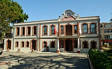
Çorlu
| Çorlu | ||||
|
||||
| Basic data | ||||
|---|---|---|---|---|
| Province (il) : | Tekirdağ | |||
| Coordinates : | 41 ° 10 ' N , 27 ° 48' E | |||
| Height : | 183 m | |||
| Residents : | 200,577 (2008) | |||
| Telephone code : | (+90) 282 | |||
| Postal code : | 598xx | |||
| License plate : | 59 | |||
| Structure and administration (status: 2014) | ||||
| Mayor : | Ünal Baysan ( CHP ) | |||
| Website: | ||||
| Çorlu County | ||||
| Residents : | 236,682 (2008) | |||
| Surface: | 899 km² | |||
| Population density : | 263 inhabitants per km² | |||
| Kaymakam : | Levent Kılıç | |||
| Website (Kaymakam): | ||||
Çorlu ( Latin Caenophrurium , Greek Τσόρλου Tsorlou or Τυρολόη Tyroloi }) is a district town in the European part of Turkey .
geography
Çorlu is located in the Tekirdağ Province in Eastern Thrace , about 90 km west of Istanbul city center . Çorlu has 200,577 inhabitants.
history
In ancient times the place was called Caenophrurium . The Roman emperor Aurelian was murdered in the vicinity in 275 and buried here.
economy
Çorlu is a fast growing industrial city and is characterized by numerous companies in the textile and food industry.
traffic
The Çorlu train station is on the İstanbul Sirkeci – Swilengrad railway line .
In Çorlu lies Tekirdağ Çorlu Airport .
Attractions
On the outskirts, next to the railway line , a Byzantine fortress can be seen.
Personalities
- Memduh Şevket Esendal (1883–1952), writer and diplomat
- Kemal Kurt (1947–2002), writer, translator and photographer
Web links
Commons : Çorlu - collection of images, videos and audio files
Individual evidence
- ↑ a b Turkish Institute for Statistics ( Memento from December 5, 2012 in the web archive archive.today ), accessed November 28, 2009


