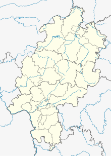
Ödinghausen (desert)
Coordinates: 51 ° 22 ′ 43 " N , 9 ° 15 ′ 43" E
Ödinghausen (also Oedinghausen ) is a deserted area in the district of Escheberg , a district of Zierenberg in the Kassel district , northern Hesse .
location
The small village was located at an altitude of 306 m above sea level, about 3 km west-north-west of the core town of Zierenberg, immediately south of the Wachtkopf (320 m) and east-northeast of the Rohrküppels (353 m) in the headwaters of the then "Landwehrgraben" creek, which was south-east of the Rangen estate flows into the warmth . In the south rises the massif of the Kleiner (531.8 m) and the Great Gudenberg (568.7 m). The road from Zierenberg to Oberelsungen , today's L 3214, later passed the town immediately south of the Gudenberg complex , and from this the road to Escheberg branched off immediately west of the town, today's K 87. With reference to today's traffic infrastructure the former location is in the triangle between the district road 87, the federal highway 44 ( Dortmund - Kassel ) and the railway line Volkmarsen-Vellmar-Obervellmar of the North Hessian RegioTram Kassel .
history
The place is mentioned for the first time as “Eddinchusen” in 1261, at the time of the Thuringian-Hessian War of Succession , in a document from Hasungen Monastery . Since the related Lords von Gudenberg and Wolff von Gudenberg already had property there at that time, the place was evidently settled earlier.
In the 15th century the parish village "Ödinghausen" was (also "Odinghusen") as kurmainzisches fief of each in half owned Uradel sgeschlechter the Gudenberg and Wolff of Gudenberg. At the beginning of the 16th century the place became desolate. When Eberhard von Gudenberg, the last male offspring of his line, died in 1534, half of the town came to his son-in-law, the Landgrave-Hessian marshal Hermann von der Malsburg , who had the town resettled by six farmers from 1545. In 1550 he bought half of the Wolff von Gudenberg: the farmers were compensated and a manorial estate was built on the site of the former hamlet . The church stood until the end of the 16th century.
Towards the end of the 17th century, half of the farm was pledged to Landgrave Karl von Hessen-Kassel , and in 1711 the second half . In 1787 the court was redeemed again by the Lords of Malsburg .
In 1965 the farm was closed in the course of the construction of the A 44 motorway.
Footnotes
- ^ Electorate of Hesse 1840-1861 - 14th Zierenberg. Historical maps. In: Landesgeschichtliches Informationssystem Hessen (LAGIS).
- ^ Konrad Wilhelm Ledderhose: Contributions to the description of the church state of the Hessen-Casselischen Lande. Kassel, 1780, p. 130
Web links
- Ödinghausen, Kassel district. Historical local dictionary for Hessen. (As of November 11, 2014). In: Landesgeschichtliches Informationssystem Hessen (LAGIS).
