A59 road
| A59 road in the UK | |

|
|
| map | |
| Basic data | |
| Operator: | |
| Start of the street: | Wallasey |
| End of street: | York |
| Overall length: | 175 km (108.7 mi ) |
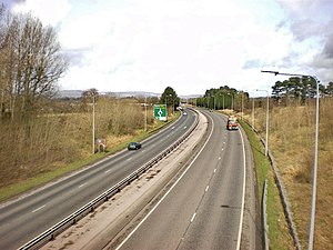
| The A59 near Clitheroe (photo 2009) | |
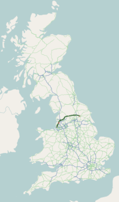
The A59 road ( English for road A59 ) is a 175 km long, predominantly designated as a primary route road in England, which connects Wallasey with York .
course
The road then leads to the M53 motorway from Wallasey through the toll road Kingsway Tunnel under the Mersey to Liverpool , leaves the city to the north, touching the ends of the M57 motorway and the M58 motorway and leads via Ormskirk to Preston . There it turns to the east, crosses the M6 motorway at its junction 31 and leads at some distance to the north past Blackburn towards Clitheroe , which is bypassed on a bypass to the southeast. It continues to follow the River Ribbleupstream, but leaves Ribblesdale at Gisburn. As a result, after the confluence with the A56 road, Skipton is bypassed to the north (partly together with the A65 road ) and the A59 follows the Kex Beck upwards, only to drop off again to Blubberhouses . The next larger town is Harrogate , where the A61 road crosses and the Pennines massif is left again. The road then crosses the A1 (M) motorway and continues to York , where it ends in the center on the A19 road .


