M53 motorway
| M53 motorway in the UK | |||||||||||||||||||||||||||||||||||||
|
|
|||||||||||||||||||||||||||||||||||||
| map | |||||||||||||||||||||||||||||||||||||
| Basic data | |||||||||||||||||||||||||||||||||||||
| Operator: | Highways Agency | ||||||||||||||||||||||||||||||||||||
| Start of the street: | Wallasey | ||||||||||||||||||||||||||||||||||||
| End of street: | Chester | ||||||||||||||||||||||||||||||||||||
| Overall length: | 30.4 km (18.9 mi ) | ||||||||||||||||||||||||||||||||||||
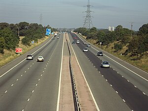
| M53 at Storeton (photo 2009) | |||||||||||||||||||||||||||||||||||||
|
Course of the road
|
|||||||||||||||||||||||||||||||||||||
The M53 motorway ( English for, M53 ') is a little over 30 km long, Between 1972 and 1982 built, in its northern section to the car plant in Ellesmere Port, first as M531 designated motorway in England , on the Wirral Peninsula between the River Mersey and the River Dee from Wallasey in a predominantly south-southeast direction to the northeast outskirts of the city of Chester and then merges into the A55 road . The towns of Birkenhead , Bebington and Ellesmere Port are close to the motorway that crosses the M56 motorway .


