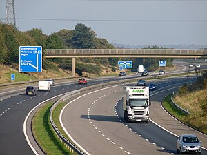
M58 motorway
| M58 motorway in the UK | |
|
|
|
| map | |
| Basic data | |
| Operator: | Highways Agency |
| Start of the street: | Switch Island , Aintree |
| End of street: | M6 motorway , Junction 26 |
| Overall length: | 19.3 km (12 mi ) |
| M58, junction 3, at Bickerstaffe (photo 2008) | |
The M58 motorway ( English for highway M58 ) is a since 1980 standing at full length in operation, 19.3 km long motorway in England . It connects the northern outskirts of Liverpool with the M6 motorway near Wigan . The connection to the M6 is via two roundabouts and Junction 26.


