M2 motorway
| M2 motorway in the UK | |||||||||||||||||||||||||||||||||||||||||||

|
|||||||||||||||||||||||||||||||||||||||||||
| map | |||||||||||||||||||||||||||||||||||||||||||
| Basic data | |||||||||||||||||||||||||||||||||||||||||||
| Operator: | Highways Agency | ||||||||||||||||||||||||||||||||||||||||||
| Overall length: | 41.4 km (25.7 mi ) | ||||||||||||||||||||||||||||||||||||||||||
| The M2 at junction 5 | |||||||||||||||||||||||||||||||||||||||||||
|
Course of the road
|
|||||||||||||||||||||||||||||||||||||||||||
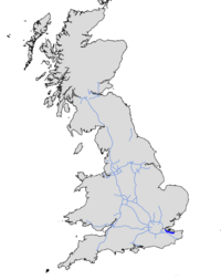
The M2 motorway ( English for 'Autobahn M2') is a motorway in the English county of Kent . It is 41.4 km long and serves as a bypass road for a section of the A2. The M2 runs through north Kent, Sittingsbourne and Faversham and is the only M-Motorway not linked to other M-Motorways.
The M2 is the only freeway without a primary destination. "London" is signposted to the west and "Canterbury, Channel Tunnel, Dover" to the east, but the motorway is not even near these destinations.
history
The M2 was built in the 1960s, the bypass for Kent's north was built in 1963 and the rest in 1965. The openings took place in three steps:
- Connection 1 to 2 in 1965
- Connection 2 to 5 in 1963
- Connection 5 to 7 in 1965
It was planned to extend the road to London and Dover to make the M2 the main link between London and the Canal Ports, but this was never realized. Originally the M2 was supposed to be called A2 (M), but the Daily Telegraph referred to the street as M2 in its reports, so the Department of Transportation changed the name to M2.
Connection improvements
The M2 was not changed until the 1990s. When the M20 between London and Folkestone was completed in 1991, traffic increased, and the M2 was only left as a bypass for north Kent. Junction 1 was expanded when the A289 (Wainscott Northern Bypass) was built in the late 1990s.
Extensions
The M2 was heavily used between junctions 1 and 4, so work began in 2000 to upgrade the motorway from a four-lane to an eight-lane motorway. The project required a change to Ports 1 and 3 and a second bridge over the River Medway . The existing bridge was converted into a four-lane, eastbound carriageway. The carriageway running westwards is formed by the new bridge. The entire section was illuminated. The expansion was completed in July 2003.


