Afon Tywi
|
Afon Tywi River Towy |
||
|
Run of the Tywi |
||
| Data | ||
| location | Wales | |
| River system | Afon Tywi | |
| source | Cambrian Mountains 52 ° 15 ′ 11 " N , 3 ° 45 ′ 23" W. |
|
| Source height | 488 m | |
| muzzle | at Llansteffan in the Carmarthen Bay Coordinates: 51 ° 45 ′ 18 " N , 4 ° 23 ′ 11" W 51 ° 45 ′ 18 " N , 4 ° 23 ′ 11" W. |
|
| Mouth height | 0 m | |
| Height difference | 488 m | |
| Bottom slope | 4.4 ‰ | |
| length | 110 km | |
| Left tributaries | Llandovery Bran, Afon Sawdde, Afon Cennen | |
| Right tributaries | Afon Dulas, Afon Cothi, Afon Gwili | |
| Reservoirs flowed through | Llyn Brianne Reservoir | |
| Small towns | Llandovery, Llandeilo, Carmarthen | |
|
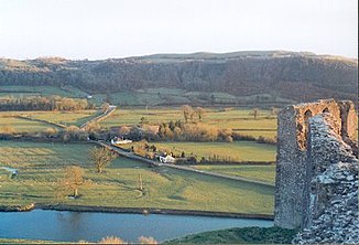
View of the river from Dryslwyn Castle |
||
The Afon Tywi ( English River Towy ) is a river in Wales . At 110 km in length, it is considered to be the longest river that flows completely through Wales.
geography
The Tywi has its source on the slopes of Crug Gynan in the Cambrian Mountains . It flows south through the Tywi Forest , where it forms the border between Ceredigion and Powys , until after 10 km it flows into the Llyn Brianne Reservoir . After leaving the reservoir, the river flows down a steep mountain valley. Shortly after Llandovery , the Llandovery Bran flows into it. The Tywi then flows southwest to Llandeilo and then with a slight gradient through a wide trough valley , where the Afon Dulas , Afon Cothi and numerous other streams flow further west. Before Carmarthen , at Abergwili it takes on its largest tributary, the Afon Gwili . The tides in the river are noticeable until shortly before Carmarthen . The Tywi now flows southwest until it flows into the Carmarthen Bay at Llansteffan together with the River Taf and the Gwendraeth .
The normal water level of the Tywi at Pothouse Wharf near Carmarthen fluctuates between 2.65 and 6.12 m, the maximum water level was measured on January 3, 2014 and was 6.35 m.
environment
Most of the river's catchment area is rural, only in Llandovery, Llandeilo and Carmarthen does it flow through urban regions. The 80 km long middle course between Llandeilo and Carmarthen is a Special Area of Conservation . The Tywi is of European importance as a habitat for otters , catfish , brook lampreys , feints , allis shad and salmon .
Economy and Transport
The Llyn Brianne Reservoir was established in the 1970s to regulate water as well as supply drinking water to South East Wales.
The Tywi is known as a fishing area for salmon and trout.
Much of the A40 motorway and the Heart of Wales Line railway line run along the river. There is no longer a bridge over the river between the estuary and Carmarthen, making Carmarthen a transport hub for South West Wales.
history
In the Middle Ages, the valley of the Tywi, Ystrad Tywi , with Dinefwr Castle formed the core area of the Principality of Deheubarth . During their attempt to conquer Wales , the Normans built Carmarthen Castle on the spot to which the Tywi was navigable .
Web links
Individual evidence
- ↑ Welcome to Llandeilo. (No longer available online.) Archived from the original on October 8, 2014 ; Retrieved July 18, 2014 .
- ^ Environment Agency: Tywi at Pothouse Wharf. Retrieved July 18, 2014 .
- ↑ Countryside Council for Wales: Afon Tywi / River Tywi SAC. (No longer available online.) Archived from the original on July 14, 2014 ; Retrieved July 18, 2014 .

