Ahlersbach (Kinzig, Schlüchtern-Herolz)
| Ahlersbach | ||
|
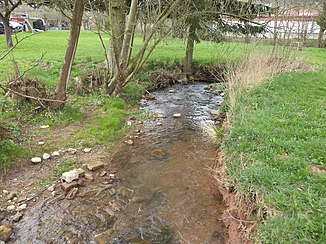
The Ahlersbach in Herolz |
||
| Data | ||
| Water code | DE : 2478118 | |
| location |
Hessian-Franconian mountainous region
|
|
| River system | Rhine | |
| Drain over | Kinzig → Main → Rhine → North Sea | |
| source | about 1 km west of Sinntal - Weiperz . 50 ° 18 ′ 21 ″ N , 9 ° 34 ′ 11 ″ E |
|
| Source height | approx. 478 m above sea level NHN | |
| muzzle | near Schlüchtern - Herolz in the Kinzig coordinates: 50 ° 20 ′ 43 ″ N , 9 ° 33 ′ 33 ″ E 50 ° 20 ′ 43 ″ N , 9 ° 33 ′ 33 ″ E |
|
| Mouth height | approx. 227 m above sea level NHN | |
| Height difference | approx. 251 m | |
| Bottom slope | approx. 46 ‰ | |
| length | 5.5 km | |
| Catchment area | 7.475 km² | |
| Drain at the mouth |
MQ |
99.2 l / s |
|
The Ahlersbach (front) flows into a left arm of the Kinzig (from right to left) |
||
The Ahlersbach is a five and a half kilometer long left and southern tributary of the Kinzig in the Main-Kinzig district in the Hessian Spessart .
geography
course
The Ahlersbach rises at an altitude of about 478 m above sea level. NHN a good kilometer west of the Sinntaler district Weiperz in a meadow on the northern edge of a mixed forest.
It flows in a northerly direction first through forest and then through fields and meadows. It now changes its direction to the north-west and then runs through grassland on the north-east edge of the village that is part of Schlüchtern and named after him . A little further down the stream it turns sharply to the north-northeast and is then strengthened by the Lietebach near a small pond west of the vineyard . The Ahlersbach now runs first through forest and then turning more and more to the north through grassland.
About a kilometer later it reaches the southern edge of the Schlüchtern district of Herolz . It passes the southern part of the village and finally flows out at an altitude of about 227 m above sea level. NHN in the left main arm of the Kinzig divided there .
Its 5.5 km long run ends about 251 meters below its source, so it has a mean bed gradient of about 46 ‰.
Catchment area
The 7.48 km² catchment area of the Ahlersbach lies in the sandstone Spessart and is drained to the North Sea via the Kinzig, Main and Rhine rivers.
It borders
- in the east to that of the Kinzig
- in the southeast to that of the Wolper , which flows into the Kinzig
- in the south to that of the Gronaubach , which drains into the Main via the Sinn
- and in the southwest to that of the Kinzig tributary Auerbach .
The highest point is at 503.9 m above sea level. NHN an unnamed mountain in the south-southwest of the catchment area.
Tributaries
- Lietebach ( left ), 0.7 km
Kinzig river system
places
Only the places marked in italics are direct residents.
The Ahlersbach flows through the following villages:
See also
literature
- Christoph Poch, Andreas Herz: The Hessian Spessart waters on the way to Europe. In: District Committee of the Main-Kinzig District (ed.): Mitteilungsblatt Zentrum für Regionalgeschichte 40, 2015, pp. 14-19.
Web links
- Course and catchment area of the Ahlersbach on the water map service of the Hessian Ministry for the Environment, Climate Protection, Agriculture and Consumer Protection ( information )
- Course of the Ahlersbach on the measuring table sheets at susudata.de

