Aksu Çayı (Mediterranean)
|
Aksu Çayı ancient names: Kestros, Cestrus |
||
|
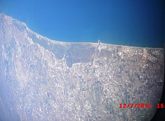
Satellite image of the lower reaches of the Aksu Çayı |
||
| Data | ||
| location | Antalya , Burdur , Isparta ( Turkey ) | |
| River system | Aksu Çayı | |
| source | western Taurus Mountains 37 ° 42 ′ 33 ″ N , 30 ° 31 ′ 43 ″ E |
|
| Source height | approx. 1500 m | |
| muzzle | east of Antalya in the Gulf of Antalya Coordinates: 36 ° 51 ′ 13 ″ N , 30 ° 55 ′ 13 ″ E 36 ° 51 ′ 13 ″ N , 30 ° 55 ′ 13 ″ E |
|
| Mouth height | 0 m | |
| Height difference | approx. 1500 m | |
| Bottom slope | approx. 9.3 ‰ | |
| length | 162 km | |
| Left tributaries | Kovada Çayı | |
| Reservoirs flowed through |
Karacaören-1 dam , Karacaören-2 dam |
|
| Big cities | Isparta | |
The Aksu Çayı is a 162 km long tributary of the Mediterranean in the south of Turkey ( Asia Minor ).
The Aksu Çayı was called Kestros (Latinized Cestrus ) in ancient times . Its Hittite name was Kaštaraya. The river has its source in the western Taurus Mountains south of Isparta . It flows through the city in a north-easterly direction and then turns south. It takes the Kovada Çayı from the left and flows into the reservoir of the Karacaören-1 dam . Then he passes the Karacaören-2 dam . He sets his course to the south continues and finally ends at the so-called Turkish Riviera east of Antalya in the Gulf of Antalya .
Individual evidence
- ^ Max Gander: The geographic relations of the Lukka countries . Texts of the Hittites, issue 27 (2010). ISBN 978-3-8253-5809-9 . Pp. 63ff., 183
