
al-Batina

The Batina Plain ( Arabic الباطنة, DMG al-Bāṭina ) is a fertile, densely populated coastal strip in northern Oman and one of the regions of the country. Until 2001, al-Batina was one of the governorates of Oman, with the capital Suhar . On October 28, 2011, it was divided into the governorates of Shamal al-Batina (Al-Batina North) and Dschanub al-Batina (Al-Batina South).
The region stretches for about 250 km along the Gulf of Oman and extends from the border with the United Arab Emirates (Emirate al-Fujairah ) down to the region around the Omani capital Muscat . Often the northern and southern ends are indicated with the places Chatma al-Malaha (in the north) and Rasl al-hamra (in the south). The region extends over an area of 13,222 km².
geography
Off the mainland Al-Batina coast are the Ad Dimaniyat Islands and the Sawadi Islands .
economy
The coastal plain is on average 25 km wide and has been used intensively for agriculture for many centuries. This is the center of Omani agriculture, and in addition to huge amounts of dates, citrus fruits, bananas, mangos and tomatoes are grown on a large scale. In addition to agriculture, there are also industrial and maritime activities. The center for this is Suhar , the largest and most important town in the Batina Plain with just over 100,000 inhabitants. There are still three high-yield copper mines in Suhar, and the port is currently being rebuilt to allow more extensive shipping. Tourism also plays an increasingly important role in the Batina plain. The area attracts more and more tourists with its clean beaches and cultural offerings (castles, palaces, forts, old towns, Islamic architecture, etc.). The places Rustaq (for some time the capital of Oman), al-Hazm and Nachl (“date palm”) should be mentioned.
population
The Batina plain is the most densely populated region of Oman (apart from the small capital region ) and counted 772,590 inhabitants on an area of 13,222.44 km² at the 2010 census, which results in a population density of 58.4. If you include the neighboring capital region, there are over one and a half million. The most important cities are the regional capitals Suhar (130,000 inhabitants) and Rustaq (28,000 inhabitants). Other larger cities are al-Chabura (42,000 inhabitants), as-Suwaiq (28,000 inhabitants), Chadra as-Saad (24,000 inhabitants), Saham (13,000 inhabitants), Barka (13,000 inhabitants) and Nachl (11,000 inhabitants).
climate
The climate is dry all year round, which is why most of the year must be watered. It is warm in winter and very hot with high humidity in summer; the peak values here reach 48 ° C. The sea always invites you to swim.
Administrative division
The Shamal al-Batina Governorate (northern area) includes the Wilayat:
The Governorate of Janub al-Batina (southern area) includes the Wilayat:
- Rustaq (capital)
- al-Masnaʿa
- Awabi
- Barka
- Nachl
- Wadi al-Maʿawil
Historical maps of Oman
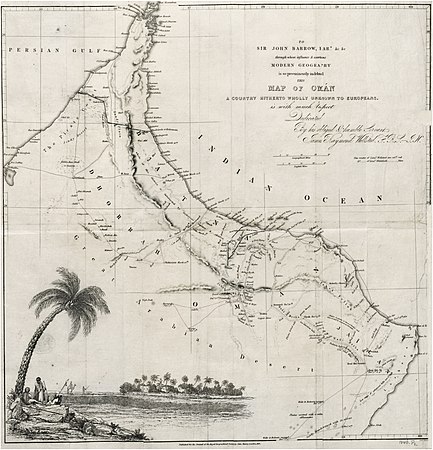
1838

1873

1879
_p1.027_MAP_OF_OMAN_(retouched).jpg)
.jpg)
.jpg)
Individual evidence
- ↑ Governorates of Sultanate Of Oman ( Memento of February 7, 2014 in the Internet Archive )
- ^ Seven new divisions created in Oman
- ↑ http://www.timesofoman.com/innercat.asp?detail=51336&rand (link not available)
- ↑ http://www.citypopulation.de/php/oman-batinahnorth.php
- ↑ http://www.citypopulation.de/php/oman-batinahsouth.php