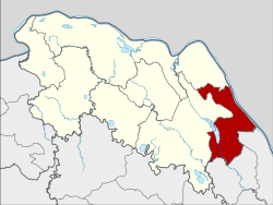
Bueng Khong Long district
|
Bueng Khong Long บึง โขง หลง |
|
|---|---|
| Province: | Bueng Kan |
| Surface: | 398.2 km² |
| Residents: | 36,807 (2013) |
| Population density : | 87.2 U / km² |
| ZIP : | 38220 |
| Geocode : | 3806 |
| map | |

|
|
Amphoe Bueng Khong Long ( Thai : อำเภอ บึง โขง หลง ) is a district ( amphoe - administrative district) in the east of Bueng Kan Province . The province of Bueng Kan is located in the north of the northeast region of Thailand , the so-called Isan .
geography
The province of Bueng Kan is located about 615 kilometers northeast of Bangkok along the Mekong , which is the border with Laos .
Bueng Khong Long District borders the following counties (from the south clockwise) to the Amphoe Ban Phaeng and Na Thom the province of Nakhon Phanom and to the Amphoe Seka and Bung Khla in the province of Nong Khai. To the east lies the Bolikhamsai province of Laos on the other bank of the Mekong .
history
Bueng Khong Long was first established on January 7, 1986 as a "branch circle" ( King Amphoe ) by being separated from the Amphoe Seka . On November 4, 1993, it was promoted to Amphoe.
administration
Provincial Administration
Bueng Khong Long County is divided into four tambon (“subdistricts” or “parishes”), which are further subdivided into 57 muban (“villages”).
| No. | Surname | Thai | Muban | Pop. |
|---|---|---|---|---|
| 1. | Bueng Khong Long | บึง โขง หลง | 17th | 10,681 |
| 2. | Pho Mak Khaeng | โพธิ์ หมากแข้ง | 16 | 12,647 |
| 3. | Dong bang | ดง บัง | 11 | 6,388 |
| 4th | Tha Dok Kham | ท่า ดอก คำ | 13 | 7.091 |
Local administration
There are two municipalities with "small town" status ( Thesaban Tambon ) in the district:
- Bueng Ngam (Thai: เทศบาล ตำบล บึง งาม ), consisting of parts of the Tambon Bueng Khong Long.
- Bueng Khong Long (Thai: เทศบาล ตำบล บึง โขง หลง ), consisting of parts of the Tambon Pho Mak Khaeng and the remaining parts of the Tambon Bueng Khong Long.
There are also three " Tambon Administrative Organizations " ( องค์การ บริหาร ส่วน ตำบล - Tambon Administrative Organizations, TAO):
- Pho Mak Khaeng (Thai: องค์การ บริหาร ส่วน ตำบล โพธิ์ หมากแข้ง )
- Dong Bang (Thai: องค์การ บริหาร ส่วน ตำบล ดง บัง )
- Tha Dok Kham (Thai: องค์การ บริหาร ส่วน ตำบล ท่า ดอก คำ )
Individual evidence
- ↑ ประกาศ กระทรวง มหาดไทย เรื่อง แบ่ง เขต ท้องที่ อำเภอ เซกา จังหวัด หนองคาย ตั้ง เป็น กิ่ง อำเภอ บึง โขง หลง . In: Royal Gazette . 103, No. 9 ง , January 21, 1986, p. 159.
- ↑ พระราชกฤษฎีกา ตั้ง อำเภอ ลำ ทับ อำเภอ ร่องคำ อำเภอ เวียง แหง อำเภอ นา โยง อำเภอ แก้ง สนาม นาง อำเภอ โนน แดง อำเภอ บ้านหลวง อำเภอ กะพ้อ อำเภอ ศรี บรรพต บรรพต อำเภอ แก่ง กระจาน อำเภอ อำเภอ หนอง สูง อำเภอ สบ เมย อำเภอ เมย วดี อำเภอ โคก เจริญ อำเภอ ทุ่งหัวช้าง อำเภอ วัง ขาว ขาว ขาว ขาว ขาว ขาว หิน อำเภอ ดอนพุด อำเภอ บึง โขง หลง และ อำเภอ ห้วย ค ต พ.ศ. ๒๕๓๖ . In: Royal Gazette . 110, No. 179 ก ฉบับ พิเศษ (special), November 3, 1993, pp. 1-3.
- ↑ 2013 population statistics ( Thai ) Department of Provincial Administration. Retrieved August 4, 2014.
Web links
Coordinates: 17 ° 58 ' N , 104 ° 3' E