Andělský vrch
| Andělský vrch | ||
|---|---|---|
|
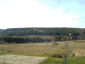
View from the southeast from road no.361 |
||
| height | 572 m | |
| location | Czech Republic / Poland | |
| Mountains | Jizera foothills | |
| Coordinates | 50 ° 55 '55 " N , 15 ° 16' 3" E | |
|
|
||
| particularities | highest point of the Frýdlantská pahorkatina | |
The Andělský vrch (German Schöbicht ) is a mountain in the Czech Republic and Poland . The less prominent wooded elevation is located two and a half kilometers east of Nové Město pod Smrkem on the Polish-Czech border and, at 572 meters above sea level, forms the highest elevation of the Frýdlantská pahorkatina and of its subunit Hejnická pahorkatina ( Haindorf hill country ).
geography
The Andělský vrch is the easternmost and highest point of the Heinersdorfer Ridge ( Jindřichovický hřeben ). The Jindřichovický potok ( Heinersdorfer Wasser ) rises on its northern slope . Towards the east lies the Łużica ( Lausitzbach ) valley on the Polish side , and the Lomnice ( Lomnitzbach ) valley to the southwest on Czech territory . The Czerniawska Kopa ( Dresslerberg , 776 m) rises to the southeast, the Mała Góra ( Kleine Berg , 728 m), the Rapická hora ( Raplitz , 708 m) and the Měděnec ( Kupferberg , 777 m) to the south , and the Hřebenáč ( Kohlhübel ) to the west , 566 m). The road from Nové Město pod Smrkem to Ulicko runs at the southern foot of the Andělský vrch.
Surrounding villages are Dětřichovec and Na Hranici ( Hainbusch ) in the north, Wola Sokołowska ( Heller ), Unięcice ( Meffersdorf ), Gierałtówek ( Neu Gersdorf ) and Pobiedna in the northeast, Ulicko ( Bergstrasse and Straßberg ) in the east, Bílý Potok in the south, Lázněz and Přebytek in the south-west, Nové Město pod Smrkem and Podlesí in the west and Horní Řasnice and Jindřichovice pod Smrkem in the north-west.
history
The old name Schöbicht is derived from a steeply sloping street , analogous to the Schöber . This led south of the mountain between Straßberg and Neustadt over a pass from the Lausitz Valley to the Lomnitztal. On the border was the village of Schickewald , which was destroyed and extinguished during the Thirty Years War. It is not known when the name Andělský vrch (in English Engelsberg ) came about. The elevation is shown without a name on Polish maps.
After the healing spring in the valley of the Ztracený potok between the Měděnec and the Sviňský vrch had been known since 1780, the spring-rich, but little developed area east of Nové Město pod Smrkem was examined more closely at the beginning of the 21st century. In 2010, a joint search for radioactive sources began by the Faculty of Natural Sciences of Charles University and the Technical Institute of Wrocław University of Technology . On June 12, 2010 the Rafael spring was discovered with a radioactivity of 3000 Bq / l. Then another ten springs were found, of which the Michael spring with 5500 Bq / l is the strongest radioactive mineral water spring in the Czech Republic. The water from the Uriel spring contains hydrogen sulfide . A small moor spring was named as the Samuel spring. The radioactivity of the spring water is comparable to the radioactive springs of Jáchymov .

