Antigo
| Antigo | ||
|---|---|---|
![Antigo's Opera House is listed on the National Register of Historic Places. [1]](https://upload.wikimedia.org/wikipedia/commons/thumb/8/86/Antigo_Opera_House.jpg/298px-Antigo_Opera_House.jpg) Antigo's Opera House is listed on the National Register of Historic Places . |
||
| Location in Wisconsin | ||
|
|
||
| Basic data | ||
| Foundation : | 1878 | |
| State : | United States | |
| State : | Wisconsin | |
| County : | Langlade County | |
| Coordinates : | 45 ° 9 ′ N , 89 ° 9 ′ W | |
| Time zone : | Central ( UTC − 6 / −5 ) | |
| Residents : | 8,234 (as of 2010) | |
| Population density : | 493.1 inhabitants per km 2 | |
| Area : | 16.8 km 2 (about 6 mi 2 ) of which 16.7 km 2 (about 6 mi 2 ) is land |
|
| Height : | 457 m | |
| Postcodes : | 54409 | |
| Area code : | +1 715 | |
| FIPS : | 55-02250 | |
| GNIS ID : | 1582700 | |
| Website : | www.antigo-city.org | |
| Mayor : | Bill Brandt | |
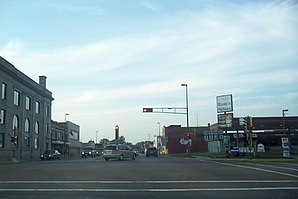
 Center of Antigo |
||
Antigo is a municipality (with the status " City ") and the administrative seat of Langlade County in the US -amerikanischen State Wisconsin . In 2010 Antigo had 8,234 inhabitants.
Antigo is the center of an agricultural and forestry district and the local produce is mainly lumber, furniture, frames, doors and shutters, wheel hubs and spokes and other wood products.
Surname
Nequi-Antigo-sebi comes from the Ojibwe language; means "spring river" or "evergreen"; and was used by the Anishinabe as the name of the river flowing through the region.
history
The place was founded in 1878 by Francis A. Deleglise. The Deleglises log cabin is preserved as a museum attraction at the Langlade County Museum . The large area of flat land, well-grown commercial forests and the fertility of the soil around Antigo soon attracted more settlers. Antigo received its charter in 1883. At the beginning of the 20th century, Antigo was known for its sawmills. A hundred years later there is an economic balance between industry, agriculture and forestry.
geography
Antigo lies at 45 ° 8 'north latitude and 89 ° 9' west longitude, extends over 16.8 km² and lies on a plateau 457 meters above sea level.
US Highway 45 and Wisconsin Highways 5 , 47 , 52 and 64 run through Antigo in a north-south direction . The Langlade County Airport is located 4 km northeast of the city. The city is connected to the Chicago and North Western Railway network.
The closest larger cities are Wausau (approx. 50 km southwest) and Green Bay (approx. 130 km southeast). The capital of the state, Madison is about 230 km south of Antigo.
population
According to the 2010 census , Antigo had 8,234 people in 3,613 households. The population density was 493.1 people per square kilometer. Statistically, 2.21 people lived in each of the 3,613 households.
The racial the population was composed of 95.1 percent white, 0.5 percent African American, 1.4 percent Native American, 0.4 percent Asian and 0.8 percent from other ethnic groups; 1.7 percent were descended from two or more races. Hispanic or Latino of any race was 2.7 percent of the population.
23.5 percent of the population were under 18 years old, 57.4 percent were between 18 and 64 and 19.1 percent were 65 years or older. 52.1 percent of the population was female.
The average annual income for a household was 38,669 USD . The per capita income was $ 19,218. 19.9 percent of the population lived below the poverty line.
sons and daughters of the town
- Justin Berg , baseball player with the Chicago Cubs ,
- John Bradley , member of the US Navy , flag hoist on Iwo Jima ,
- D. Wayne Lukas , horse trainer ,
- Joe Piskula , ice hockey player for the Calgary Flames .
Individual evidence
- ^ National Directory of Historic Places, entries for Wisconsin, Langdale County
- ↑ US Postal Service - ZIP Codes
- ↑ a b American Fact Finder. Retrieved March 9, 2014
