Apatzingán de la Constitución
| Apatzingán de la Constitución | ||
|---|---|---|
|
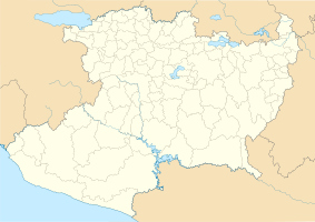
Coordinates: 19 ° 5 ′ N , 102 ° 21 ′ W Apatzingán de la Constitución on the map of Michoacán
|
||
| Basic data | ||
| Country | Mexico | |
| State | Michoacan | |
| Municipio | Apatzingán | |
| City foundation | 1617 | |
| Residents | 99,010 (2010) | |
| City insignia | ||
| Detailed data | ||
| surface | 23.4 km 2 | |
| Population density | 4,231 inhabitants / km 2 | |
| height | 325 m | |
| prefix | 453 | |
| Website | ||
| Apatzingán Cathedral | ||
Apatzingán de la Constitución or Apatzingán for short is a large Mexican city in the state of Michoacán with around 105,000 inhabitants. The city is the administrative seat of the Municipio Apatzingán and since 1962 the seat of a diocese .
Toponym
The name of the city is of Indian origin and was taken from the Nahuatl : apatzincan ("place with small rivers"; apan = river, tzin (diminutive), can = place).
Location and climate
Apatzingán is located in the southwestern slopes of the Sierra Madre Occidental at an altitude of only about 325 m . The closest major city is Uruapán , about 80 km (driving distance) northeast ; the provincial capital Morelia is approx. 185 km away and the port city Lazaro Cárdenas is approx. 195 km south on the Pacific coast . Apatzingán has a national airport (airport code: AZG). The climate is temperate to warm; Rain (approx. 695 mm / year) falls predominantly in the summer half-year.
Population development
| year | 2000 | 2010 |
| Residents | 93,756 | 99.010 |
The vast majority of the population is of Indian descent; Mestizos are also numerous . Most of the time, however, Spanish is spoken .
economy
Apatzingán is a fruit and vegetable growing center in Mexico; there are corresponding preservation and processing companies. In addition, extensive cattle breeding (ganadería) is practiced in the municipality .
history
Apatzingán was founded by the Spaniards around 1617; Franciscan monks promoted Christianization. During the Mexican struggle for independence (1810-1821), the first constitution of Mexico, the constitution of Apatzingán , was written in Apatzingán in 1814 by members of the congress - hence the name of the city. The elevation to the city took place in 1883.
In May 2011, around 2,500 residents of Apatzingán and the surrounding area fled the drug war violence in Mexico . Members of the Los Caballeros Templarios drug cartel blocked a street in the city for two days. The government asked residents to leave the city and about 40 schools were closed.
At the end of October 2013, around 300 armed members of a vigilante group tried to take control of the city. This failed. Presumably in response to this, drug lords burned down several gas stations. Power plants were attacked with large-caliber weapons and Molotov cocktails . A resulting power outage hit more than 400,000 residents and several industrial companies in Michoacán.
Attractions
Cultural institutions are rare; the three-aisled but only single-towered former main church and today's cathedral is dedicated to the Assumption of Mary (Asunción) and dates from the middle of the 20th century. Nevertheless, Apatzingán is of regional tourist importance because of its swimming pools etc.
sons and daughters of the town
- Nazario Moreno González (1970-2014), drug lord
Web links
- Apatzingán - photos + information (inafed, Spanish)
- Apatzingán, tourism - photos + brief information (spanish)
Individual evidence
- ↑ Apatzingán - climate tables
- ↑ Apatzingán - population development
- ↑ Apatzingán - fruits and vegetables
- ↑ Bloody skirmish between gangster gangs in Mexico. In: Neue Zürcher Zeitung . May 27, 2011, accessed May 27, 2011 .
- ↑ Mexico: Navy takes control of the Pacific port . Frankfurter Allgemeine . November 5, 2013. Retrieved June 8, 2017.

