Atherton (Queensland)
| Atherton | |||||||
|---|---|---|---|---|---|---|---|
 The main street of Atherton |
|||||||
|
|||||||
|
|||||||
|
|||||||
|
|||||||
|
|||||||
|
|
|||||||
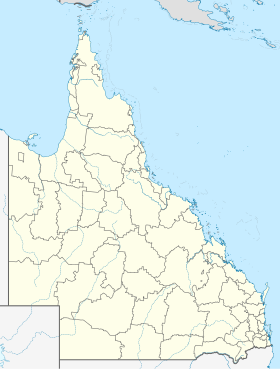
Atherton (ɑða'tɒn) is the central city in the Atherton Tableland in Queensland in Australia and is located about 80 km southwest of Cairns . Atherton was named after John Atherton , one of its founders, and received town charter on February 23, 1886. The city lies on the slope of an extinct volcano and is surrounded by several small hills known as the "Seven Sisters". The volcanic mountains and the tropical rainforest with its many waterfalls attract numerous tourists.
history
In 1875, James Venture Muligan was the first European to explore the region. Although he was looking for gold, he found tin near what is now the city of Herberton . This news reached John Atherton, who later also found tin on the Tinaroo River .
John Atherton was born in Lancashire , England on August 9, 1837 . His family emigrated to Australia in 1844 and settled in Bald Blair near Armidale , New South Wales . In 1857 he was herding sheep in the Rockhampton district with his brother James and lived on Mount Hedlow Farm. His family followed him in 1860. In 1873, Atherton took over the Cashmere Farm on the Burdekin River , but sold it two years later and in 1875 moved further west towards what is now Atherton Tableland .
Originally the area of what is now Atherton was called "Prior's Pocket" and the town developed from logging camps. Mainly cedars (red cedar) were felled, which once covered the entire Atherton Tableland . The first official urban lands were offered for sale on February 23, 1883.
- Chinese history
The Chinese were indispensable in colonizing Athertons. A large Chinese settlement already existed before the first Europeans settled in the region. One of the few remaining buildings from this period is the Hou Wang Temple.
geography
The Atherton Tableland is an ideal recreational area for tourists. There are many natural and cultural attractions. These include waterfalls, volcanic craters, historical mines, cities, museums, exotic bird and animal watching in the tropical rainforest. Rivers and rainforests as well as the national parks offer numerous opportunities for recreational activities.
- Altitude
750–835 m:
- Atherton 700 m
- Kairi 710 m
- Lake Tinaroo 670 m
- Tolga 760 m
- size
- 620 square kilometers
climate
Atherton is in the tropics and therefore only experiences two seasons. The rainy season and the dry season ( en .: The wet and the dry). So it rains very often for six months. This is known by the local population as "the drizzle" ( de .: The drizzle). The nearby Mareeba, on the other hand, mockingly advertises with 300 sunny days a year.
- Average temperatures
- Summer 17–35 ° C
- Winter 5–22 ° C
- Average rainfall
- 1360 mm - (annually)
Flora and fauna
The rainforest and the always warm temperatures with a lot of rain make the region around Atherton stand out as a green oasis from the region, which is otherwise characterized by Australian drought. The flora and fauna can be described as rich. In terms of animals, platypuses , tree kangaroos and turtles should be mentioned. When walking along a small hiking trail in nearby Yungaburra, you can often see some platypus.
economy
The land around Atherton is used for growing many crops. Potatoes, sugar cane, mangoes, corn, avocados, peanuts. The Atherton Tablelands are one of the most productive agricultural areas in Australia. The region lives from agriculture. At any time of the year something is being harvested and harvest workers are sought. The Grand Hotel and the Atherton Travelers Lodge provide workers to farmers. Backpackers are welcome workers.
traffic
- Streets
From Atherton the Gillies Highway leads to Yungaburra and the Kennedy Highway to Mareeba and Herberton Road to Herberton .
- Public transport
Atherton can only be reached by bus or your own car. Whitecar Coaches make 18 trips a week to Cairns and back. The route leads over Tolga , Walkamin , Mareeba and Kuranda and takes about 2:30 hours . The bus stops at both the airport and the train station in Cairns. Connections to Ravenshoe , Heberton and Chillagoe also exist.
There is the Atherton Taxi Service
Culture
Every year at the end of August Atherton celebrates the Maize Festival ( en .: Maize Festival) with a parade and the election of the maize queen. A small fair is also being set up for this occasion. In the small town there are two restaurants ( en .: Pubs). The Grand Hotel and Barron Valley (BV) with live concerts and horse racing.
education
Atherton has two elementary schools, a secondary school and an independent high school (Grade 12 school), as well as a TAFE campus. There are also several day care centers in the city center.
- Atherton State High School
- Atherton State School
- Jubilee Christian College
- St Joseph's Catholic Primary School
- Tropical North Institute of TAFE
administration
Atherton is the seat of the Atherton Shire Council. The current mayor is Cd Jim Chapman.
health
Atherton Hospital is the hospital in the Tablelands Health District and is located in Atherton. It also has an emergency medical department.
sons and daughters of the town
- Alexander Michailowitsch Prokhorov (1916–2002), Soviet physicist
- Ron Grainer (1922–1981), composer
Individual evidence
- ↑ Australian Bureau of Statistics : Atherton ( English ) In: 2016 Census QuickStats . June 27, 2017. Retrieved April 13, 2010.
