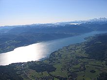
Attersee-Mondsee basin
The Attersee-Mondsee basin is one of 41 Upper Austrian spatial units and is located in the Salzkammergut .
location
The spatial unit comprises two sub-units, on the one hand the water areas of the large lakes and on the other hand the landscape with the tourist-dominated lake edge areas.
The total size of the Attersee-Mondsee basin is 111.93 km². The deepest area is at around 469 m above sea level. A. the Attersee . The highest elevations in the area are agricultural and forestry areas at around 570 m above sea level. A.
The following municipal areas are mainly located in the Attersee-Mondsee basin (starting in the west): Attersee , Nussdorf am Attersee , Unterach , Weyregg , Steinbach , Mondsee , St. Lorenz and Tiefgraben .
The room unit is surrounded by the following Upper Austria room units (clockwise, starting in the north): Vöckla-Ager-Hügelland , Traun and Atterseer Flysch Mountains , Salzkammergut Pre-Alps and the Mondsee Flysch Mountains .
Characteristic
- Basin landscape with Attersee, Mondsee and Irrsee , which are connected by rivers. Rivers outside of the localities are predominantly near-natural, but estuary areas are mostly heavily built-up.
- Land use predominantly agricultural as grassland (little arable use) and as settlement area.
- There are many tourist settlement centers near the shore and therefore mostly built very densely (Attersee and Mondsee), but in some cases also very close to nature. On the near-natural banks, reeds and large sedge (Irrsee and partly Mondsee) are striking. In addition, a strong urban sprawl characterizes the landscape.
- There are only small forest areas, these are mostly managed as spruce forests , followed by beech and fir trees . Small-scale bank slope forests with beech, ash and maple can be found.
- Few professional fishermen but a lot of angling due to the occurrence of pearl fish and sea doves in Atter and Mondsee, but fish migration is severely impaired by many weirs.
- Cultivated landscape only in the western part (around Irrsee and Mondsee) preserved over a large area (orchards, hedges , forms of agricultural settlement).
- In particular, around the Irrsee large, nationally significant silting bogs with litter meadow use. The Irrseebecken is also an important meadow breeding bird area , especially for the curlew .
- Very good water quality in the lakes.
- Strong tourist use and infrastructure (swimming, camping, marinas).
literature
- Office of the Upper Austrian Provincial Government, Nature Conservation Department (Ed.): Nature and Landscape / Guiding Principles for Upper Austria. Volume 12: Attersee-Mondsee basin spatial unit . Linz 2007 ( pdf [accessed December 3, 2015]).
Web links
- Map of the Attersee-Mondsee-Basin spatial unit. In: Environment and Nature. Office of Upper Austria. State government, accessed on December 3, 2015 .
- Attersee-Mondsee basin. In: Nature and Landscape in Upper Austria. Office of Upper Austria. State government, accessed on December 3, 2015 .


