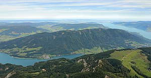
Mondsee Flysch Mountains

The Mondsee Flyschberge are one of 41 Upper Austrian spatial units and are located in the foothills of the Alps.
location
The spatial unit comprises three spatially isolated sub-areas, which are separated on the one hand by the Mondsee and on the other hand by the state of Salzburg and are located in the districts of Vöcklabruck and Braunau .
The area of the Mondseer Flyschberge spatial unit in Upper Austria is 197.28 km². The north-south extension is around 16 km, the east-west extension around 18 km. The deepest area is around 500 m above sea level. A. at the edge of the Attersee-Mondsee basin. The highest point in the area is the Hochplett at 1134 m above sea level. A. (Hochplettspitz).
The following municipal areas are mainly located in the Mondsee Flysch Mountains (in alphabetical order): Innerschwand , Nussdorf , Oberwang , Oberhofen , Straß im Attergau , Tiefgraben and Zell am Moos . In the Salzburg region there are also Thalgau , Henndorf , Neumarkt am Wallersee and Straßwalchen .
The room unit is surrounded by the following room units (clockwise, starting in the north): Vöckla-Ager-Hügelland , Attersee-Mondsee basin and the Salzburg lake area ( southern Innviertel lake area on the Upper Austrian side ).
The Attersee-Mondsee-Basin spatial unit divides this spatial unit with the Mondseeland into the Attersee-Mondsee mountains and the Kolomannsberg line on the Salzburg border . In addition, on the Upper Austrian side, for systematic reasons, the Tannberg northwest of the Straßwalchen pass landscape is added to the spatial unit, as this still belongs to the alpine fly units.
The spatial unit is divided into two sub-units in ecological and landscape terms:
- Meadow cultural landscape on moraines
- Closed wooded area on the hills
Characteristic
- Flyschbergland consisting of sandstone and marl between 500 and 1100 meters above sea level.
- Heavily structured with numerous ditches and streams.
- Very high proportion of forests (60 to 70%) with large forests on the mountains. The forests are hardly close to nature and have a high proportion of spruce . The few near-natural forests consist of beech , alder and ash .
- Small deposits of sweet chestnuts of cultural and historical interest still exist.
- The streams are largely unregulated, the trees accompanying the banks are not continuous and are more like islands.
- The cultural landscape shows a close connection between the agriculturally used areas and the forest area. Traditionally there is grassland farming. In the rich cultural landscape you will find many larch meadows, orchards , alpine pastures , poor and wet meadows . The settlements are laid out in individual farms or small hamlets .
- There are significant moors in the southern parts.
- The Oberwang basin is clearly sprawled and is cut through by the motorway ( Westautobahn ).
- The rainy area is a recreational area with numerous viewpoints.
literature
- Office of the Upper Austrian Provincial Government, Nature Conservation Department (Ed.): Nature and Landscape / Guiding Principles for Upper Austria. Volume 28: Space unit Mondsee Flysch Mountains . Krems and Linz 2007 ( pdf [accessed November 30, 2014]).
Web links
- Map of the space unit Mondsee Flyschberge. In: DORIS . Retrieved November 30, 2014 .
- Mondsee Flysch Mountains. In: Nature and Landscape in Upper Austria. Retrieved November 30, 2014 .


