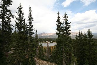
Soon Mountain Pass
| Soon Mountain Pass | |||
|---|---|---|---|
|
View from the pass |
|||
| Compass direction | south | north | |
| Pass height | 3266 m | ||
| county | Duchesne County , Utah ( USA ) | Summit County , Utah ( USA ) | |
| Watershed | Provo River → Utah Lake | Duchesne River → Green River → Colorado River | |
| Valley locations | Kamas | Evanston | |
| expansion | Utah State Route 150 | ||
| Mountains | Uinta Mountains ( Rocky Mountains ) | ||
| map | |||
|
|
|||
| Coordinates | 40 ° 42 ′ 0 ″ N , 110 ° 54 ′ 0 ″ W | ||
The Bald Mountain Pass is a mountain pass in the north of the US state of Utah . The pass lies on the border of Summit County and Duchesne Counties . It crosses the chain of the Uinta Mountains between Bald Mountain (3640 m) and Murdoch Mountain (3417 m) and represents the highest paved road connection in the state of Utah.
The Hayden Pass (3,154 m) to the north between Hayden Peak (3804 m) and Mount Marsell (3456 m) is also crossed by State Route 150. This forms the watershed between the systems of the Duchesne River and the Bear River .

