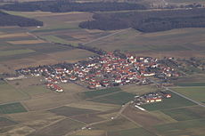
Ballingshausen
|
Ballingshausen
Stadtlauringen market
Coordinates: 50 ° 9 ′ 46 ″ N , 10 ° 20 ′ 0 ″ E
|
||
|---|---|---|
| Height : | 349 m above sea level NN | |
| Residents : | 420 | |
| Incorporation : | May 1, 1978 | |
| Postal code : | 97488 | |
| Area code : | 09724 | |
|
Location of Ballingshausen in Bavaria |
||
Ballingshausen is part of the municipality of Stadtlauringen in the Lower Franconian district of Schweinfurt .
geography
Ballingshausen is located about 15 kilometers north of Schweinfurt on the state road 2280 in the direction of Bad Königshofen and three kilometers northwest of Lake Ellertshausen . With its 420 inhabitants, the village is 349 meters above sea level . The place lies on the plateau of the Schweinfurt Rhön ( Hesselbacher Waldland , natural spatial main unit 139). The assignment of the Federal Agency for Nature Conservation to the grave field (main unit 138 1 ) can not be traced .
history
Ballingshausen belonged to the Altlandkreis Schweinfurt . On May 1, 1978, the previously independent municipality was incorporated into Markt Stadtlauringen, which until the regional reform in Bavaria belonged to the Hofheim district in Lower Franconia .
Public facilities
One of the three kindergartens in the municipality of Stadtlauringen is in Ballingshausen.
Attractions
The Catholic Church of St. Bartholomew and Dionysius is a listed building. It contains ceiling stucco in the rare Regency style .
Personalities
- Pius Keller (born September 30, 1825 in Ballingshausen, † March 15, 1904 in Münnerstadt), Augustinian hermit, restorer of the Augustinian order in Germany
Web links
literature
- Germany - black and white, colorful, sonorous . Volume 1: History of the parish Altenmünster / Lower Franconia. CD output. Contents include: Sebastian Zeißner: History of the parish Altenmünster in Lower Franconia . Sebastian Zeißner: Ballingshausen.
Individual evidence
- ^ Federal Agency for Nature Conservation, Map Service, Landscapes in Germany.
- ^ Federal Statistical Office (ed.): Historical municipality directory for the Federal Republic of Germany. Name, border and key number changes in municipalities, counties and administrative districts from May 27, 1970 to December 31, 1982 . W. Kohlhammer GmbH, Stuttgart and Mainz 1983, ISBN 3-17-003263-1 , p. 753 .


