Batopilas
| Batopilas | ||
|---|---|---|
|
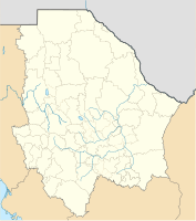
Coordinates: 27 ° 2 ′ N , 107 ° 44 ′ W Batopilas on the map of Chihuahua
|
||
| Basic data | ||
| Country | Mexico | |
| State | Chihuahua | |
| Municipio | Batopilas | |
| City foundation | 1708 | |
| Residents | 1220 (2010) | |
| Detailed data | ||
| surface | 0.7 km 2 | |
| Population density | 1,743 inhabitants / km 2 | |
| height | 580 m | |
| Website | ||
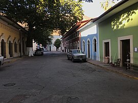
| Batopilas - main street | ||
Batopilas is a place with only about 1,200 inhabitants and the capital of a municipality (municipio) with about 11,500 inhabitants in the extreme south of the Mexican state Chihuahua near the border with the state of Sinaloa . The place is the administrative seat of the municipality of the same name . Because of its historic city center, it is one of the Pueblos Mágicos .
Location and climate
The place Batopilas lies in a valley traversed by the Río Batopilas and about 550 to 580 m high with an almost tropical climate in the otherwise rather barren north-western highlands of Mexico ( Sierra Madre Occidental ). The city of Chihuahua is approx. 400 km (driving distance) in a northeast direction; it is approx. 280 km to the coast of the Gulf of California at Los Mochis . The climate is temperate to warm; the abundant rain for northern Mexico (approx. 995 mm / year) falls almost exclusively in the summer half-year.
Population development
| year | 2000 | 2005 | 2010 |
| Residents | 1,175 | 1,210 | 1,220 |
A large part of the community's mostly Indian-born residents speak the regional Tarahumara language .
economy
From the 18th to the 20th centuries, Batopilas was the center of an area of several silver mines . Corn, beans, vegetables, agaves and opuntia are grown in the fields in the area; There are small craft shops and shops in the village itself.
history
The place was founded in 1708 by the Spaniard Pedro de la Cruz, who had applied for a claim in the area . Around 1780 the community had around 50,000 inhabitants, all of whom had followed the “call of the silver”. With the decline of silver exports to Spain in the course of the Mexican War of Independence (1810-1821), the population fell to about 10 families. Then the mining industry experienced a renewed upswing under the leadership of a few Americans - silver production in 1883 was approximately 1.25 million pounds. In 1887 several mines in the region were merged under the name Batopilas Consolidated Mining Company , but they were all abandoned in the early 20th century.
Attractions

- The center of Batopilas has - similar to Álamos in the neighboring state of Sonora - the fading charm of a colonial town.
- Surroundings
- Approx. 8 km southeast of the village, isolated in the Batopilas Canyon , is the church of the Misión de Satevó , also called Misión del Santo Ángel Custodio or Catedral Perdida , built by the Jesuit order ; it is one of the most beautiful colonial buildings in the region.
- Nearby are the ruins of the Hacienda de San Miguel, founded by the American Alexander Robey Shepherd (1835–1902) as a silver smelter . Nearby, a railway bridge built only to transport ore crosses the Río Batopilas.
Personalities
- Manuel Gómez Morín (1897–1972), politician and financial expert
Web links
- Batopilas Canyon, hiking routes etc. - photos + information
- Batopilas, history etc. - photos + information (English)

